MyTopo
Bosebuck Mountain Maine US Topo Map
Couldn't load pickup availability
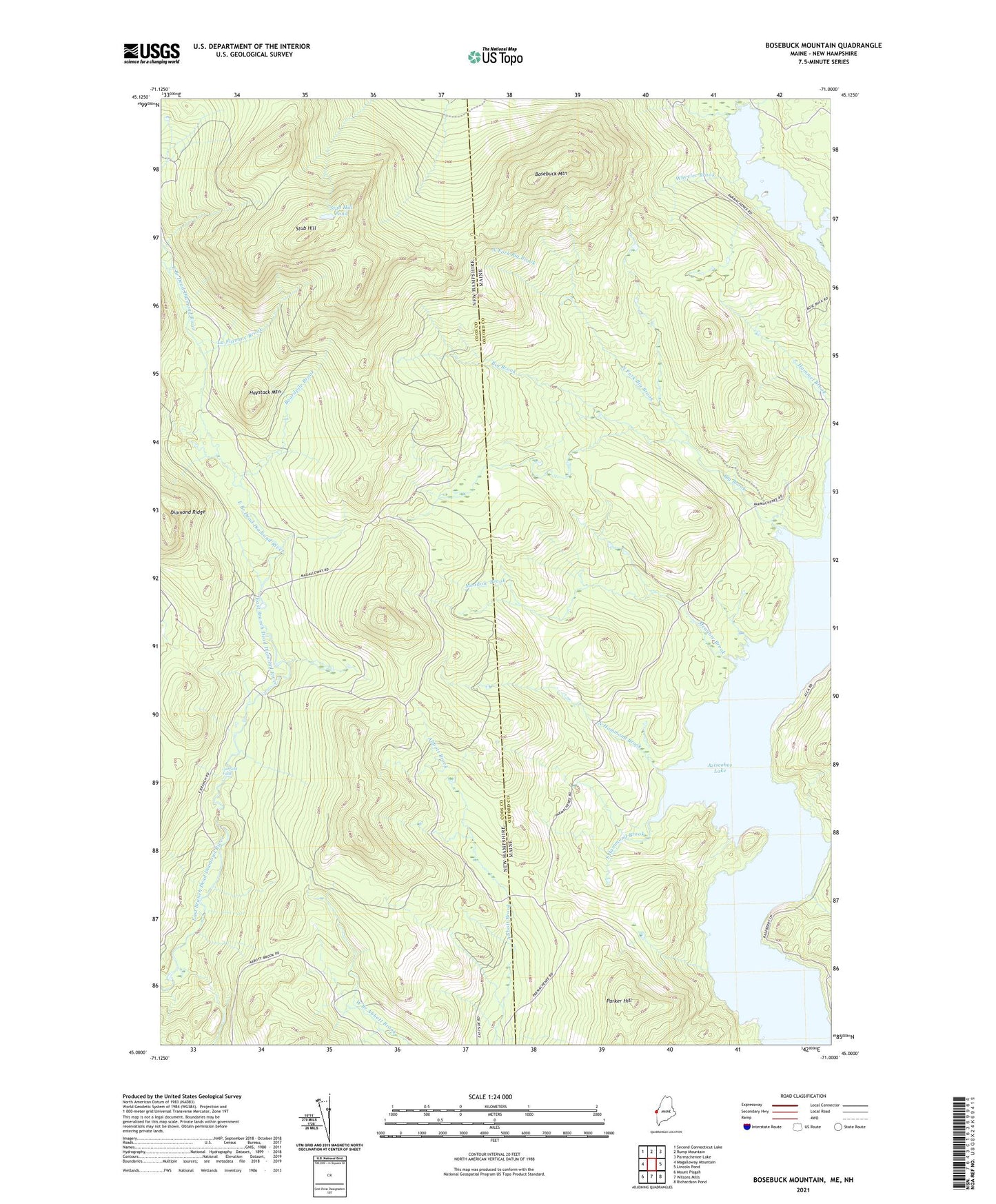
2021 topographic map quadrangle Bosebuck Mountain in the states of Maine, New Hampshire. Scale: 1:24000. Based on the newly updated USGS 7.5' US Topo map series, this map is in the following counties: Oxford, Coos. The map contains contour data, water features, and other items you are used to seeing on USGS maps, but also has updated roads and other features. This is the next generation of topographic maps. Printed on high-quality waterproof paper with UV fade-resistant inks.
Quads adjacent to this one:
West: Magalloway Mountain
Northwest: Second Connecticut Lake
North: Rump Mountain
Northeast: Parmachenee Lake
East: Lincoln Pond
Southeast: Richardson Pond
Southwest: Mount Pisgah
Contains the following named places: Aldrich Brook, Big Brook, Boardpile Brook, Bosebuck Mountain, Camp Number 31, Camp Number 7, East Branch Dead Diamond River, Garfield Falls, Haystack Mountain, La Flamme Brook, Lincoln Brook, Meadow Brook, North Fork Big Brook, North Hammond Brook, Parker Hill, South Hammond Brook, Stub Hill, Stub Hill Pond, Wheeler Brook