MyTopo
Winterville Maine US Topo Map
Couldn't load pickup availability
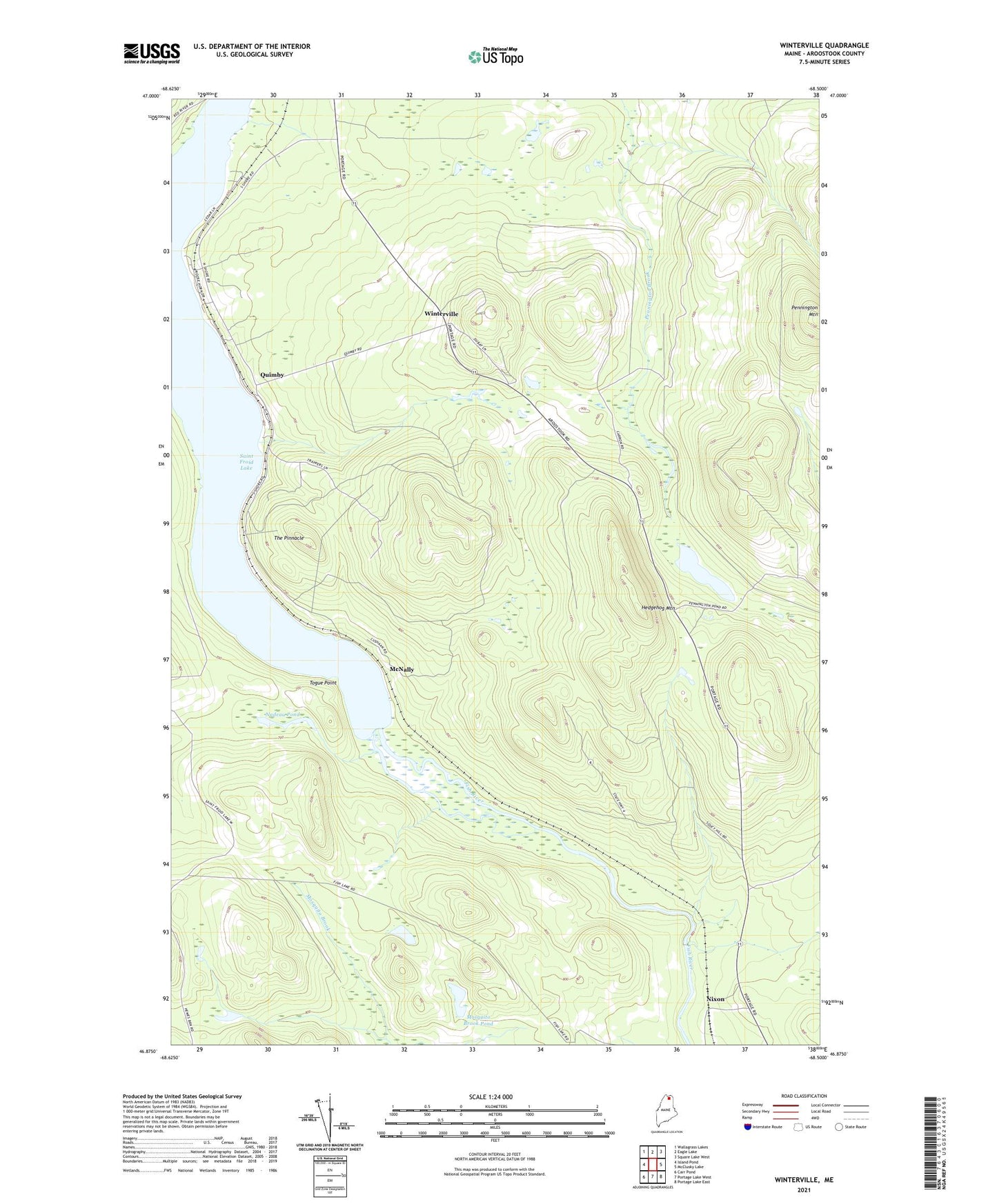
2021 topographic map quadrangle Winterville in the state of Maine. Scale: 1:24000. Based on the newly updated USGS 7.5' US Topo map series, this map is in the following counties: Aroostook. The map contains contour data, water features, and other items you are used to seeing on USGS maps, but also has updated roads and other features. This is the next generation of topographic maps. Printed on high-quality waterproof paper with UV fade-resistant inks.
Quads adjacent to this one:
West: Island Pond
Northwest: Wallagrass Lakes
North: Eagle Lake
Northeast: Square Lake West
East: McClusky Lake
Southeast: Portage Lake East
South: Portage Lake West
Southwest: Carr Pond
Contains the following named places: Hedgehog Mountain, McNally, Mosquito Brook Pond, Nadeau Pond, Nixon, Pennington Mountain, Pennington Pond, Quimby, Quimby Post Office, Saint Froid Lake, T14 R6 WELS, T15 R6 WELS, The Pinnacle, Togue Point, Winterville, Winterville Post Office, Winterville Station