MyTopo
Woodland Maine US Topo Map
Couldn't load pickup availability
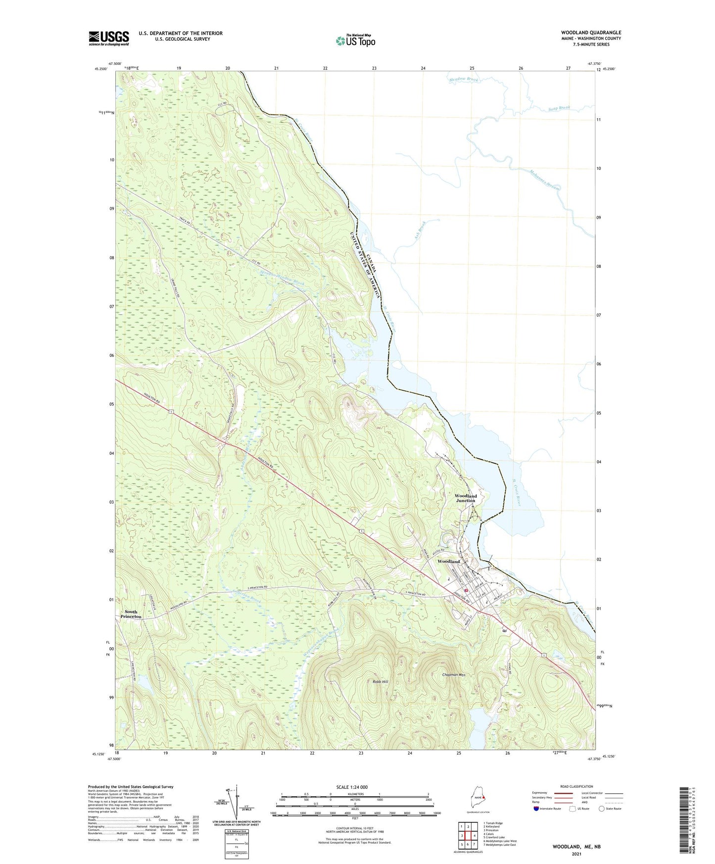
2021 topographic map quadrangle Woodland in the state of Maine. Scale: 1:24000. Based on the newly updated USGS 7.5' US Topo map series, this map is in the following counties: Washington. The map contains contour data, water features, and other items you are used to seeing on USGS maps, but also has updated roads and other features. This is the next generation of topographic maps. Printed on high-quality waterproof paper with UV fade-resistant inks.
Quads adjacent to this one:
West: Princeton
Northwest: Tomah Ridge
North: Kelleyland
East: Calais
Southeast: Meddybemps Lake East
South: Meddybemps Lake West
Southwest: Crawford Lake
Contains the following named places: Anderson Brook, Baileyville Fire Department, Baileyville Police Department, Baileyville Post Office, Baileyville Volunteer Ambulance Service, Chapman Mountain, Downeast Emergency Medical Services, Georgia-Pacific Corporation Heliport, Robb Hill, Saint Croix River Reservoir, Saint James Church, Sprague Meadow Brook, Town of Baileyville, Wapsaconhagan Brook, Woodland, Woodland Baptist Church, Woodland Census Designated Place, Woodland Dam, Woodland Elementary School, Woodland Flowage, Woodland Junction, Woodland Junior Senior High School, Woodland Public Library