MyTopo
Worthley Pond Maine US Topo Map
Couldn't load pickup availability
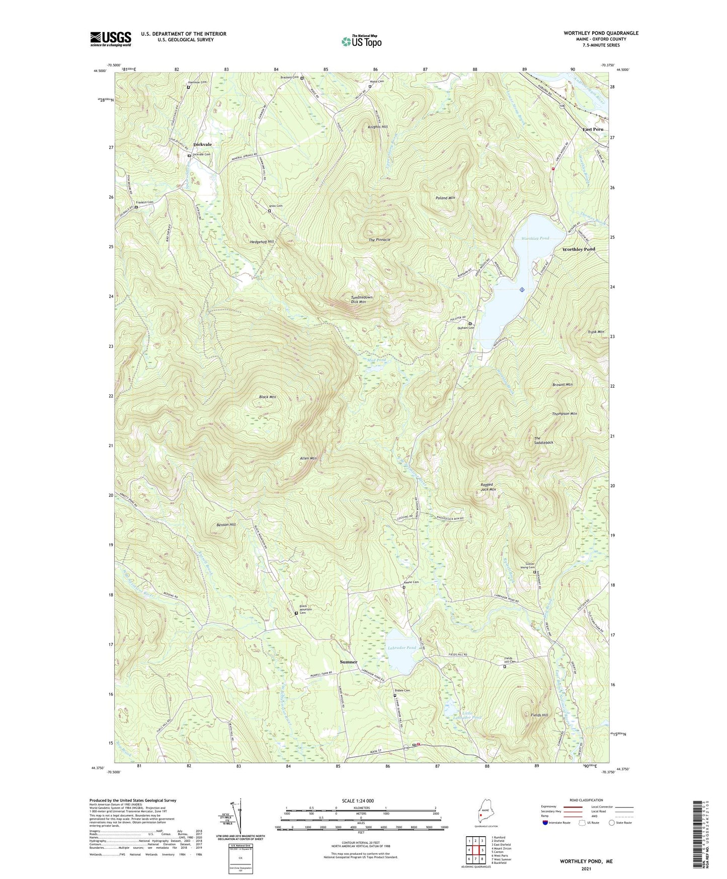
2021 topographic map quadrangle Worthley Pond in the state of Maine. Scale: 1:24000. Based on the newly updated USGS 7.5' US Topo map series, this map is in the following counties: Oxford. The map contains contour data, water features, and other items you are used to seeing on USGS maps, but also has updated roads and other features. This is the next generation of topographic maps. Printed on high-quality waterproof paper with UV fade-resistant inks.
Quads adjacent to this one:
West: Mount Zircon
Northwest: Rumford
North: Dixfield
Northeast: East Dixfield
East: Canton
Southeast: Buckfield
South: West Sumner
Southwest: West Paris
Contains the following named places: Allen Mountain, Benson Hill, Bisbee Cemetery, Black Mountain, Black Mountain Cemetery, Bog Brook, Brackett Cemetery, Browns Mountain, Dickvale, Dickvale Cemetery, East Peru, Fields Hill, Fields Hill Cemetery, Franklin Cemetery, Glover Young Cemetery, Hammon Cemetery, Hedgehog Hill, Keene Cemetery, Knights Hill, Knox Cemetery, Labrador Pond, Little Labrador Pond, Mud Pond, Oldham Cemetery, Peru Fire Department Substation, Poland Mountain, Ragged Jack Mountain, Russell Brook, Sumner, Sumner Post Office, Sumner Volunteer Fire Department, The Pinnacle, The Saddleback, Thomas Brook, Thompson Mountain, Town of Peru, Tumbledown Dick Mountain, Waite Cemetery, Worthley Pond, Worthley Pond Dam, ZIP Codes: 04290, 04292