MyTopo
Barton Maryland US Topo Map
Couldn't load pickup availability
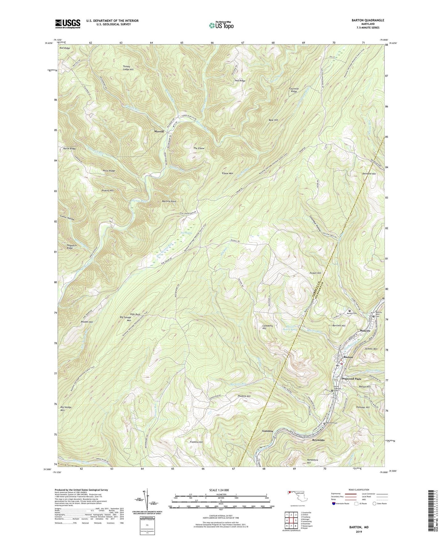
2019 topographic map quadrangle Barton in the state of Maryland. Scale: 1:24000. Based on the newly updated USGS 7.5' US Topo map series, this map is in the following counties: Garrett, Allegany. The map contains contour data, water features, and other items you are used to seeing on USGS maps, but also has updated roads and other features. This is the next generation of topographic maps. Printed on high-quality waterproof paper with UV fade-resistant inks.
Quads adjacent to this one:
West: Bittinger
Northwest: Grantsville
North: Avilton
Northeast: Frostburg
East: Lonaconing
Southeast: Keyser
Southwest: Kitzmiller
Contains the following named places: Barlett Cemetery, Bartlett Hill, Barton, Barton Debris Basin, Barton Debris Basin Dam, Barton Elementary School, Barton Hill, Barton Hose Company 1, Barton Police Department, Barton Post Office, Barton Reservation, Bear Hill, Bear Pen Run, Big Savage Mountain, Blacklick Run, Bluelick Run, Broadwater Chapel, Butcher Run, Caledonia Hill, Cucumber Hollow, Custer Hollow, Detmold Hill, District 11 The Elbow, District 4 Bloomington, District 9 Barton, Dogwood Flats, Elbow Mountain, Elk Lick Run, Franklin Hill, Gannon, Hampshire Hill, High Rock, Horse Ridge, Laurel Run, Little Savage River, Merrill, Michaels Run, Mill Run, Mill Run Church, Moores Run, Moran Field, Morrison, Morrison Cemetery, Moscow, Moscow Census Designated Place, Moscow Mills Cemetery, Moscow School, Mount Zion Church, Nikep Post Office, Phoenix, Phoenix Hill, Pickell Hill, Piedmon Dam, Piedmont Dam, Pine Swamp, Point Ridge, Poplar Lick Run, Potomac Hill, Reynolds, Rhodes Hill, Saint Gabriels Cemetery, Silver Bell Run, Swamp Run, The Elbow, Town of Barton, Turkey Lodge Hill, Turkey Lodge Ridge, Warnick Point, Warnick Run, West Branch Bluelick Run, ZIP Codes: 21521, 21562