MyTopo
Bloodsworth Island Maryland US Topo Map
Couldn't load pickup availability
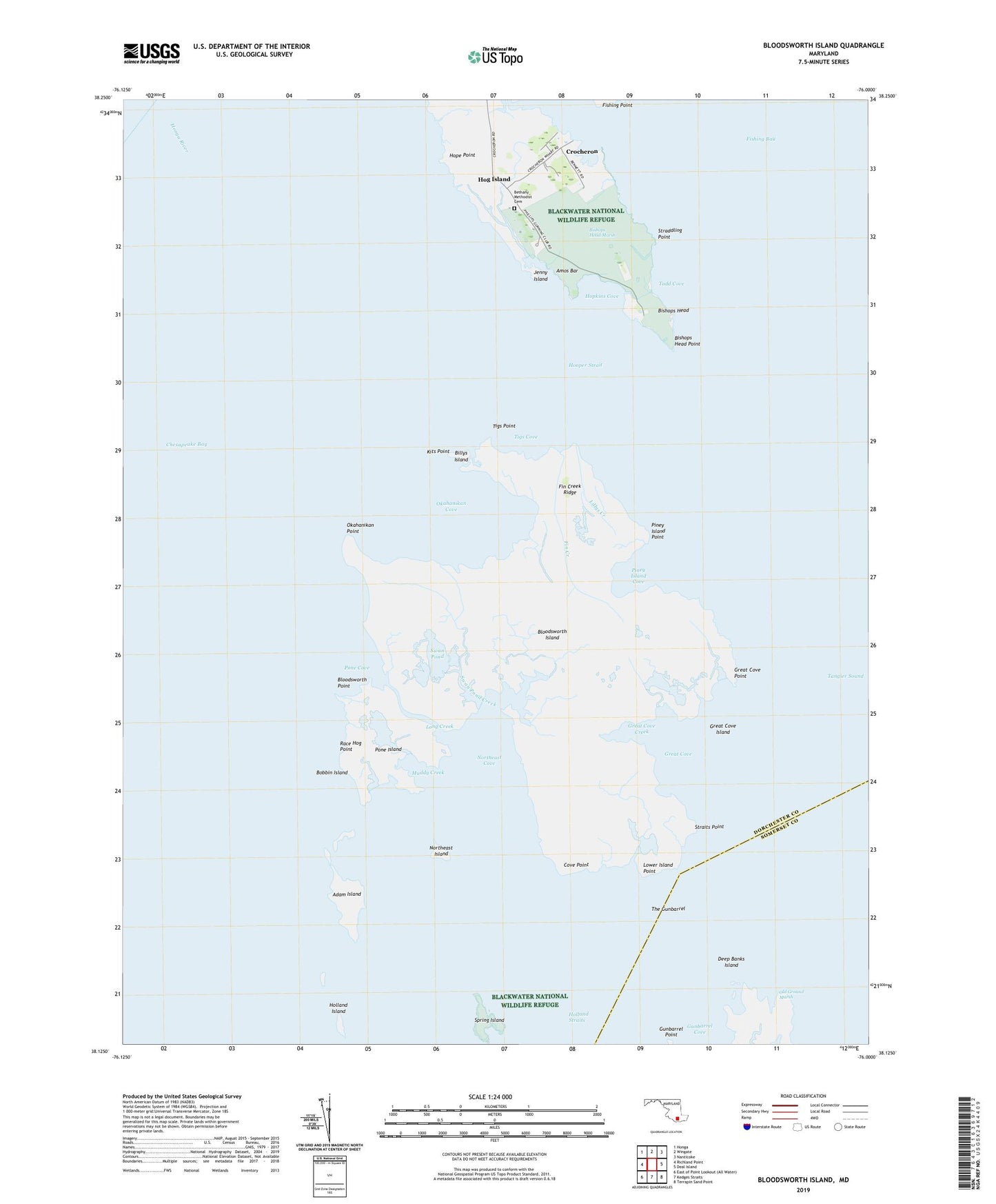
2019 topographic map quadrangle Bloodsworth Island in the state of Maryland. Scale: 1:24000. Based on the newly updated USGS 7.5' US Topo map series, this map is in the following counties: Dorchester, Somerset. The map contains contour data, water features, and other items you are used to seeing on USGS maps, but also has updated roads and other features. This is the next generation of topographic maps. Printed on high-quality waterproof paper with UV fade-resistant inks.
Quads adjacent to this one:
West: Richland Point
Northwest: Honga
North: Wingate
Northeast: Nanticoke
East: Deal Island
Southeast: Terrapin Sand Point
South: Kedges Straits
Contains the following named places: Adam Island, Amos Bar, Bethany Methodist Cemetery, Bethany United Methodist Church, Billys Island, Bishops Head, Bishops Head Marsh, Bishops Head Point, Bloodsworth Island, Bloodsworth Point, Bobbin Island, Courtnay Island, Cove Point, Crocheron, Crocheron Post Office, Deep Banks Island, District 10 Straits, Fin Creek, Fin Creek Ridge, Fishing Point, Great Cove, Great Cove Creek, Great Cove Island, Great Cove Point, Gunbarrel Point, Hog Island, Holland Island Bay, Holland Straits, Honga River, Honga River Light, Hooper Strait, Hooper Strait Light, Hope Point, Hopkins Cove, Jenny Island, Kits Point, Lillys Creek, Long Creek, Long Island, Lower Island Point, Muddy Creek, Northeast Cove, Northeast Island, Okahanikan Cove, Okahanikan Point, Piney Island Cove, Piney Island Point, Pone Cove, Pone Island, Race Hog Point, Sound Point, South Marsh Island, Spring Island, Straddling Point, Straits Point, Swan Pond, Swan Pond Creek, Tedious Creek, The Gunbarrel, Tigs Cove, Tigs Point, Todd Cove, Turtle Egg Island, ZIP Code: 21627