MyTopo
Clear Spring Maryland US Topo Map
Couldn't load pickup availability
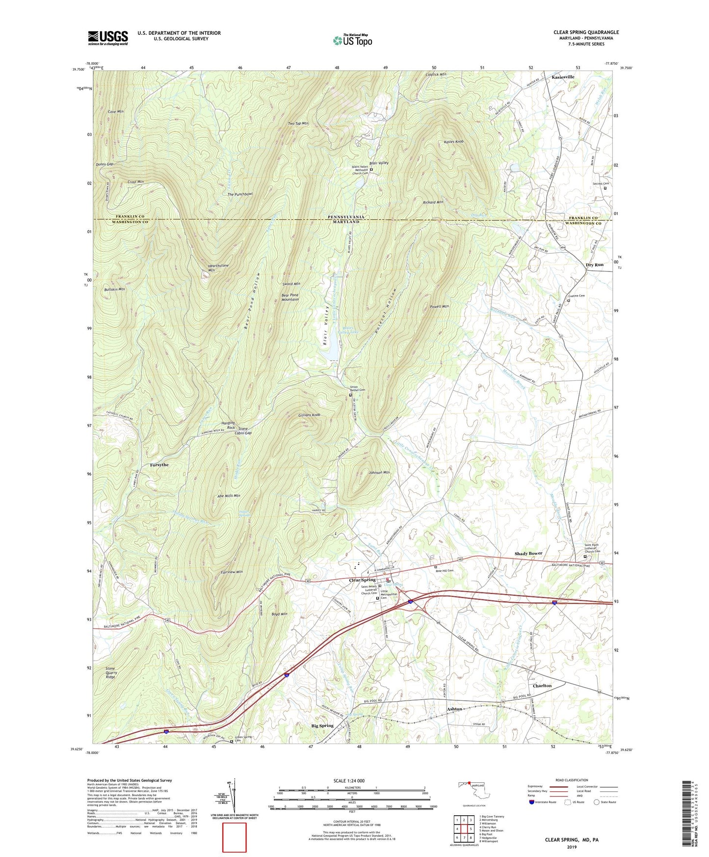
2019 topographic map quadrangle Clear Spring in the states of Maryland, Pennsylvania. Scale: 1:24000. Based on the newly updated USGS 7.5' US Topo map series, this map is in the following counties: Washington, Franklin. The map contains contour data, water features, and other items you are used to seeing on USGS maps, but also has updated roads and other features. This is the next generation of topographic maps. Printed on high-quality waterproof paper with UV fade-resistant inks.
Quads adjacent to this one:
West: Cherry Run
Northwest: Big Cove Tannery
North: Mercersburg
Northeast: Williamson
East: Mason and Dixon
Southeast: Williamsport
South: Hedgesville
Contains the following named places: Abe Mills Mountain, Ashton, Bear Pond Hollow, Bear Pond Mountains, Big Spring, Big Spring Census Designated Place, Blair Valley, Blairs Valley Dam, Blairs Valley First Church of God Cemetery, Blairs Valley Lake, Blairs Valley Methodist Church Cemetery, Boyd Mountain, Bullskin Mountain, Charlton, Charlton Census Designated Place, Clear Spring, Clear Spring Ambulance Squad 49, Clear Spring Elementary School, Clear Spring High School, Clear Spring Middle School, Clear Spring Park, Clear Spring Post Office, Clear Spring Station, Clear Spring Town Hall, Clear Spring Volunteer Fire Company 4, Cross Mountain, Cushwa Cemetery, Cushwa Mill, District 4 Clear Spring, Dry Run, Dunns Gap, Fairview Mountain, Fairview Outdoor Education Center, Faith School, Forsythe, Gillians Knob, Green Spring Cemetery, Hanging Rock, Hearthstone Mountain, Hinkle Run, Indian Springs, Indian Springs Run, Indian Springs Wildlife Demonstration Area, Johns Hopkins University Geological Research Station, Johnson Mountain, Kasies Knob, Kasiesville, Knob Hill Winery, Little Metropolitan Cemetery, McLaughlin School, Oliver Co Dam, Polecat Hollow, Powell Mountain, Rickard Mountain, Rose Hill Cemetery, Saint Andrews Episcopal Church, Saint Clements Chapel, Saint Johns United Church of Christ, Saint Michaels Catholic Church, Saint Pauls Church, Saint Pauls Lutheran Church Cemetery, Saint Peters Evangelical Lutheran Church, Saint Peters Lutheran Church Cemetery, Secrest Cemetery, Shady Bower, Stone Cabin Gap, Stone Quarry Ridge, Stoneleigh Farm, Sword Mountain, The Punchbowl, Town of Clear Spring, Trinity Church of God, Two Top Mountain, Union Bethel Church of God, Union Church, Union School, WCRH-FM (Williamsport), WHAG-TV (Hagerstown), WWPB-TV (Hagerstown), ZIP Code: 21722