MyTopo
Ashley Michigan US Topo Map
Couldn't load pickup availability
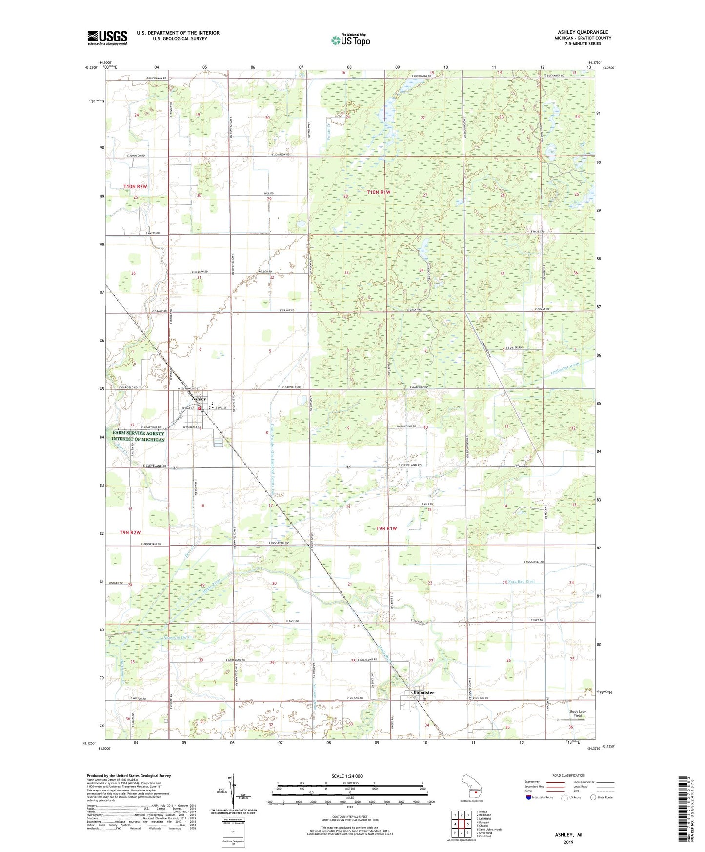
2019 topographic map quadrangle Ashley in the state of Michigan. Scale: 1:24000. Based on the newly updated USGS 7.5' US Topo map series, this map is in the following counties: Gratiot. The map contains contour data, water features, and other items you are used to seeing on USGS maps, but also has updated roads and other features. This is the next generation of topographic maps. Printed on high-quality waterproof paper with UV fade-resistant inks.
Quads adjacent to this one:
West: Pompeii
Northwest: Ithaca
North: Rathbone
Northeast: Lakefield
East: Chapin
Southeast: Ovid East
South: Ovid West
Southwest: Saint Johns North
Contains the following named places: Ashley, Ashley Care Center, Ashley Community School, Ashley Family Care Center, Ashley Fire Department, Ashley Post Office, Ashley Rescue Squad, Ashley Station, Bannister, Bannister Post Office, Bannister Station, Bannister United Methodist Church, Bear Creek, Drain Number One Hundred Forty-two, Gladwin Cornerstone Baptist Church, Halterman Creek, Kridner Farms, Newsom Drain, Saint Cyril's Church, Shady Lawn Field, Stella Post Office, Sturgis Drain, Township of Elba, Township of Hamilton, United Methodist Church, Village of Ashley, ZIP Code: 48807