MyTopo
Atlanta Michigan US Topo Map
Couldn't load pickup availability
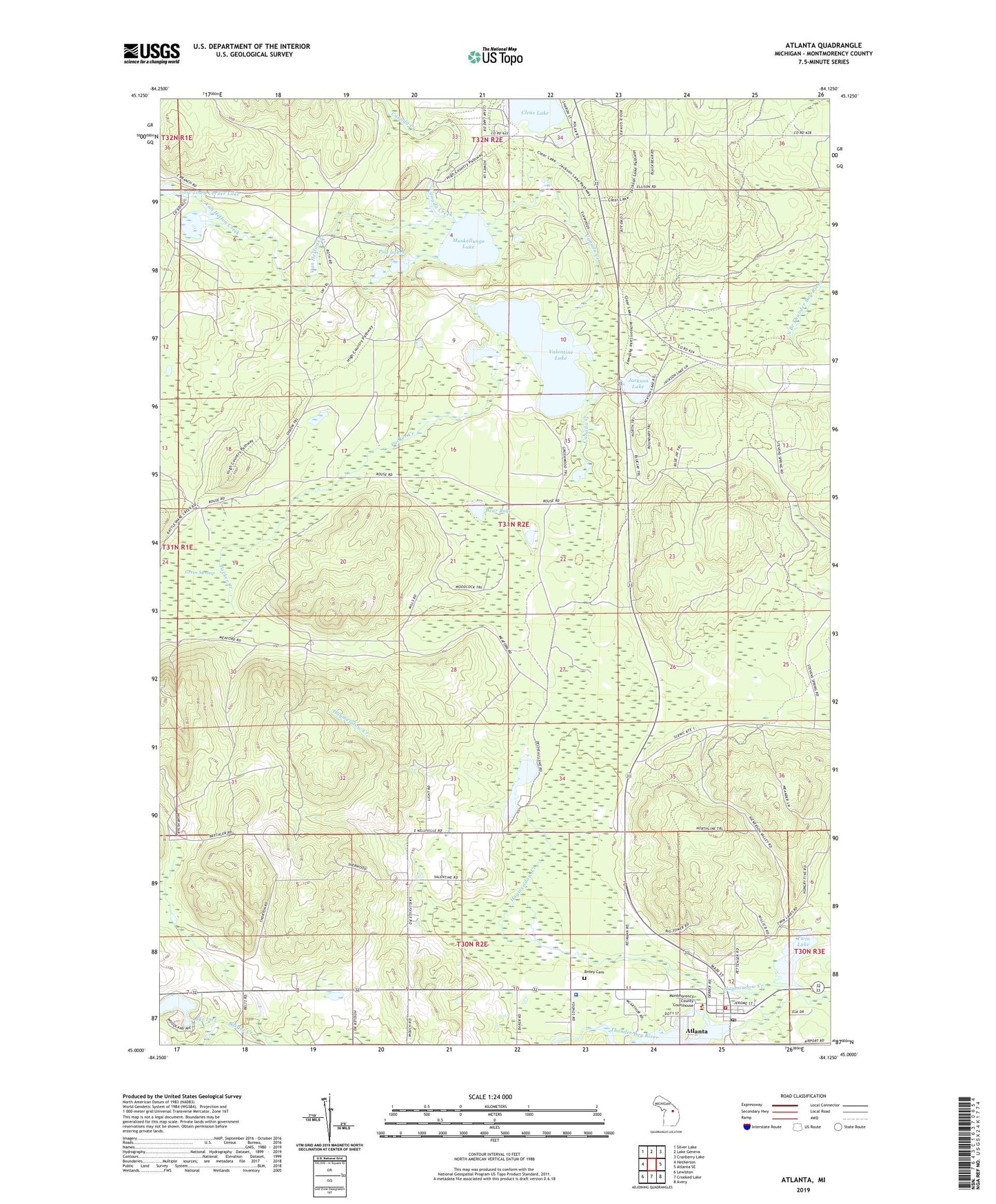
2019 topographic map quadrangle Atlanta in the state of Michigan. Scale: 1:24000. Based on the newly updated USGS 7.5' US Topo map series, this map is in the following counties: Montmorency. The map contains contour data, water features, and other items you are used to seeing on USGS maps, but also has updated roads and other features. This is the next generation of topographic maps. Printed on high-quality waterproof paper with UV fade-resistant inks.
Quads adjacent to this one:
West: Hetherton
Northwest: Silver Lake
North: Lake Geneva
Northeast: Cranberry Lake
East: Atlanta SE
Southeast: Avery
South: Crooked Lake
Southwest: Lewiston
Contains the following named places: Atlanta, Atlanta Bible Church, Atlanta Census Designated Place, Atlanta Congregational Church, Atlanta Full Gospel Assembly, Atlanta Post Office, Atlanta Public Library, Atlanta Station, Bear Lake, Big Rock, Big Rock Congregational Church, Big Rock Historical Marker, Big Rock Post Office, Briley Cemetery, Church of Christ, Clear Lake, De Cheau Lake, East Town Corner Lake, Elk Ridge Golf Course, Haymeadow Creek, Jackson Lake, Jackson Lake State Forest Campground, Kingdom Hall of Jehovah's Witnesses, Lake Inez, Michigan Department of Natural Resources Atlanta Forest Area, Montmorency County, Montmorency County Courthouse, Montmorency County Fairgrounds, Montmorency County Sheriff's Office, Muskellunge Lake, Northern Michigan Restoration Branch Church, Packer Creek, Pug Lakes, Saint Marks Episcopal Church, Township of Briley, Tri - Township Emergency Medical Services, Tri - Township Fire Department, Twin Lake, Valentine Lake, Valentine Lake Station, Valentine Post Office, Van Hetton Creek, ZIP Code: 49709