
MyTopo
Au Train Michigan US Topo Map
Couldn't load pickup availability
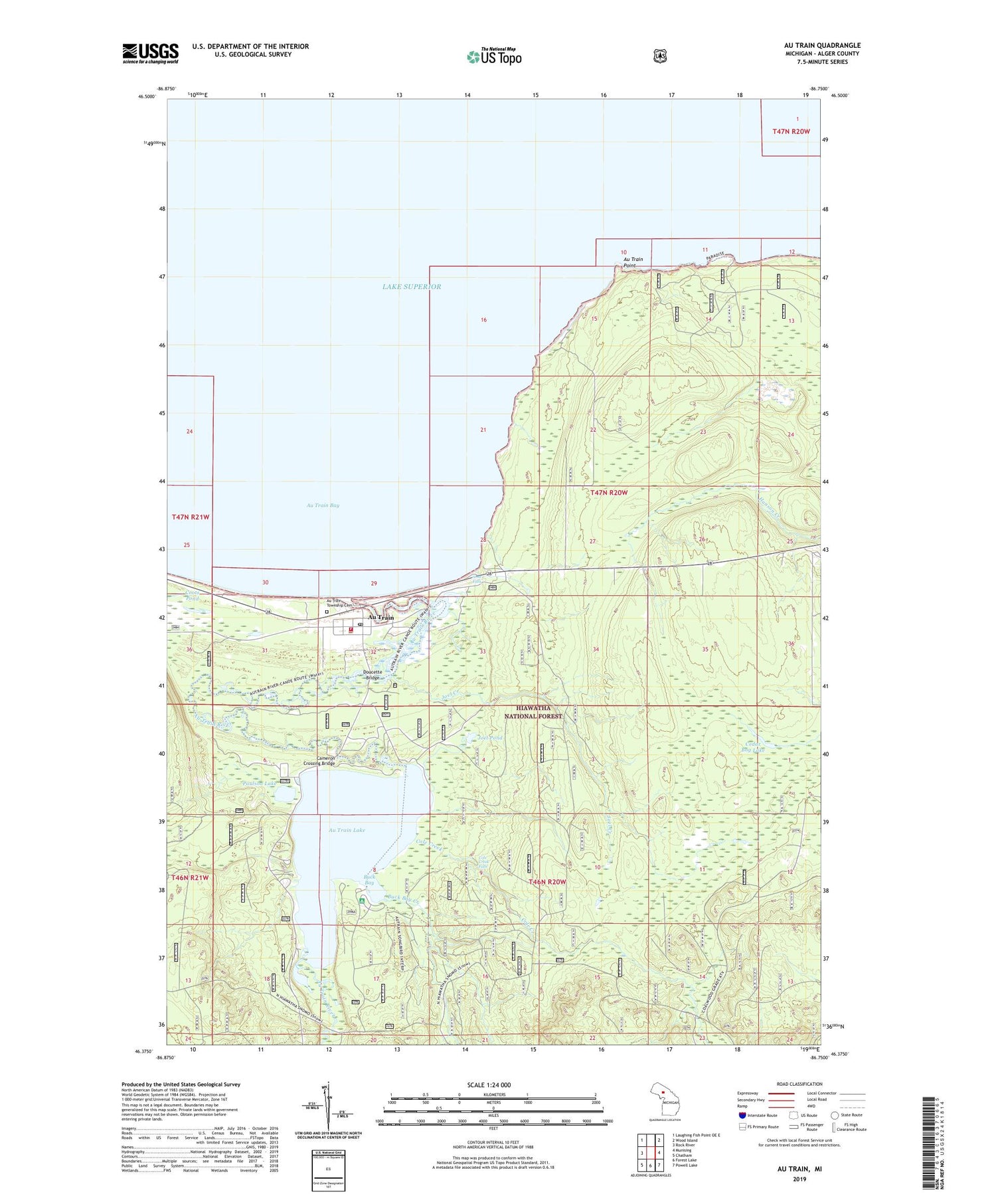
2019 topographic map quadrangle Au Train in the state of Michigan. Scale: 1:24000. Based on the newly updated USGS 7.5' US Topo map series, this map is in the following counties: Alger. The map contains contour data, water features, and other items you are used to seeing on USGS maps, but also has updated roads and other features. This is the next generation of topographic maps. Printed on high-quality waterproof paper with UV fade-resistant inks.
Quads adjacent to this one:
West: Rock River
Northwest: Laughing Fish Point OE E
Northeast: Wood Island
East: Munising
Southeast: Powell Lake
South: Forest Lake
Southwest: Chatham
Contains the following named places: Au Train, Au Train Lake, Au Train Lake Campground, Au Train Point, Au Train Post Office, Au Train River, Au Train Station, Au Train Township Cemetery, Autrain Township Volunteer Fire Department, Buck Bay, Buck Bay Creek, Cameron Crossing Bridge, Cedar Bog Lake, Cole Creek, Cole Creek Falls, Coots Pond, Doucette Bridge, Joel Creek, Joel Pond, Lake Superior Historical Marker, Paulson House Historical Marker, Paulson Lake, Ridge, Saint Therese Catholic Mission, Scott Falls, Scott Falls Roadside Park, Williams Shoal


