MyTopo
Backus Lake Michigan US Topo Map
Couldn't load pickup availability
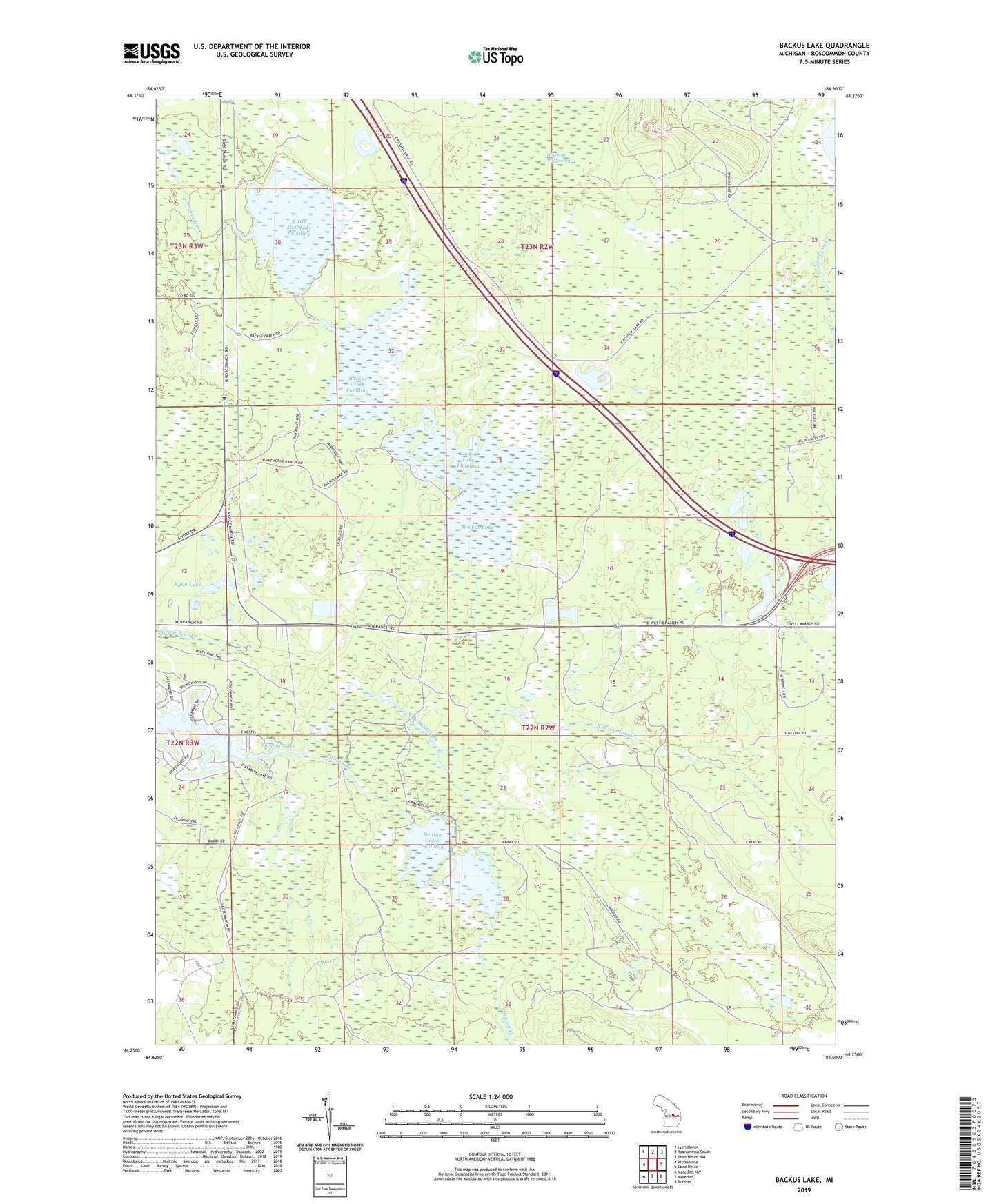
2019 topographic map quadrangle Backus Lake in the state of Michigan. Scale: 1:24000. Based on the newly updated USGS 7.5' US Topo map series, this map is in the following counties: Roscommon. The map contains contour data, water features, and other items you are used to seeing on USGS maps, but also has updated roads and other features. This is the next generation of topographic maps. Printed on high-quality waterproof paper with UV fade-resistant inks.
Quads adjacent to this one:
West: Prudenville
Northwest: Lyon Manor
North: Roscommon South
Northeast: Saint Helen NW
East: Saint Helen
Southeast: Butman
South: Meredith
Southwest: Meredith NW
Contains the following named places: Backus Creek Flooding, Backus Creek State Game Area, Backus Lake, Backus Lake Flooding, Denton Creek Flooding, Houghton Lake Seventh Day Adventist Church, Kingdom Hall, Lake James, Little Mud Lake Flooding, North Branch Denton Creek, Roscommon County, Ryan Lake, Shadow Lake, Township of Backus, ZIP Code: 48651