
MyTopo
Baie de Wasai Michigan US Topo Map
Couldn't load pickup availability
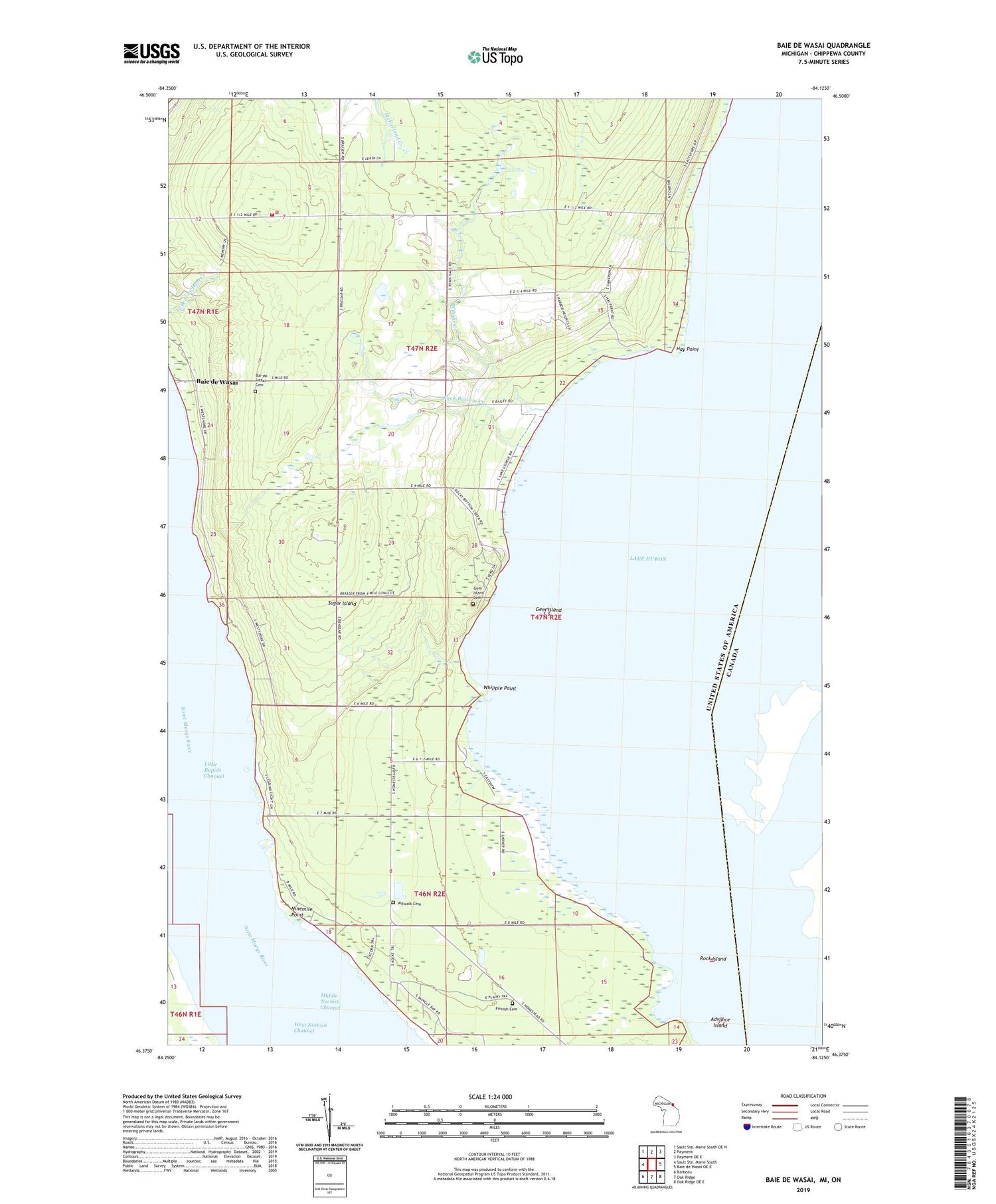
2019 topographic map quadrangle Baie de Wasai in the state of Michigan. Scale: 1:24000. Based on the newly updated USGS 7.5' US Topo map series, this map is in the following counties: Chippewa. The map contains contour data, water features, and other items you are used to seeing on USGS maps, but also has updated roads and other features. This is the next generation of topographic maps. Printed on high-quality waterproof paper with UV fade-resistant inks.
Quads adjacent to this one:
North: Payment
Northeast: Payment OE E
East: Baie de Wasai OE E
Southeast: Oak Ridge OE E
South: Oak Ridge
Southwest: Barbeau
Contains the following named places: Advance Island, Bai - De - Wasai Cemetery, Baie de Wasai, Baie de Wasai Post Office, Farmers Hall, Finnish Cemetery, Gem Island, Gem Island Cemetery, Hay Point, Hiawatha School, Lake George, Lake Nicolet, Little Rapids Channel, Ninemile Point, Rock Bottom Creek, Rock Island, Sacred Heart Church, Saints John and Anne Church, Sault Sainte Marie Reservation, Sugar Island, Sugar Island Ambulance Corporation / Sugar Island Volunteer Fire Department, Sugar Island Leading Light, Township of Sugar Island, WCMZ-FM (Sault Sainte Marie), Whipple Point, Wilmar Creek, Wilwalk Cemetery


