MyTopo
Wolverine Michigan US Topo Map
Couldn't load pickup availability
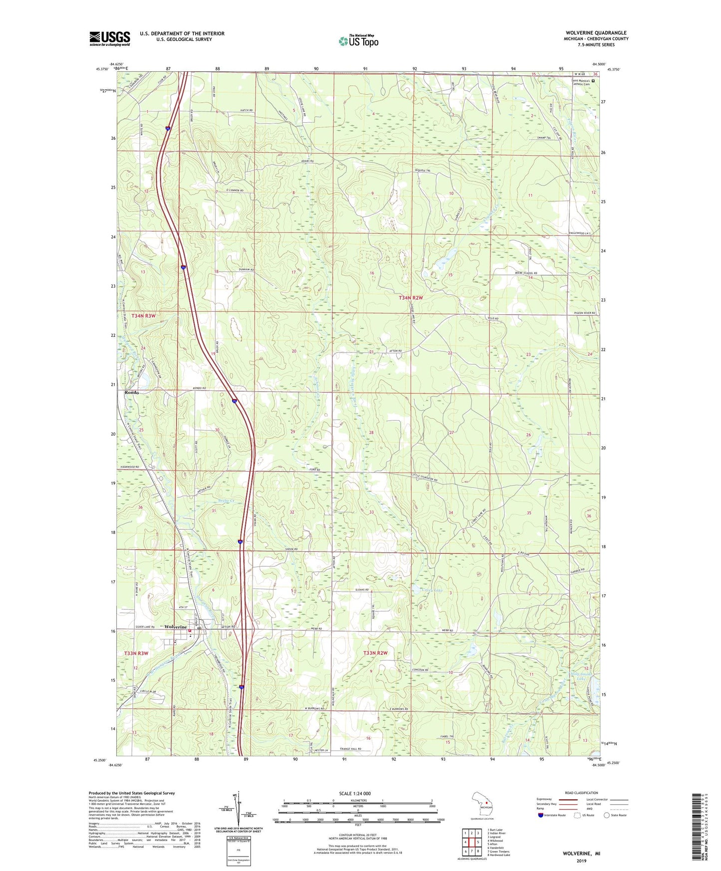
2019 topographic map quadrangle Wolverine in the state of Michigan. Scale: 1:24000. Based on the newly updated USGS 7.5' US Topo map series, this map is in the following counties: Cheboygan. The map contains contour data, water features, and other items you are used to seeing on USGS maps, but also has updated roads and other features. This is the next generation of topographic maps. Printed on high-quality waterproof paper with UV fade-resistant inks.
Quads adjacent to this one:
West: Wildwood
Northwest: Burt Lake
North: Indian River
Northeast: Legrand
East: Afton
Southeast: Hardwood Lake
South: Green Timbers
Southwest: Vanderbilt
Contains the following named places: Beebe Creek, Corey Lake, Dodge Creek, Echo Lake, Goose Lake, Haakwood, Haakwood Post Office, Haakwood State Forest Campground, Haakwood Station, Holy Smoke Lake, Johnson Creek, Michigan Central Depot Historical Marker, Rondo, Rondo Post Office, Rondo Station, Saint Monica's Catholic Cemetery, Township of Ellis, Village of Wolverine, West Branch Sturgeon River, Wolverine, Wolverine Baptist Church, Wolverine Congregational Church, Wolverine Elementary School, Wolverine Fire Department, Wolverine Free Methodist Church, Wolverine High School, Wolverine Lookout Tower, Wolverine Post Office, Wolverine Station, ZIP Code: 49799