MyTopo
Wooden Shoe Village Michigan US Topo Map
Couldn't load pickup availability
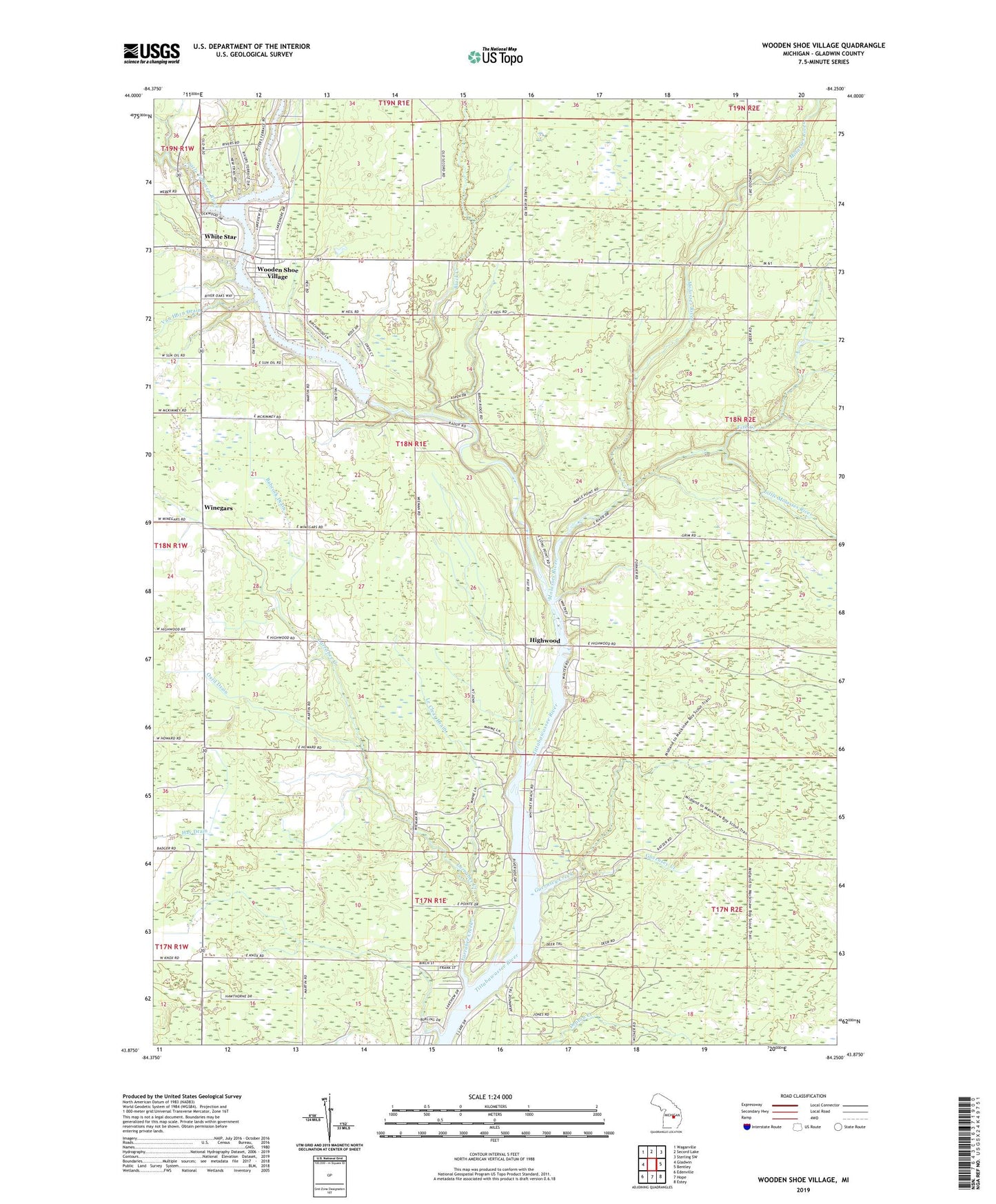
2019 topographic map quadrangle Wooden Shoe Village in the state of Michigan. Scale: 1:24000. Based on the newly updated USGS 7.5' US Topo map series, this map is in the following counties: Gladwin. The map contains contour data, water features, and other items you are used to seeing on USGS maps, but also has updated roads and other features. This is the next generation of topographic maps. Printed on high-quality waterproof paper with UV fade-resistant inks.
Quads adjacent to this one:
West: Gladwin
Northwest: Wagarville
North: Secord Lake
Northeast: Sterling SW
East: Bentley
Southeast: Estey
South: Hope
Southwest: Edenville
Contains the following named places: Babcock Drain, Billings Oil Field, Black Creek, Fish Creek, Guernsey Creek, Guernsey Creek Trail, Hays Township Hall, Highwood, Highwood Post Office, Highwood Station, Key Mobile Home Court, Larrabee Creek, Le Clear Drain, Little Molasses River, Little Tobacco River, McMahan Drain, Molasses River, Oard Drain, Robbins Drain, Smallwood Dam, Smallwood Lake, South Billings Oil Field, South Buckeye Oil Field, Thompson Drain, Township of Hay, Van Horn Drain, Watersedge Golf Course, White Star, Winegars, Winegars Post Office, Winegars Station, Wooden Shoe United Methodist Church, Wooden Shoe Village