
MyTopo
Yuma Michigan US Topo Map
Couldn't load pickup availability
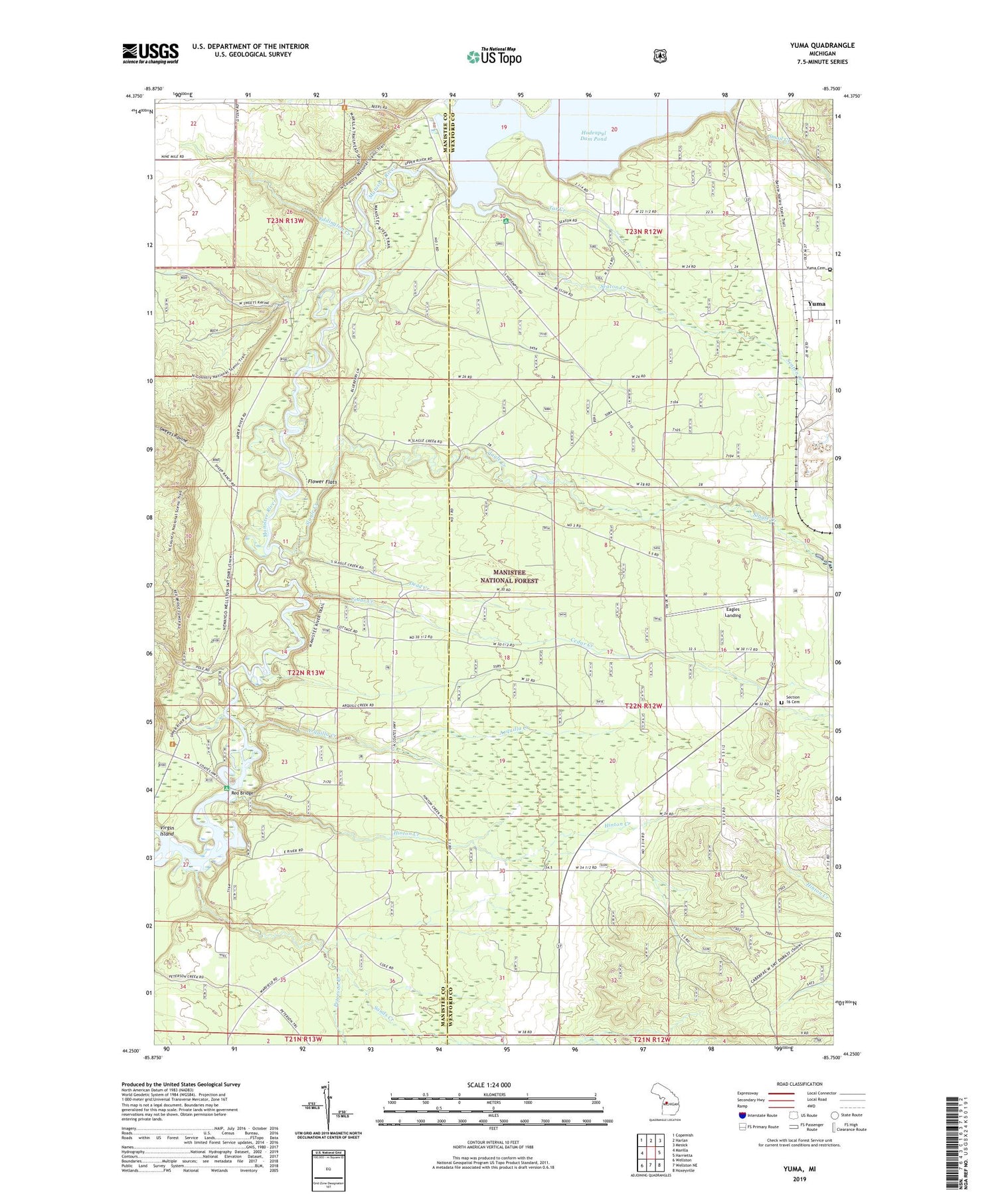
2019 topographic map quadrangle Yuma in the state of Michigan. Scale: 1:24000. Based on the newly updated USGS 7.5' US Topo map series, this map is in the following counties: Wexford, Manistee. The map contains contour data, water features, and other items you are used to seeing on USGS maps, but also has updated roads and other features. This is the next generation of topographic maps. Printed on high-quality waterproof paper with UV fade-resistant inks.
Quads adjacent to this one:
West: Marilla
Northwest: Copemish
North: Harlan
Northeast: Mesick
East: Harrietta
Southeast: Hoxeyville
South: Wellston NE
Southwest: Wellston
Contains the following named places: Arquilla Creek, Cedar Creek, Dead Creek, Eagles Landing, Eddington Creek, Flower Flats, Gospel Mission Church, Hinton Creek, Hodenpyl Dam, Hodenpyl Dam Pond, Hodenpyle Overlook, Marila Trailhead, Peterson Creek, Red Bridge, Red Bridge Lookout Tower, Red Bridge Public Access, Sands Creek, Seaton Creek, Seaton Creek Campground, Section 16 Cemetery, Slagle Creek, Smail Creek, Sweets Ravine, Tar Creek, Township of Slagle, Virgin Island, Yuma, Yuma Cemetery, Yuma Post Office, Yuma Station, ZIP Code: 49638


