MyTopo
Ada Minnesota US Topo Map
Couldn't load pickup availability
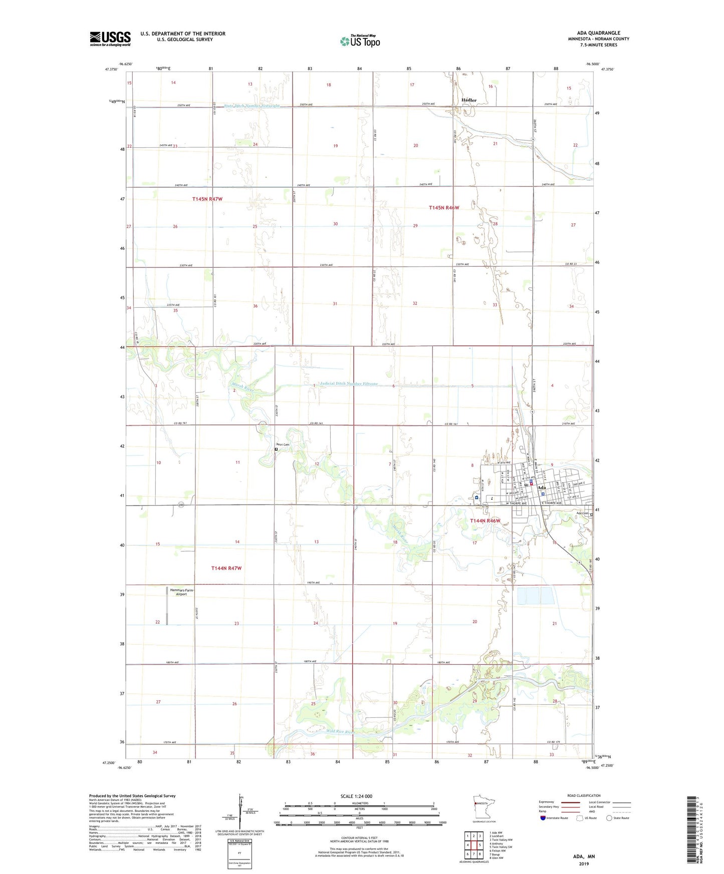
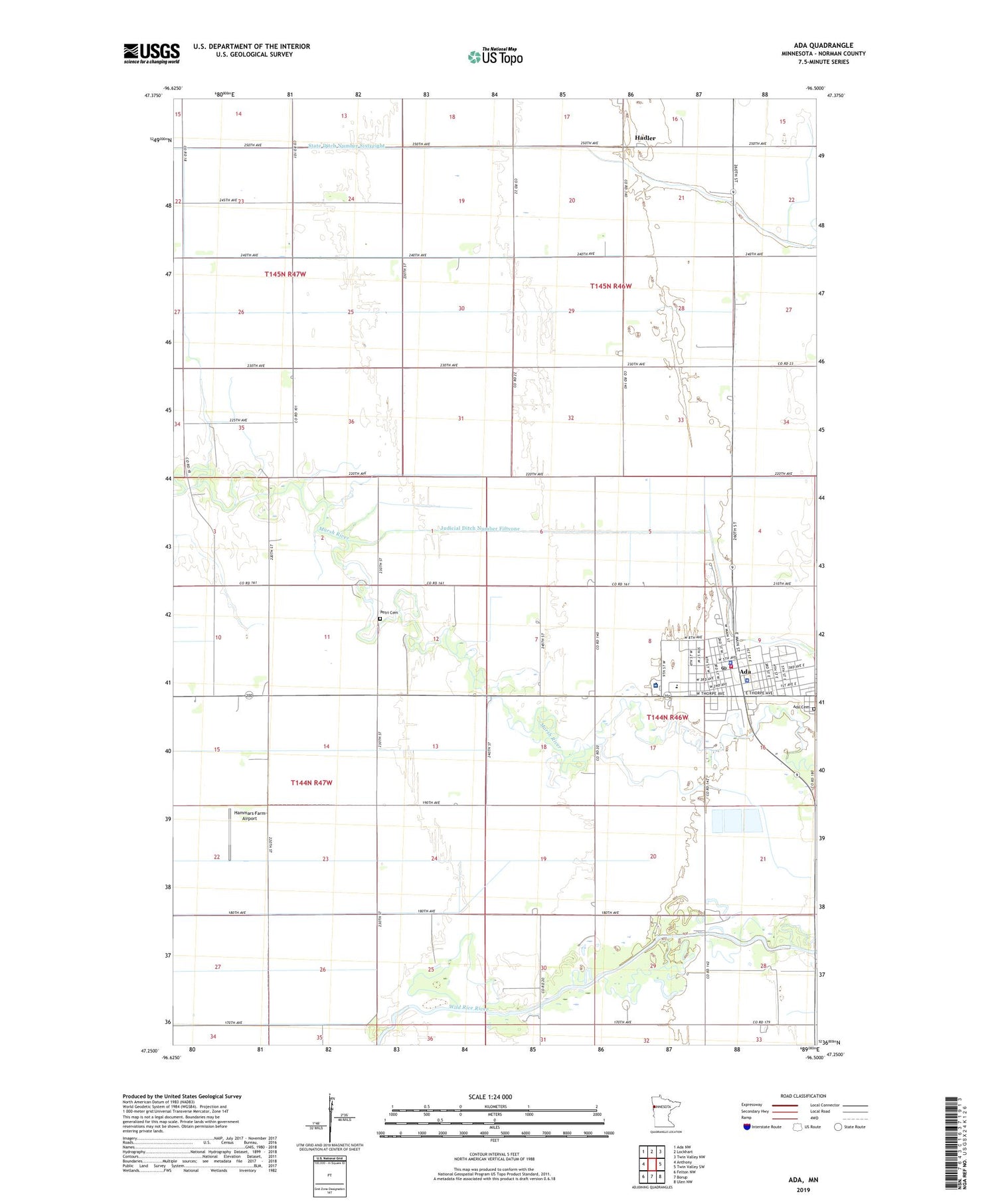
2019 topographic map quadrangle Ada in the state of Minnesota. Scale: 1:24000. Based on the newly updated USGS 7.5' US Topo map series, this map is in the following counties: Norman. The map contains contour data, water features, and other items you are used to seeing on USGS maps, but also has updated roads and other features. This is the next generation of topographic maps. Printed on high-quality waterproof paper with UV fade-resistant inks.
Quads adjacent to this one:
West: Anthony
Northwest: Ada NW
North: Lockhart
Northeast: Twin Valley NW
East: Twin Valley SW
Southeast: Ulen NW
South: Borup
Southwest: Felton NW
Contains the following named places: Ada, Ada Cemetery, Ada City Library, Ada Elementary School, Ada Junior-Senior High School, Ada Police Department, Ada Post Office, Ada Station, Ada Volunteer Fire Department, Beltrami United Methodist Church, Bosworth Park, Bridges Care Community, City of Ada, County Ditch Number Fifteen, County Ditch Number Seventeen, County Ditch Number Sixtynine, County Ditch Number Thirtysix, County Ditch Number Twentyfive, County Ditch Number Twentyfour, Dekko Park, East Side Park, Essentia Health Ada Clinic and Hospital, Evangelical Free Church, Faith United Church, Grace Lutheran Church, Hadler, Hadler Post Office, Hadler Station, Hammars Farm Airport, Heart of the Valley Golf Club, KRJB-FM (Ada), Merry Lane Mobile Home Park, Norman County Courthouse, Norman County Fairgrounds, Norman County Jail, Norman County Sheriff's Office, Petri Cemetery, Saint Joseph Catholic Church, SonRise Evangelical Free Church, State Ditch Number Sixtyeight, Township of Pleasant View, West Side Park, Zion Lutheran Church, ZIP Code: 56510