MyTopo
Akeley Minnesota US Topo Map
Couldn't load pickup availability
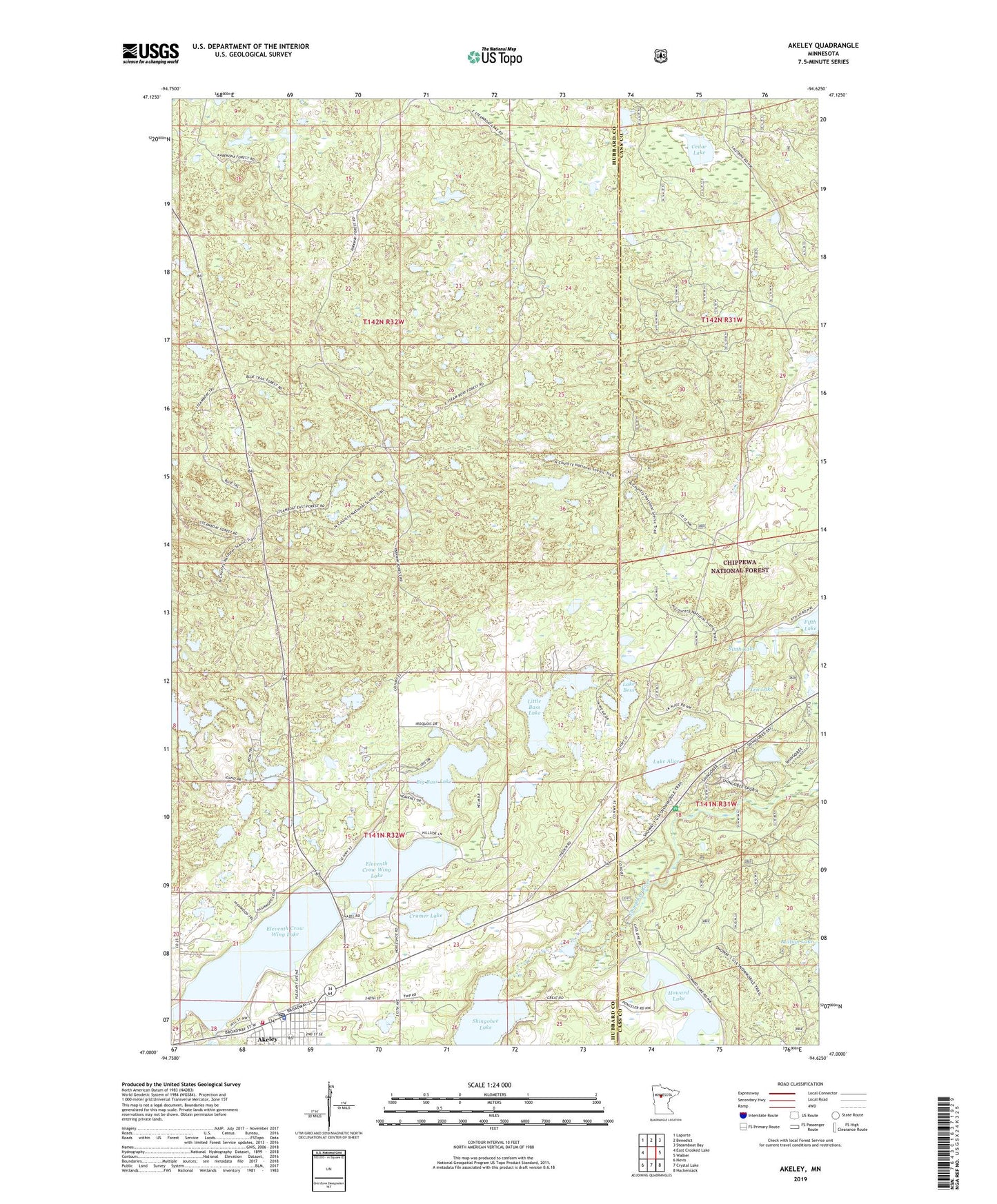
2019 topographic map quadrangle Akeley in the state of Minnesota. Scale: 1:24000. Based on the newly updated USGS 7.5' US Topo map series, this map is in the following counties: Hubbard, Cass. The map contains contour data, water features, and other items you are used to seeing on USGS maps, but also has updated roads and other features. This is the next generation of topographic maps. Printed on high-quality waterproof paper with UV fade-resistant inks.
Quads adjacent to this one:
West: East Crooked Lake
Northwest: Laporte
North: Benedict
Northeast: Steamboat Bay
East: Walker
Southeast: Hackensack
South: Crystal Lake
Southwest: Nevis
Contains the following named places: Akelely City Park, Akeley, Akeley Campground, Akeley City Hall, Akeley Elementary School, Akeley Police Department, Akeley Post Office, Akeley Railroad Station, Big Bass Lake, Cedar Lake, City of Akeley, Cramer Lake, Eastern Hubbard County Fire District Akeley Fire and Rescue, Eleventh Crow Wing Lake, First Lutheran Church, Heartland Trail, Howard Lake Trail, Lake Alice, Lake Alice Post Office, Lake Bess, Little Bass Lake, Paul Bunyan Historical Museum, Paul Bunyan Statue, Rickles Lake, Roger's on Red Lake Campground, Saint John's Catholic Church, Saint John's Lutheran Church, Schroeder Lake, Shingobee Lake, Shingobee Ski Area, Shingobee Trails, Sixth Lake, Snoway 1, Ten Lake, Township of Akeley, Township of Steamboat River, Trailhead Picnic Area, Upper Bass Lake, Walker Hackensack - Akeley School