MyTopo
Amory SE Mississippi US Topo Map
Couldn't load pickup availability
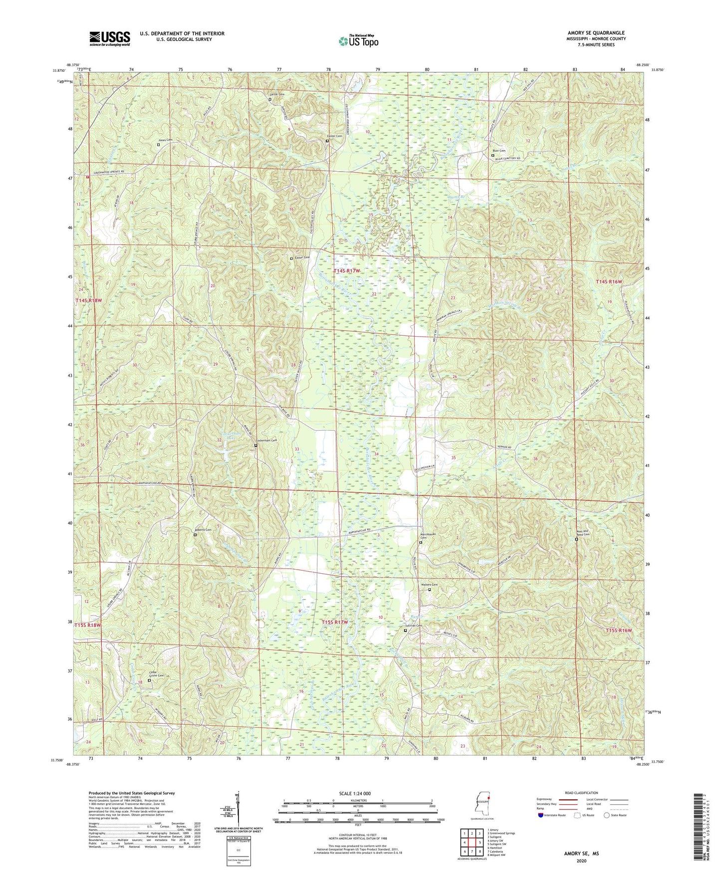
2020 topographic map quadrangle Amory SE in the state of Mississippi. Scale: 1:24000. Based on the newly updated USGS 7.5' US Topo map series, this map is in the following counties: Monroe. The map contains contour data, water features, and other items you are used to seeing on USGS maps, but also has updated roads and other features. This is the next generation of topographic maps. Printed on high-quality waterproof paper with UV fade-resistant inks.
Quads adjacent to this one:
West: Amory SW
Northwest: Amory
North: Greenwood Springs
Northeast: Sulligent
East: Sulligent SW
Southeast: Millport NW
South: Caledonia
Southwest: Hamilton
Contains the following named places: Alsup Creek, Bartahatchie Baptist Church, Beeks, Blair Cemetery, Buttahatchie, Cedar Grove Cemetery, Cockerham Cemetery, Cockerham Lake, Easter Cemetery, Glenhaven Roadside Park, Grub Springs Branch, Grub Springs Church, Grubb Springs, Jones Cemetery, Marchbanks Cemetery, Mormon Spring Branch, Mormon Springs, Moss and Reed Cemetery, Pleasant Grove Church, Pleasant Ridge Cumberland Presbyterian Church, Roberts Cemetery, Rocky Bluff Branch, Rural Hill Volunteer Fire Department, Rye, Rye Creek, Sams Branch, Sartor Cemetery, Sipsey Creek, Sullivan Cemetery, Sulphur Springs Church, Temperence Hill, Walters Cemetery, ZIP Code: 38844