MyTopo
Asa Mississippi US Topo Map
Couldn't load pickup availability
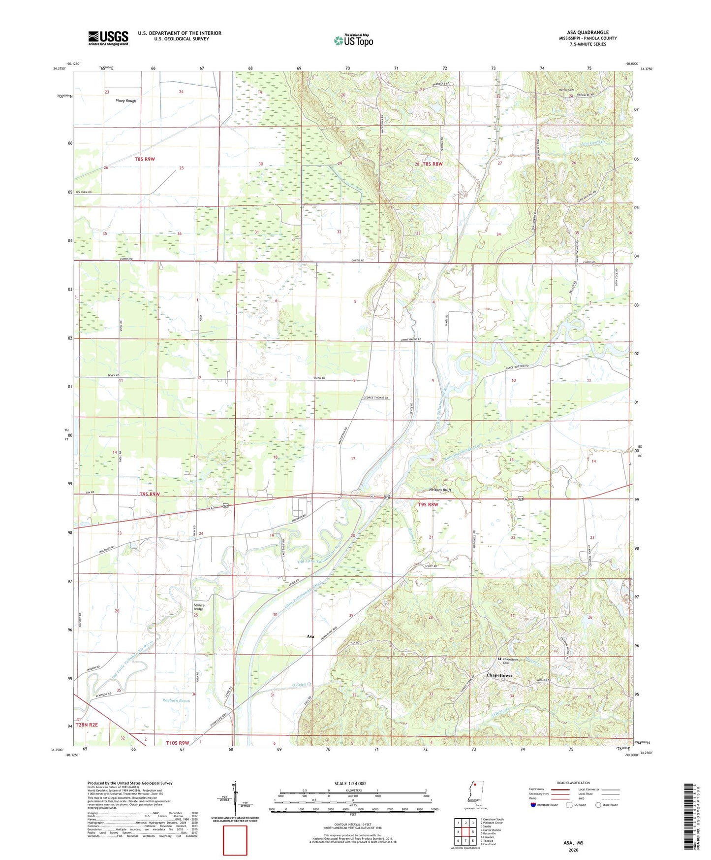
2020 topographic map quadrangle Asa in the state of Mississippi. Scale: 1:24000. Based on the newly updated USGS 7.5' US Topo map series, this map is in the following counties: Panola. The map contains contour data, water features, and other items you are used to seeing on USGS maps, but also has updated roads and other features. This is the next generation of topographic maps. Printed on high-quality waterproof paper with UV fade-resistant inks.
Quads adjacent to this one:
West: Curtis Station
Northwest: Crenshaw South
North: Pleasant Grove
Northeast: Sardis
East: Batesville
Southeast: Courtland
South: Tocowa
Southwest: Crowder
Contains the following named places: Armstead Creek, Asa, Birdsong Landing Strip, Caldwell School, Carrier Landing Field, Chapeltown, Chapeltown Cemetery, Concord Church, Concord School, Corn Cobb Church, Hayne Creek, Haynes Mill, Little Tallahatchie River, Lower Tallahatchie Y-10-37 Dam, Macedonia Church, Macedonia School, McIvor Cemetery, McIvor Church, Mount Evia Church, Nelsons Bluff, O'Brien Creek, Porters Bridge, Porters Ferry School, Running Slough Ditch, Second Concord Church, Spring Hill Church, Squirrel Bridge, Swango Chapel, Swango Church, The Round Hole, Wesley Church, West Panola Academy, Westside School