MyTopo
Barlow Mississippi US Topo Map
Couldn't load pickup availability
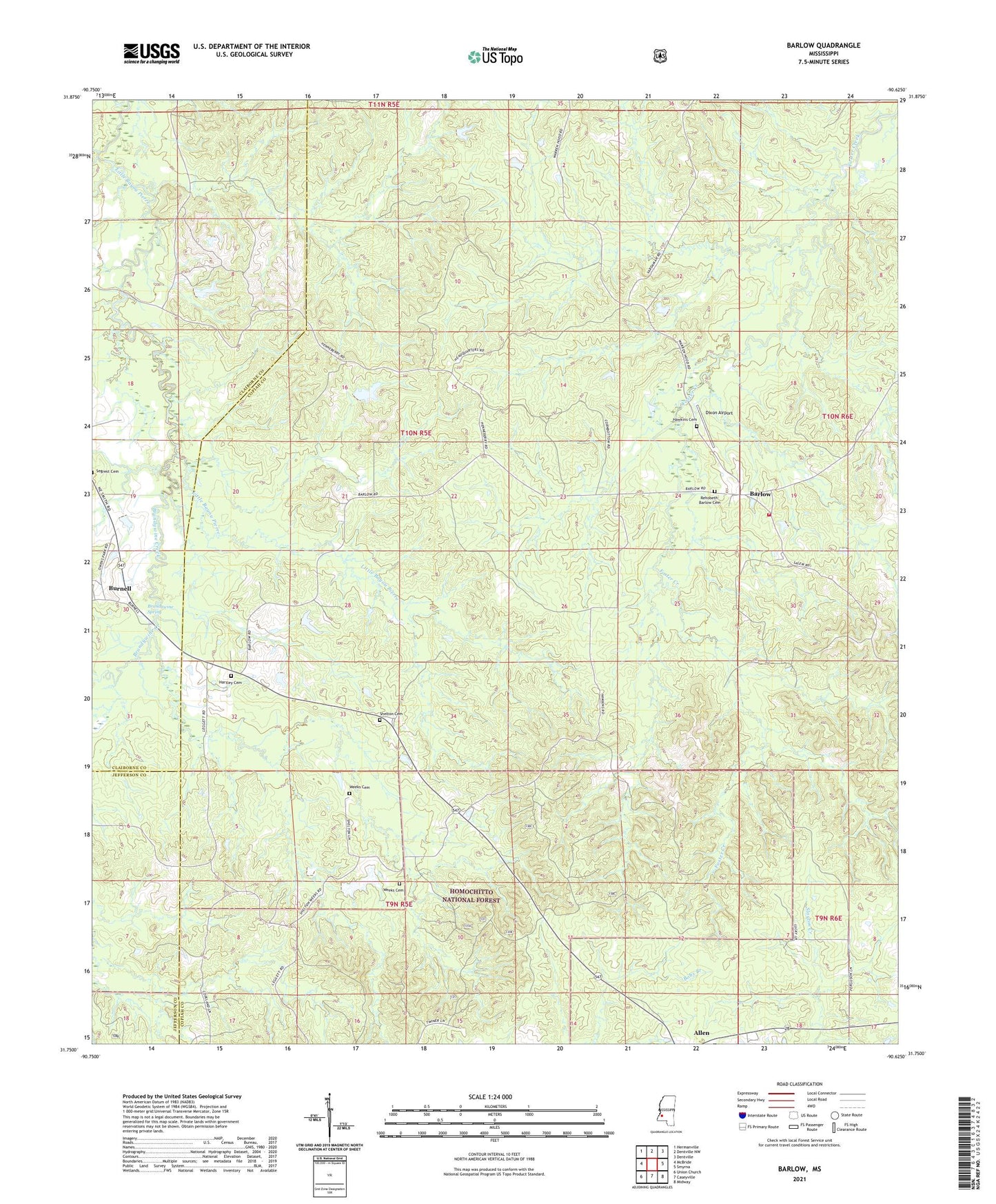
2021 topographic map quadrangle Barlow in the state of Mississippi. Scale: 1:24000. Based on the newly updated USGS 7.5' US Topo map series, this map is in the following counties: Copiah, Claiborne, Jefferson. The map contains contour data, water features, and other items you are used to seeing on USGS maps, but also has updated roads and other features. This is the next generation of topographic maps. Printed on high-quality waterproof paper with UV fade-resistant inks.
Quads adjacent to this one:
West: McBride
Northwest: Hermanville
North: Dentville NW
Northeast: Dentville
East: Smyrna
Southeast: Midway
South: Caseyville
Southwest: Union Church
Contains the following named places: Barlow, Barlow Volunteer Fire Department, Brandywine Church, Brandywine Creek, Brandywine Spring, Burnell, Copiah County State Wildlife Management Area, Dixon Airport, Farm Land Company Lake Dam, George F Henneberry Game Reserve, Hartley Cemetery, Hawkins Cemetery, Hawkins Plantation, Hickory Flat Church, Macedonia Church, Mount Zion Church, Pleasant Green Church, Providence Baptist Church, Providence Church, Rehobeth Methodist Church, Rehobeth-Barlow Cemetery, Salem Church, Shelton Cemetery, Warren Hood Lake Dam, Weeks Cemetery