MyTopo
Bayland SE Mississippi US Topo Map
Couldn't load pickup availability
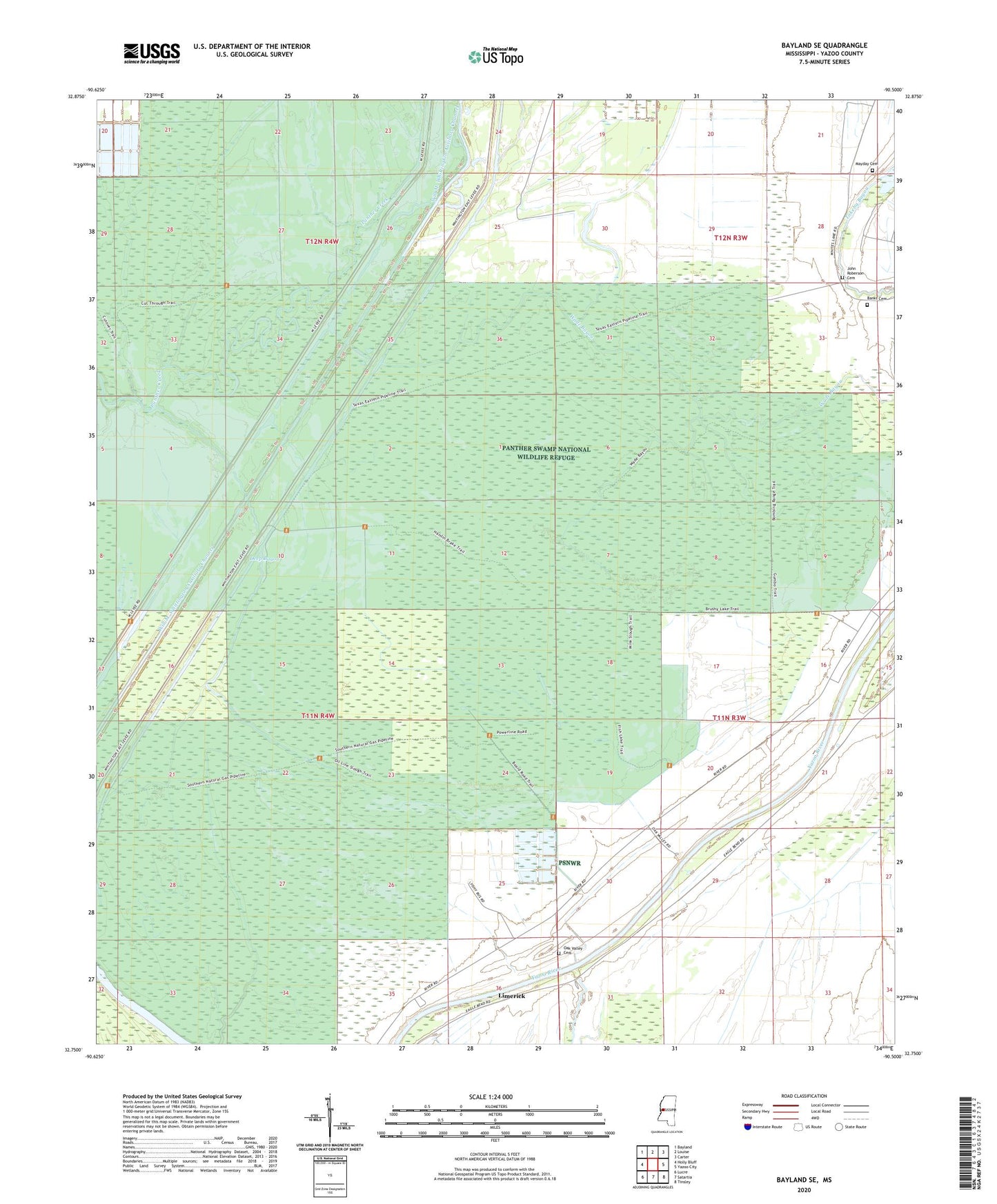
2020 topographic map quadrangle Bayland SE in the state of Mississippi. Scale: 1:24000. Based on the newly updated USGS 7.5' US Topo map series, this map is in the following counties: Yazoo. The map contains contour data, water features, and other items you are used to seeing on USGS maps, but also has updated roads and other features. This is the next generation of topographic maps. Printed on high-quality waterproof paper with UV fade-resistant inks.
Quads adjacent to this one:
West: Holly Bluff
Northwest: Bayland
North: Louise
Northeast: Carter
East: Yazoo City
Southeast: Tinsley
South: Satartia
Southwest: Lucre
Contains the following named places: Avoca Landing, Banks Cemetery, Battaille School, Deep Bayou, Haw Bluff Landing, Joes Walk Landing, John Roberson Cemetery, Lake George, Limerick, Limericks Landing, Mayday Cemetery, Mount Olive Church, New Paradise Church, Oak Valley Cemetery, Oak Valley Landing, Panther Swamp National Wildlife Refuge, Pauls Landing, Ratcliffs Landing, Rough and Ready Landing, Sherrards Old Landing, Supervisor District 5, Triune Church, Twelve Mile Bayou Landing, Wade Bayou, Willowdale Landing, ZIP Code: 39194