MyTopo
Bear Gut Bayou Mississippi US Topo Map
Couldn't load pickup availability
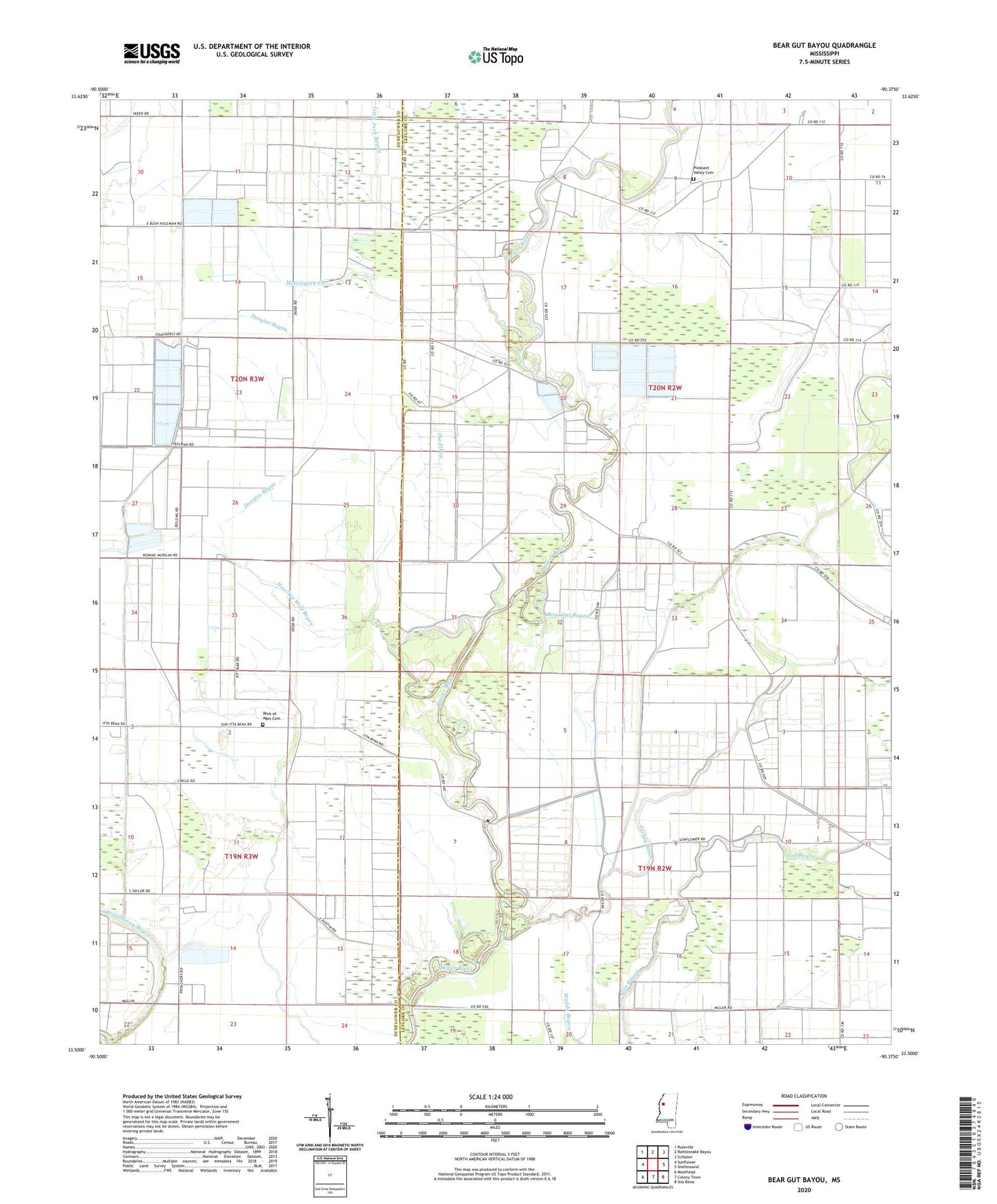
2020 topographic map quadrangle Bear Gut Bayou in the state of Mississippi. Scale: 1:24000. Based on the newly updated USGS 7.5' US Topo map series, this map is in the following counties: Leflore, Sunflower. The map contains contour data, water features, and other items you are used to seeing on USGS maps, but also has updated roads and other features. This is the next generation of topographic maps. Printed on high-quality waterproof paper with UV fade-resistant inks.
Quads adjacent to this one:
West: Sunflower
Northwest: Ruleville
North: Rattlesnake Bayou
Northeast: Schlater
East: Shellmound
Southeast: Itta Bena
South: Colony Town
Southwest: Moorhead
Contains the following named places: Bear Gut Bayou, Carl Pittman School, Douglas Bayou, Gin Bayou, Grayford School, Half Mile Church, Holmes Chapel, Hoteleon School, Howling Wolf Bayou, Jones Chapel, Little Jack Bayou, McGregory Creek, New Jerusalem Church, New Salem Church, Pitman School, Pleasant Valley Cemetery, Pleasant Valley Church, Rock of Ages Cemetery, Rock of Ages Church, Roundaway Bayou, Saint Paul Church, Tackett Fish Farms, Tackett Lake Dam, The Elbow, Turkey Bayou, Union Grove Church, Wabi School, Williams Chapel, Zion Chapel, Zion Rock Church