MyTopo
Big Swamp Mississippi US Topo Map
Couldn't load pickup availability
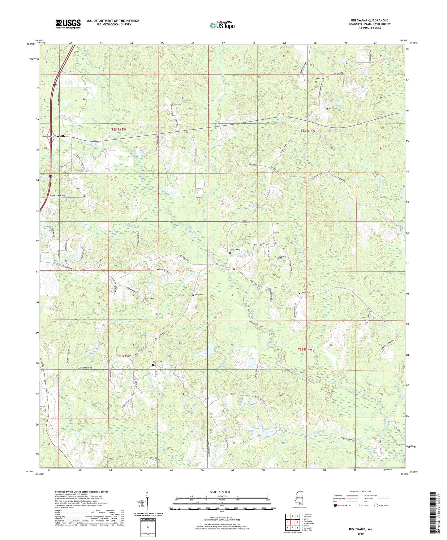
2020 topographic map quadrangle Big Swamp in the state of Mississippi. Scale: 1:24000. Based on the newly updated USGS 7.5' US Topo map series, this map is in the following counties: Pearl River. The map contains contour data, water features, and other items you are used to seeing on USGS maps, but also has updated roads and other features. This is the next generation of topographic maps. Printed on high-quality waterproof paper with UV fade-resistant inks.
Quads adjacent to this one:
West: Poplarville
Northwest: Orvisburg
North: Hillsdale
Northeast: Carnes
East: Browns Lake
Southeast: Silver Run
South: Savannah
Southwest: Millard
Contains the following named places: Alligator Creek, Beall Cemetery, Beaverdam Creek, Big Brake, Bilbo Lookout Tower, Bond Cemetery, Claude Gilheart Lake Dam, Cowpen Creek, Davis Creek, Frye Cemetery, Fryes Creek, Hickory Springs Church, Mill Creek, Mississippi Forestry Commission Pearl River County Office, Murder Creek, Myrick Cemetery, Poplar Springs Branch, Progress School, Rester Cemetery, Savannah Branch, Sheldon Creek, Smith and Smith Ranch Lake Dam, Smith Cemetery, Steephollow Volunteer Fire Department Station 3, Supervisor District 3, Waterhole Brake, Wolf River Game Management Area