MyTopo
Aldrich Missouri US Topo Map
Couldn't load pickup availability
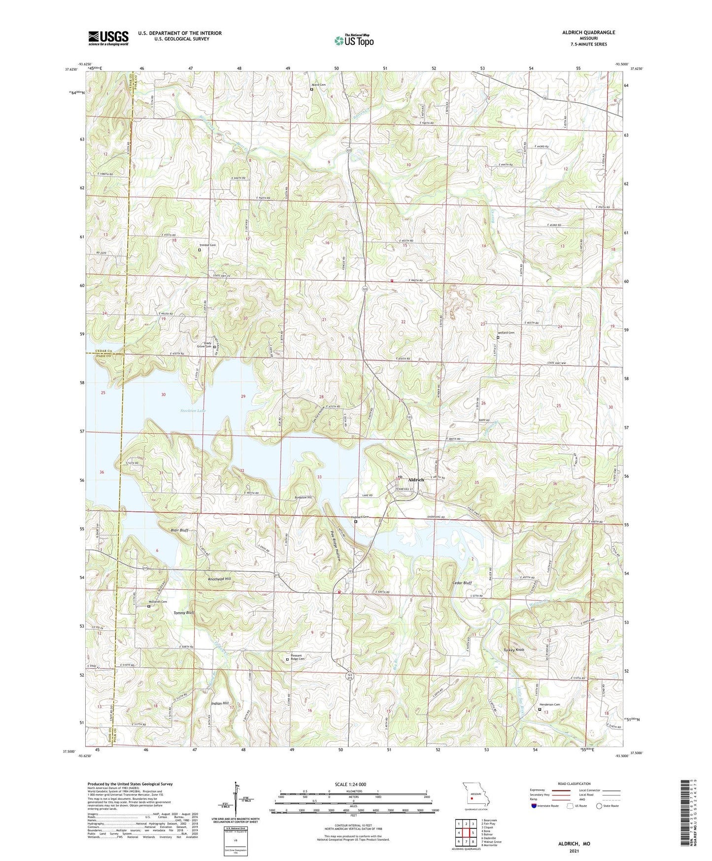
2021 topographic map quadrangle Aldrich in the state of Missouri. Scale: 1:24000. Based on the newly updated USGS 7.5' US Topo map series, this map is in the following counties: Polk, Dade, Cedar. The map contains contour data, water features, and other items you are used to seeing on USGS maps, but also has updated roads and other features. This is the next generation of topographic maps. Printed on high-quality waterproof paper with UV fade-resistant inks.
Quads adjacent to this one:
West: Bona
Northwest: Bearcreek
North: Fair Play
Northeast: Cliquot
East: Bolivar
Southeast: Morrisville
South: Walnut Grove
Southwest: Dadeville
Contains the following named places: Akard Cemetery, Aldrich, Aldrich Post Office, Barren Creek, Bear Creek Quarry, Big Branch, Blair Bluff, Bungalow Hill, Campground Church, Cedar Bluff, Coffman Branch, College Hill School, Cow Ford Hollow, Dunnegan Rural Fire Department Station 2, Edgewood School, Fox School, Henderson Cemetery, Hubbard Cemetery, Indian Hill, Kinder School, King Branch, Knothead Hill, McDaniel Cemetery, Mount Bethel School, Mount Zion Church, Orleans, Orleans School, Pea Ridge Hollow, Pleasant Ridge Cemetery, Pleasant Ridge Church, Pleasant Ridge School, Potts School, Shady Grove Cemetery, Shady Grove Mill, Shady Grove School, Stockton Lake, Tommy Bluff, Township of Union, Trimble Cemetery, Turkey Creek, Turkey Knob, Village of Aldrich, Walnut Creek, Walnut Grove Fire Protection District Station 2, Wollard Cemetery, ZIP Codes: 65601, 65649