MyTopo
Alley Spring Missouri US Topo Map
Couldn't load pickup availability
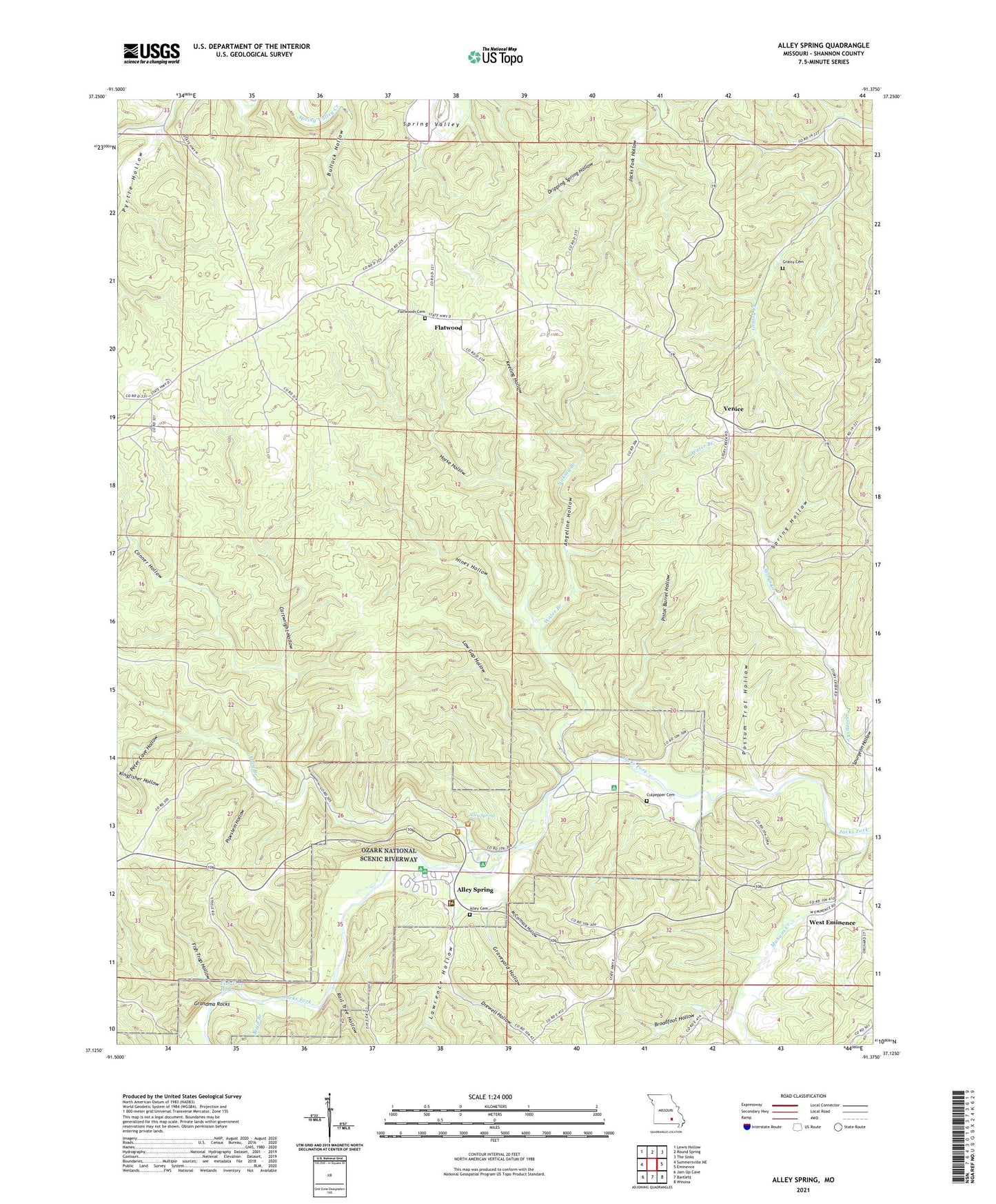
2021 topographic map quadrangle Alley Spring in the state of Missouri. Scale: 1:24000. Based on the newly updated USGS 7.5' US Topo map series, this map is in the following counties: Shannon. The map contains contour data, water features, and other items you are used to seeing on USGS maps, but also has updated roads and other features. This is the next generation of topographic maps. Printed on high-quality waterproof paper with UV fade-resistant inks.
Quads adjacent to this one:
West: Summersville NE
Northwest: Lewis Hollow
North: Round Spring
Northeast: The Sinks
East: Eminence
Southeast: Winona
South: Bartlett
Southwest: Jam Up Cave
Contains the following named places: Alley, Alley Branch, Alley Mill, Alley Spring, Alley Spring Campground, Alley Spring River Access, Alley Spring State Forest, Alley Spring State Park, Angeline Hollow, Angeline Post Office, Boyd Branch, Broadfoot Hollow, Bullock Hollow, Cartwright Hollow, Clow State Forest, Conner Hollow, Culpepper Cemetery, Drewell Hollow, Dripping Spring Hollow, Eminence Landing Strip, Eminence School, Fish Trap Hole, Fish Trap Hollow, Flatwood, Flatwoods School, Grandma Rocks, Grassy Cemetery, Grassy School, Graveyard Hollow, Hines Hollow, Horse Camp Campsite, Horse Hollow, House Hollow, Indian Pond, Keatons Campsite, Keeling Hollow, Kingfisher Hollow, Lawrence Hollow, Low Gap Hollow, Mahans Creek, McCormack Hollow, Peter Cave Hollow, Pipestem Hollow, Pistol Barrel Hollow, Possum Trot Hollow, Pyrtle Hollow, Rail Tree Hollow, Shannon County, Sinking Branch, Spring Hollow, Spur 3, Spurgeon Hollow, Storys School, Venice, Water Branch