MyTopo
Amoret Missouri US Topo Map
Couldn't load pickup availability
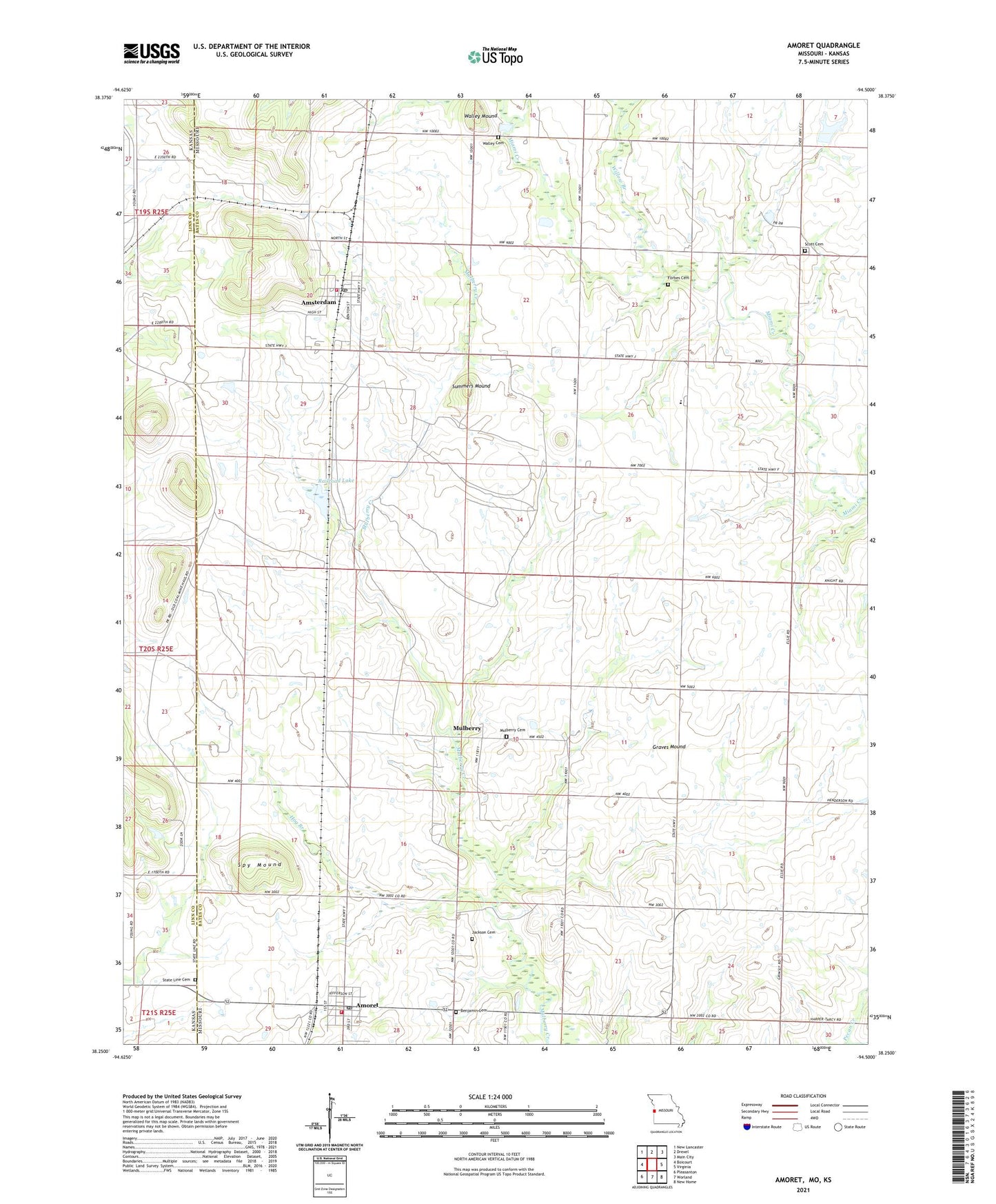
2021 topographic map quadrangle Amoret in the states of Missouri, Kansas. Scale: 1:24000. Based on the newly updated USGS 7.5' US Topo map series, this map is in the following counties: Bates, Linn. The map contains contour data, water features, and other items you are used to seeing on USGS maps, but also has updated roads and other features. This is the next generation of topographic maps. Printed on high-quality waterproof paper with UV fade-resistant inks.
Quads adjacent to this one:
West: Boicourt
Northwest: New Lancaster
North: Drexel
Northeast: Main City
East: Virginia
Southeast: New Home
South: Worland
Southwest: Pleasanton
Contains the following named places: Amoret, Amoret Fire Department, Amoret Post Office, Amoret School, Amsterdam, Amsterdam Post Office, Amsterdam Volunteer Fire Department, Benjamin Cemetery, City of Amoret, City of Amsterdam, Forbes Cemetery, Forbes School, Graves Mound, Hog Branch, Hot Water School, Jackson Cemetery, KCS Bridge A-65 Dam, Marais des Cygnes Massacre State Historic Site, Massacre Memorial State Park, Miami Elementary School, Miami High School, Mount Vernon Church, Mulberry, Mulberry Church, Nelson Lake Dam, Plain View School, Plum Branch, Railroad Lake, Scott Cemetery, Spy Mound, State Line Cemetery, Summers Mound, Township of Homer, Township of West Point, Vinton, Walley Cemetery, Walley Mound, Ward Lake Section 7 Dam, Willow Branch, Willow Branch School, ZIP Codes: 64722, 64723