MyTopo
Annada Missouri US Topo Map
Couldn't load pickup availability
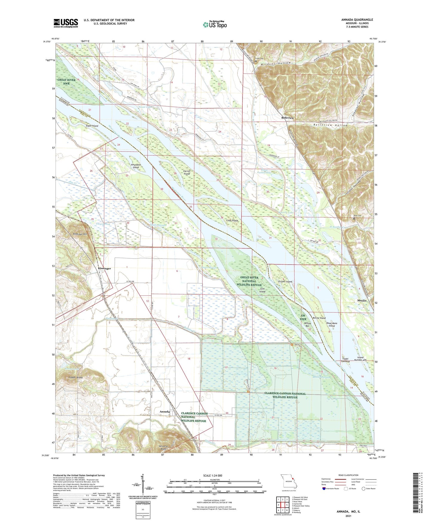
2021 topographic map quadrangle Annada in the states of Missouri, Illinois. Scale: 1:24000. Based on the newly updated USGS 7.5' US Topo map series, this map is in the following counties: Pike, Calhoun. The map contains contour data, water features, and other items you are used to seeing on USGS maps, but also has updated roads and other features. This is the next generation of topographic maps. Printed on high-quality waterproof paper with UV fade-resistant inks.
Quads adjacent to this one:
West: Clarksville
Northwest: Pleasant Hill West
North: Pleasant Hill East
Northeast: Pearl West
East: Pleasant Dale Valley
Southeast: Hamburg
South: Elsberry
Southwest: Auburn
Contains the following named places: Amaranth Island, Annada, Barber Airport, Bay Creek, Belleview, Belleview Election Precinct, Belleview Hollow, Brushy Pond, Bryants Creek, Carroll Island, Clarence Cannon National Wildlife Refuge, Coon Island, Crader Field Post Light, Crooked Creek, Dead Mans Island, Eagle Island, Forgey Pond, Fox Creek, Goose Pasture Lake, Green Wing Club, Grimes Island, Guinns Creek, Infidel Hollow, Island Number 475, Island Number 476, Keeven Dam, Keeven Lake, Kissenger, Kissenger Hill, Long Cemetery, McCoy Island, Merida Lake, Negro Slough, Pecan Lake, Poor Cemetery, Rabourn Slough, Ramsey Creek, Rip Rap Landing State Fish and Waterfowl Management Area, Riprap Landing, Shafer Slough, Slim Chute, Slim Island, Starkdale, Starkdale Post Office, Stearns Hollow, Tisdel Towhead, Village of Annada, Waverly Lake, West Panther Creek, Wildcat Hollow, Willow Bar, ZIP Code: 63330