
MyTopo
Arbyrd Missouri US Topo Map
Couldn't load pickup availability
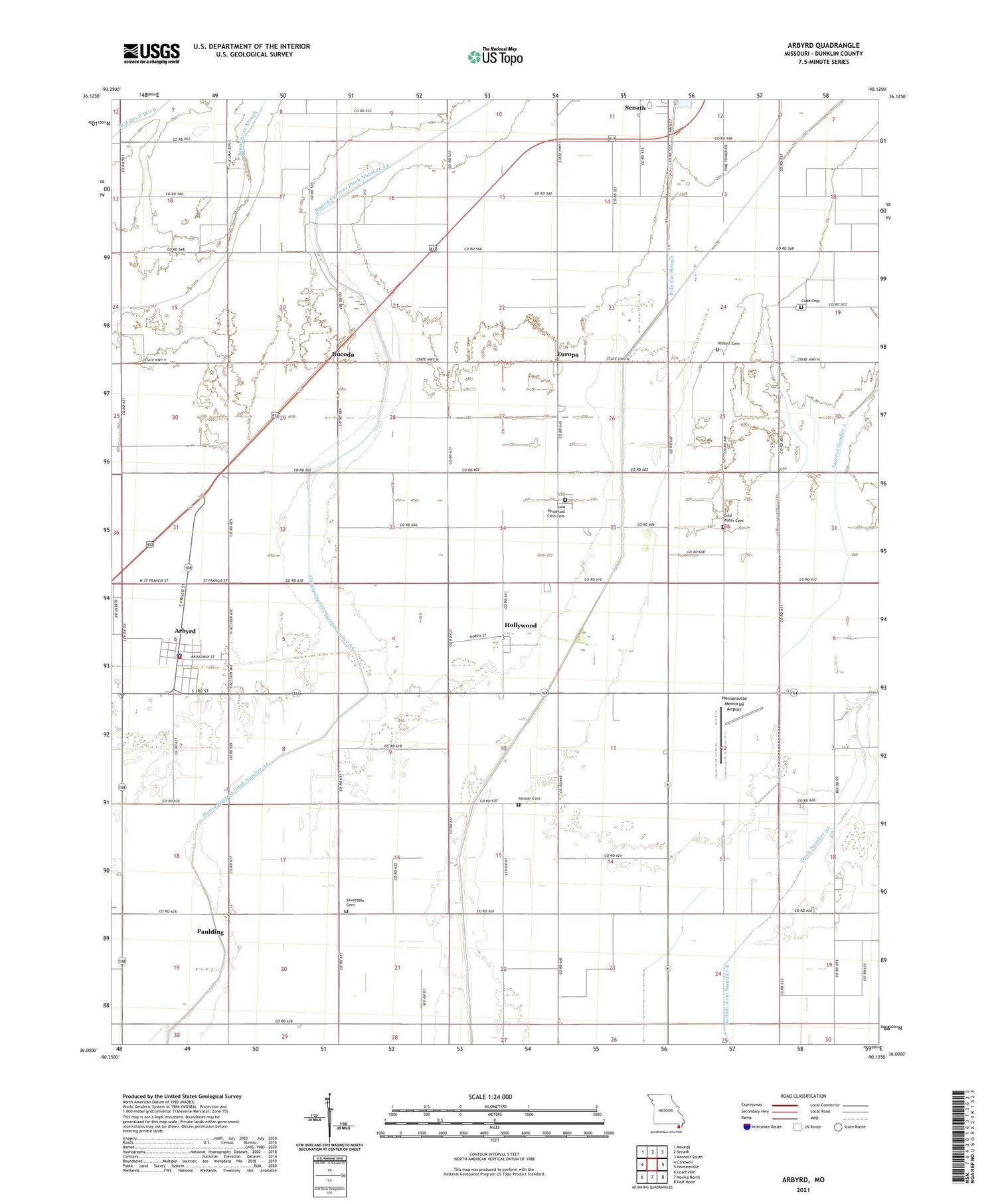
2021 topographic map quadrangle Arbyrd in the state of Missouri. Scale: 1:24000. Based on the newly updated USGS 7.5' US Topo map series, this map is in the following counties: Dunklin. The map contains contour data, water features, and other items you are used to seeing on USGS maps, but also has updated roads and other features. This is the next generation of topographic maps. Printed on high-quality waterproof paper with UV fade-resistant inks.
Quads adjacent to this one:
West: Cardwell
Northwest: Mounds
North: Senath
Northeast: Kennett South
East: Hornersville
Southeast: Half Moon
South: Manila North
Southwest: Leachville
Contains the following named places: Arbyrd, Arbyrd Police Department, Arbyrd Post Office, Arbyrd Volunteer Fire Department, Bone Camp Church, Bone School, Bucoda, Bucoda Church, Bucoda School, Buffalo Creek Ditch, Buffalo Island, Caneer, Caneer School, City of Arbyrd, Cold Water Cemetery, Coldwater Church, Coldwater School, Cole Ditch, Cude Cemetery, Cypress Point Island, Dunklin County, Europa, Europa School, Evorge, Hollywood, Hollywood Census Designated Place, Honey Cypress Ditch Number 34, Horner Cemetery, Hornersville Memorial Airport, Horse Island, Kearns, Lateral Number 2, Lulu Church, Lulu Perpetual Care Cemetery, Nesbit, New Hope Church, Old Coldwater Church, Paulding, Paulding School, Pole Cat Slough, Sand Pit, Shields Church, Shields School, Silverdale Cemetery, Silverdale Church, Silverdale School, Township of Salem, Vardell School, Wilkins Cemetery, ZIP Code: 63821


