MyTopo
Armstrong Missouri US Topo Map
Couldn't load pickup availability
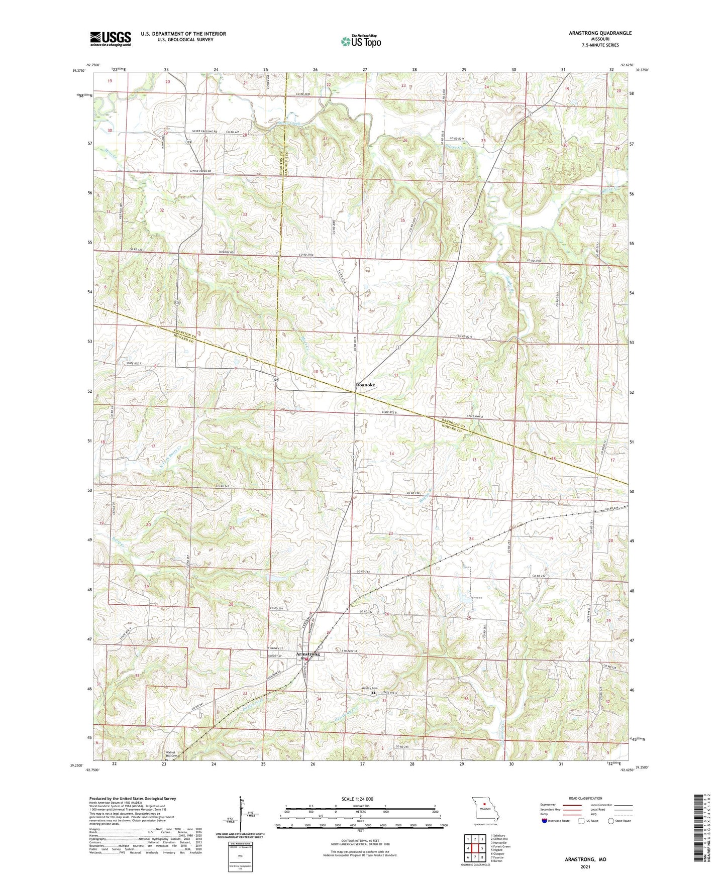
2021 topographic map quadrangle Armstrong in the state of Missouri. Scale: 1:24000. Based on the newly updated USGS 7.5' US Topo map series, this map is in the following counties: Howard, Randolph, Chariton. The map contains contour data, water features, and other items you are used to seeing on USGS maps, but also has updated roads and other features. This is the next generation of topographic maps. Printed on high-quality waterproof paper with UV fade-resistant inks.
Quads adjacent to this one:
West: Forest Green
Northwest: Salisbury
North: Clifton Hill
Northeast: Huntsville
East: Higbee
Southeast: Burton
South: Fayette
Southwest: Glasgow
Contains the following named places: Armstrong, Armstrong Fire Protection District, Armstrong Post Office, Armstrong Reservoir Dam, Armstrong School, Bagby Branch, Butner School, City of Armstrong, Helmich Lake, Helmich Lake Dam, Roanoke, Roanoke School, Robertson Farms Incorporated Dam, Sharon Church, Sharon School, Stroupe Lake Dam, Township of Prairie, Township of Silver Creek, Walnut Hill Cemetery, Wesley Cemetery, ZIP Code: 65230