MyTopo
Ash Grove Missouri US Topo Map
Couldn't load pickup availability
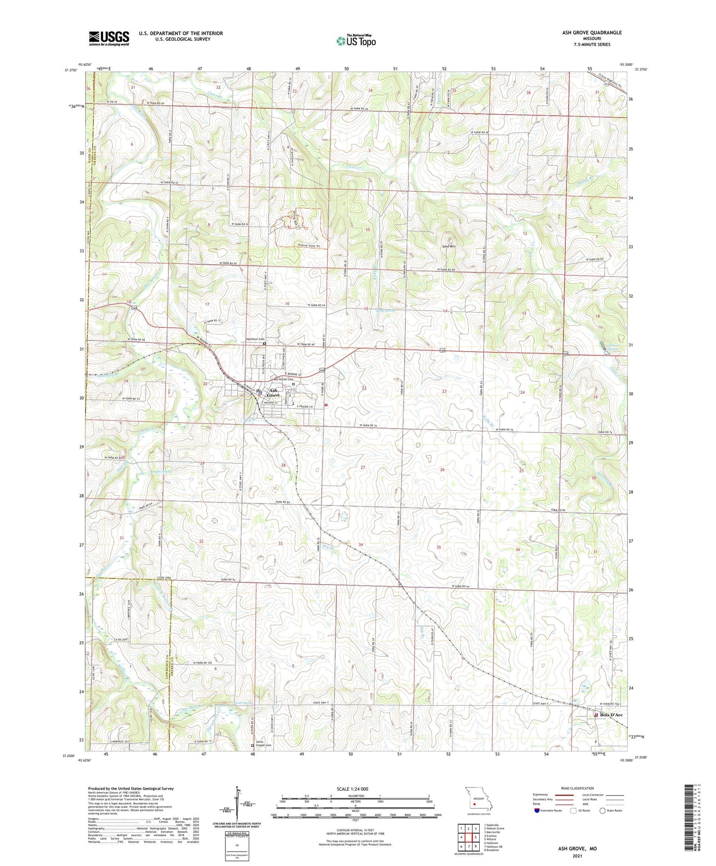
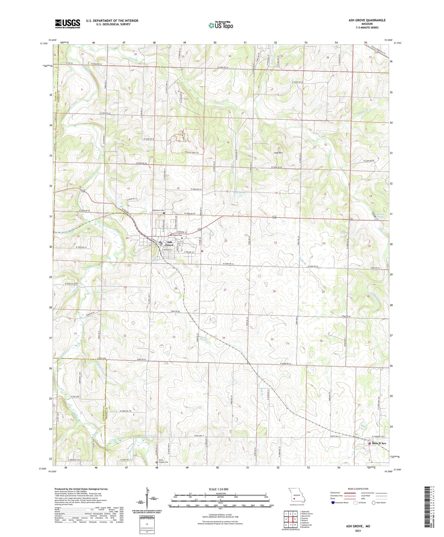
2021 topographic map quadrangle Ash Grove in the state of Missouri. Scale: 1:24000. Based on the newly updated USGS 7.5' US Topo map series, this map is in the following counties: Greene, Lawrence, Dade. The map contains contour data, water features, and other items you are used to seeing on USGS maps, but also has updated roads and other features. This is the next generation of topographic maps. Printed on high-quality waterproof paper with UV fade-resistant inks.
Quads adjacent to this one:
West: Everton
Northwest: Dadeville
North: Walnut Grove
Northeast: Morrisville
East: Willard
Southeast: Brookline
South: Halltown NE
Southwest: Halltown
Contains the following named places: Ash Grove, Ash Grove Fire Protection District, Ash Grove Police Department, Ash Grove Post Office, Bois D Arc Fire Protection District Station 1, Bois D'Arc, Bois D'Arc Post Office, Center Church, Center Hill Church, Center School, Central Church, City of Ash Grove, Coleman School, Dry Branch, Fairview School, Gentral Church, Gilmore Spring, Hall Branch, Hamilton Cemetery, Harold School, Hawkins Branch, Johns Chapel, Johns Chapel Cemetery, Kelly Branch, Kelly School, Kelly Spring, Leeper School, Leeper Spring, Mathew Brown Branch, New Site School, Pleasant Hope School, Province Branch, Sand Mountain, Sardine Creek, Sawdey Branch, Scott Spring, Staley Branch, Stony Point Church, Stony Point School, Sugar Creek, Sycamore Creek, Township of Boone Number 1, Township of Boone Number 2, ZIP Code: 65604