MyTopo
Avilla Missouri US Topo Map
Couldn't load pickup availability
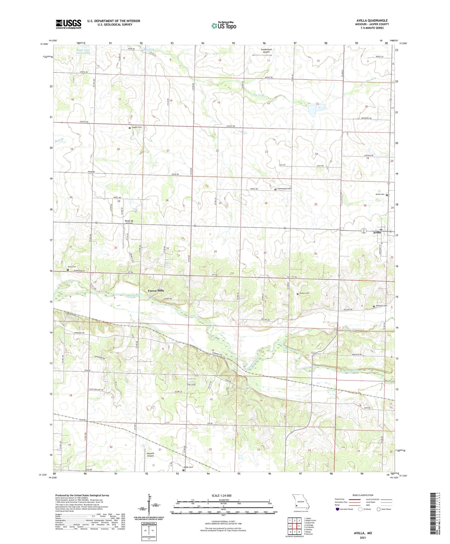
2021 topographic map quadrangle Avilla in the state of Missouri. Scale: 1:24000. Based on the newly updated USGS 7.5' US Topo map series, this map is in the following counties: Jasper. The map contains contour data, water features, and other items you are used to seeing on USGS maps, but also has updated roads and other features. This is the next generation of topographic maps. Printed on high-quality waterproof paper with UV fade-resistant inks.
Quads adjacent to this one:
West: Carthage
Northwest: Jasper
North: Maple Grove
Northeast: Dudenville
East: La Russell
Southeast: Sarcoxie
South: Reeds
Southwest: Fidelity
Contains the following named places: Andrews Airport, Arthur Cemetery, Arthur School, Avilla, Avilla Cemetery, Avilla Elementary School, Avilla Post Office, Bethany Church, Center Point Church, Center Point School, Charter Oak Church, Charter Oak School, Dimple, Elmira School, Empire School, Fasken Cemetery, Forest Mill School, Forest Mills, Grey Cemetery, Jasper Cemetery, Maple Lane Farms Lake, Melugin, Midway, Nimsick Airport, Route 66 Airfield, Summerset Cemetery, Sunderland Airport, Sunflower School, Temperance School, Town of Avilla, Township of Madison, White Oak Creek, Williams Cemetery, ZIP Codes: 64833, 64859