MyTopo
Barnumton Missouri US Topo Map
Couldn't load pickup availability
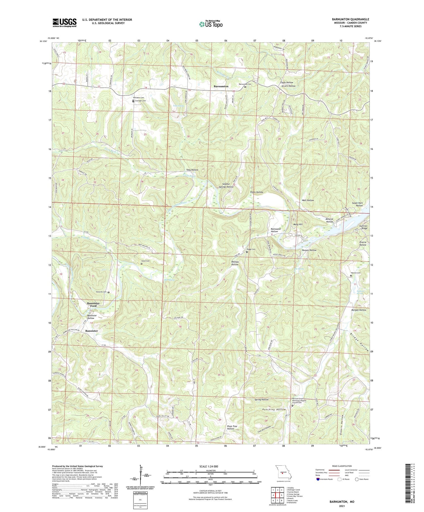
2021 topographic map quadrangle Barnumton in the state of Missouri. Scale: 1:24000. Based on the newly updated USGS 7.5' US Topo map series, this map is in the following counties: Camden. The map contains contour data, water features, and other items you are used to seeing on USGS maps, but also has updated roads and other features. This is the next generation of topographic maps. Printed on high-quality waterproof paper with UV fade-resistant inks.
Quads adjacent to this one:
West: Climax Springs
Northwest: Knobby
North: Bollinger Creek
Northeast: Sunrise Beach
East: Green Bay Terrace
Southeast: Hahatonka
South: Macks Creek
Southwest: Branch
Contains the following named places: Bannister, Bannister Ford, Bannister Hollow, Barnumton, Barnumton Cemetery, Blue Spring, Bridge Hollow, Camden School, Coelleda, Crocker School, Eadsons Spring, Edwards Cemetery, Estes Hollow, Fiery Fork, Fiery Fork State Forest, Grainger Cemetery, Hazel Valley School, Hurst Cemetery, Husson Hollow, Kolb Branch, Lime Kiln Hollow, Little Niangua River, Lower Prairie Hollow Church, Mineral Hollow, Mission Point Church, Morg Hill, Morgan Hollow, Nonsuch, Osborn Hollow, Ozark Bethel Chapel, Parrack Grove Church, Parrack Grove Missionary Baptist Church Cemetery, Phillips Hollow, Poe Spring, Prairie Hollow, Prairie Hollow School, Punching Hollow, Ragg School, Raggs Cemetery, Rainwater Hollow, Southwest Camden County Fire Protection District Station 1 Headquarters, Spring Hollow, Sulphur Springs Hollow, Susan Hart Hollow, Toby Hollow, Toby Spring, Warren Cemetery, Well Hollow, Whitaker Cemetery, ZIP Code: 65787