MyTopo
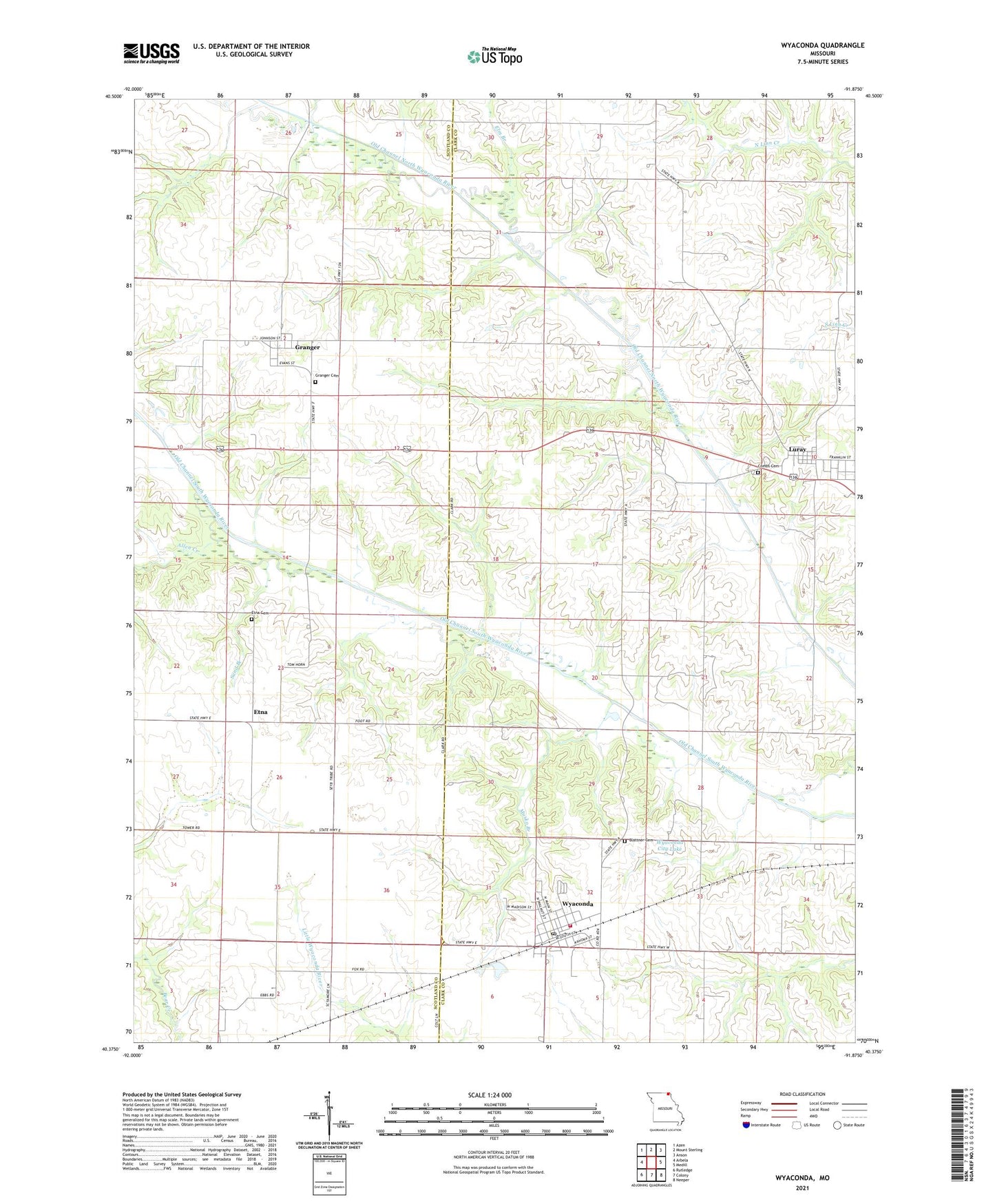
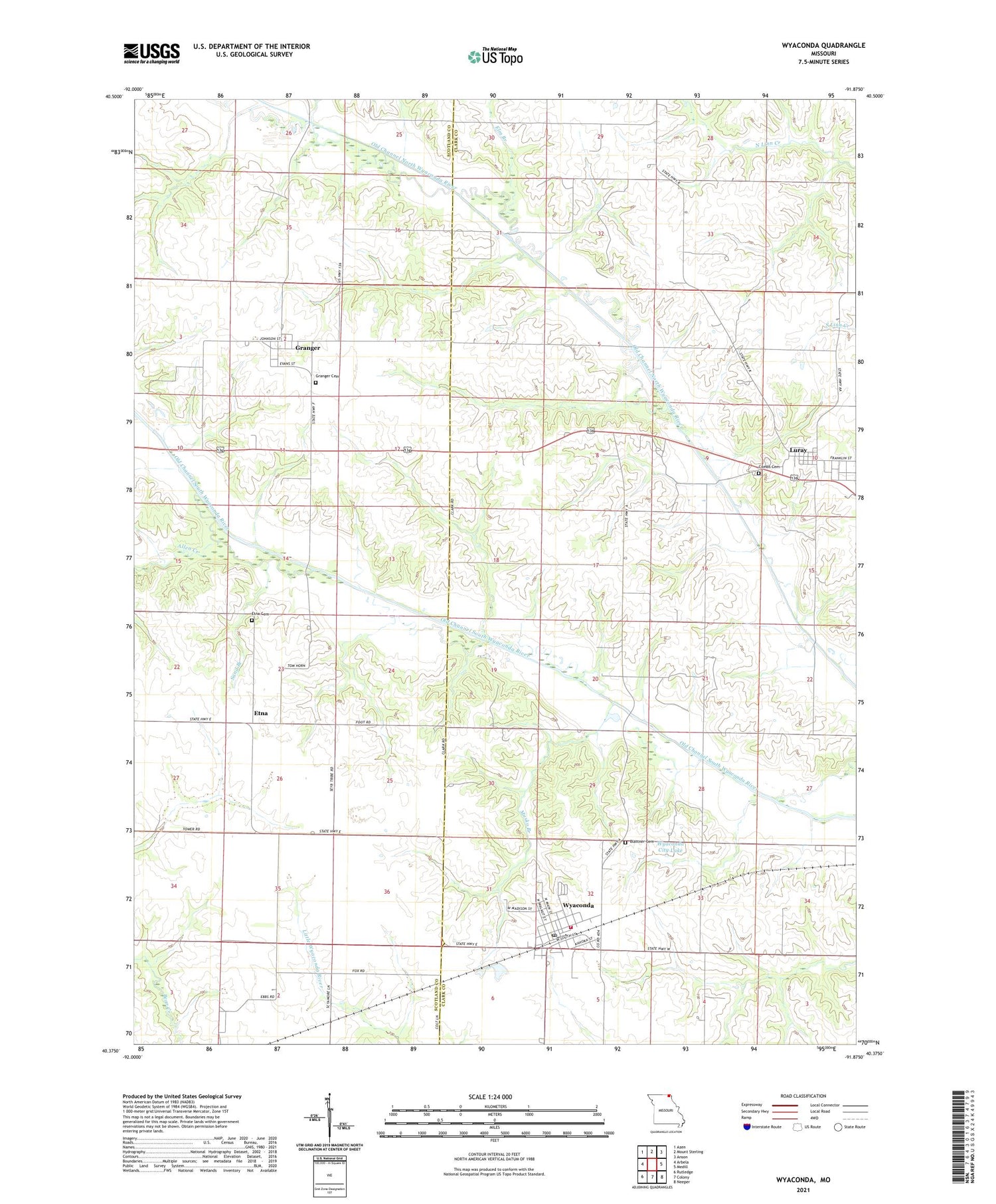
Wyaconda Missouri US Topo Map
Couldn't load pickup availability
2021 topographic map quadrangle Wyaconda in the state of Missouri. Scale: 1:24000. Based on the newly updated USGS 7.5' US Topo map series, this map is in the following counties: Clark, Scotland. The map contains contour data, water features, and other items you are used to seeing on USGS maps, but also has updated roads and other features. This is the next generation of topographic maps. Printed on high-quality waterproof paper with UV fade-resistant inks.
Quads adjacent to this one:
West: Arbela
Northwest: Azen
North: Mount Sterling
Northeast: Anson
East: Medill
Southeast: Neeper
South: Colony
Southwest: Rutledge
Contains the following named places: Allen Creek, Blattner Cemetery, Carmel, City of Wyaconda, Combs Cemetery, Eldorado, Elm Branch, Elm School, Etna, Etna Cemetery, Etna School, Flint Ridge School, Granger, Granger Cemetery, Hicks School, Luray, Musko Branch, Old Channel North Wyaconda River, Old Channel South Wyaconda River, Railroad Lake, Robertson Lake Dam, Sand Branch, Township of Wyaconda, Village of Granger, Village of Luray, Wyaconda, Wyaconda City Dam, Wyaconda City Lake, Wyaconda Community Fire Department, Wyaconda Post Office, ZIP Code: 63432