MyTopo
Acton Montana US Topo Map
Couldn't load pickup availability
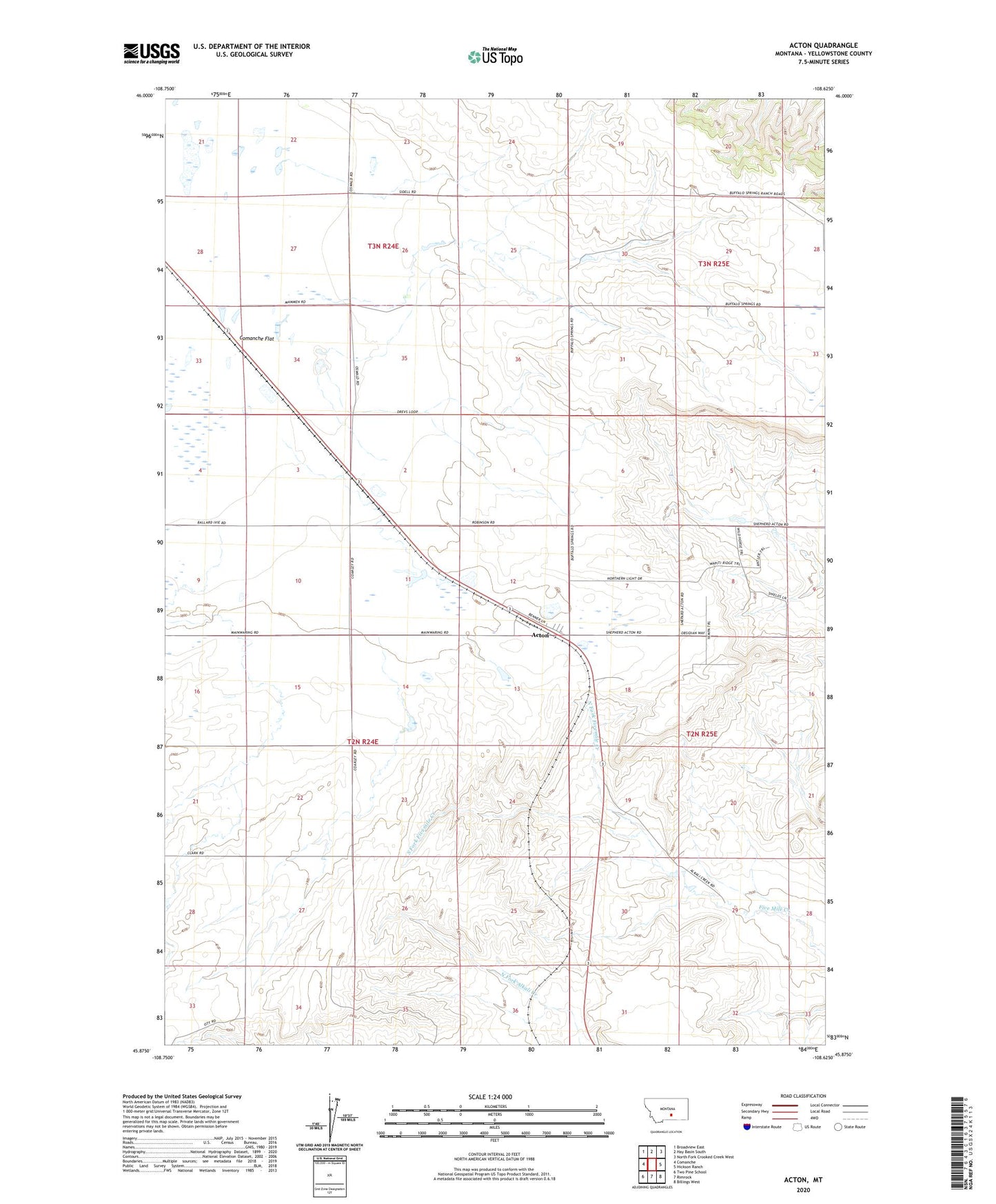
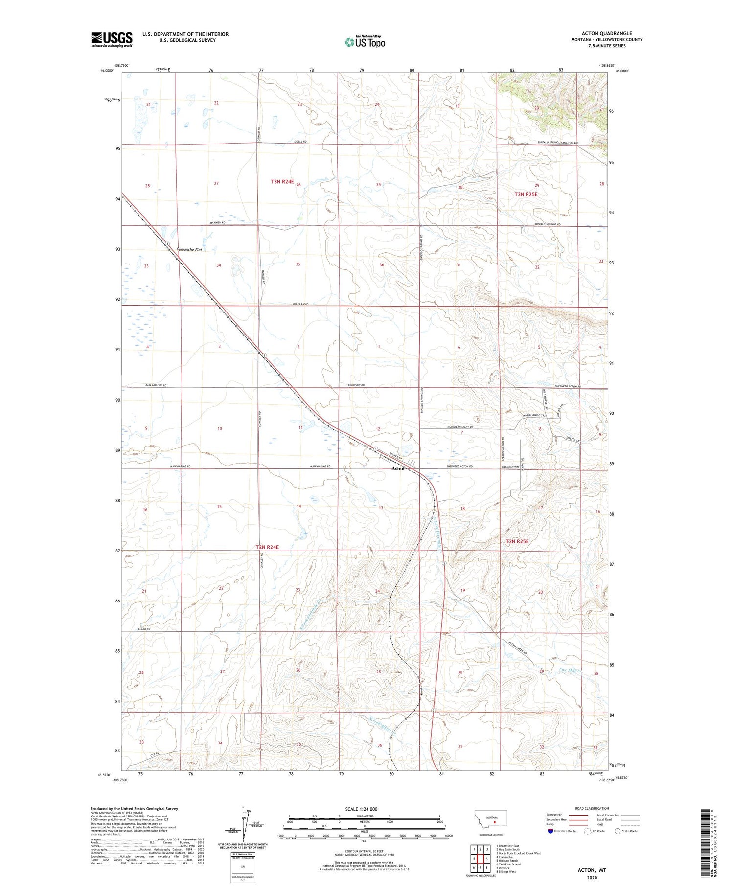
2020 topographic map quadrangle Acton in the state of Montana. Scale: 1:24000. Based on the newly updated USGS 7.5' US Topo map series, this map is in the following counties: Yellowstone. The map contains contour data, water features, and other items you are used to seeing on USGS maps, but also has updated roads and other features. This is the next generation of topographic maps. Printed on high-quality waterproof paper with UV fade-resistant inks.
Quads adjacent to this one:
West: Comanche
Northwest: Broadview East
North: Hay Basin South
Northeast: North Fork Crooked Creek West
East: Hickson Ranch
Southeast: Billings West
South: Rimrock
Southwest: Two Pine School
Contains the following named places: 02N24E12A___01 Well, 02N24E13A___01 Well, 02N24E22B___01 Well, 02N25E18B___01 Well, 02N25E19B___01 Well, 02N25E20CCDA01 Well, 02N25E20D___01 Well, 03N24E26B___01 Well, Acton, Acton Census Designated Place, Coakley Church, Fairview, North Fork Fivemile Creek, Northwest Yellowstone Division, South Fork Fivemile Creek