MyTopo
Ahern Pass Montana US Topo Map
Couldn't load pickup availability
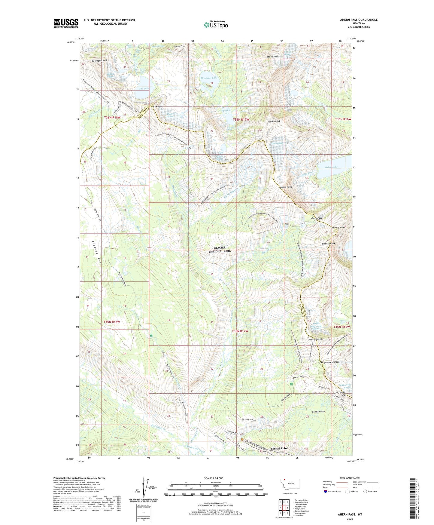
2020 topographic map quadrangle Ahern Pass in the state of Montana. Scale: 1:24000. Based on the newly updated USGS 7.5' US Topo map series, this map is in the following counties: Flathead, Glacier. The map contains contour data, water features, and other items you are used to seeing on USGS maps, but also has updated roads and other features. This is the next generation of topographic maps. Printed on high-quality waterproof paper with UV fade-resistant inks.
Quads adjacent to this one:
West: Mount Geduhn
Northwest: Porcupine Ridge
North: Mount Cleveland
Northeast: Gable Mountain
East: Many Glacier
Southeast: Logan Pass
South: Mount Cannon
Southwest: Camas Ridge East
Contains the following named places: Ahern Creek, Ahern Glacier, Ahern Pass, Ahern Peak, Atsina Falls, Cathedral Peak, Cattle Queen Creek, Chaney Glacier, Crystal Point, Fifty Mountain Shelter Cabin, Flattop Creek, Flattop Mountain, Flattop Mountain Trail, Granite Park, Granite Park Trail, Helen Lake, Highline Trail, Iceberg Notch, Iceberg Peak, Ipasha Falls, Ipasha Glacier, Ipasha Lake, Ipasha Peak, Kipp Creek, Margaret Lake, McDonald Creek Trail, Mineral Creek, Mount Kipp, Mount Merritt, Natoas Peak, North Swiftcurrent Glacier, Old Sun Glacier, Paiota Falls, Pyramid Peak, Raven Quiver Falls, Shepard Glacier, Sue Lake, Swiftcurrent Mountain, Swiftcurrent Pass, The Loop