MyTopo
Ahles Montana US Topo Map
Couldn't load pickup availability
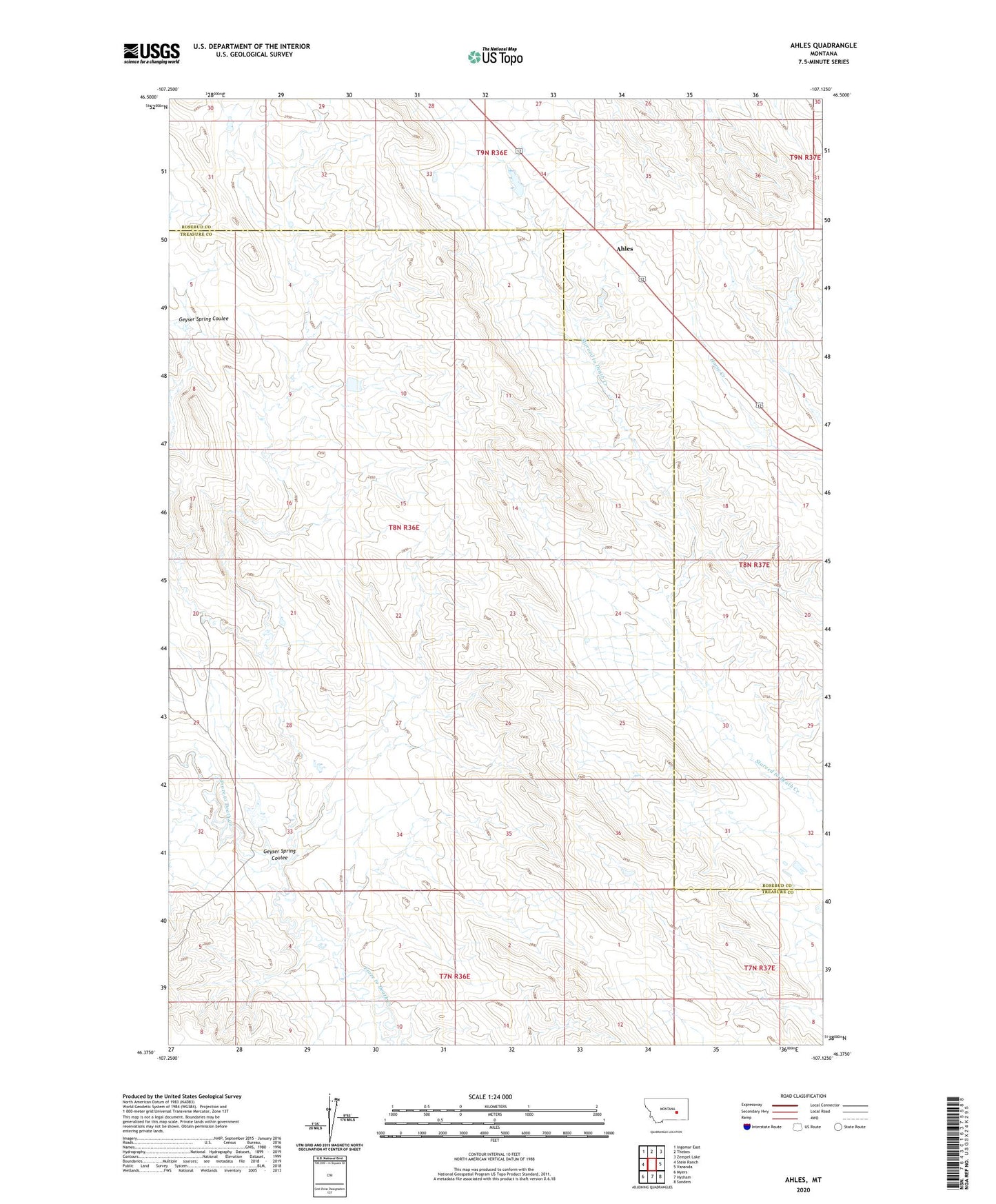
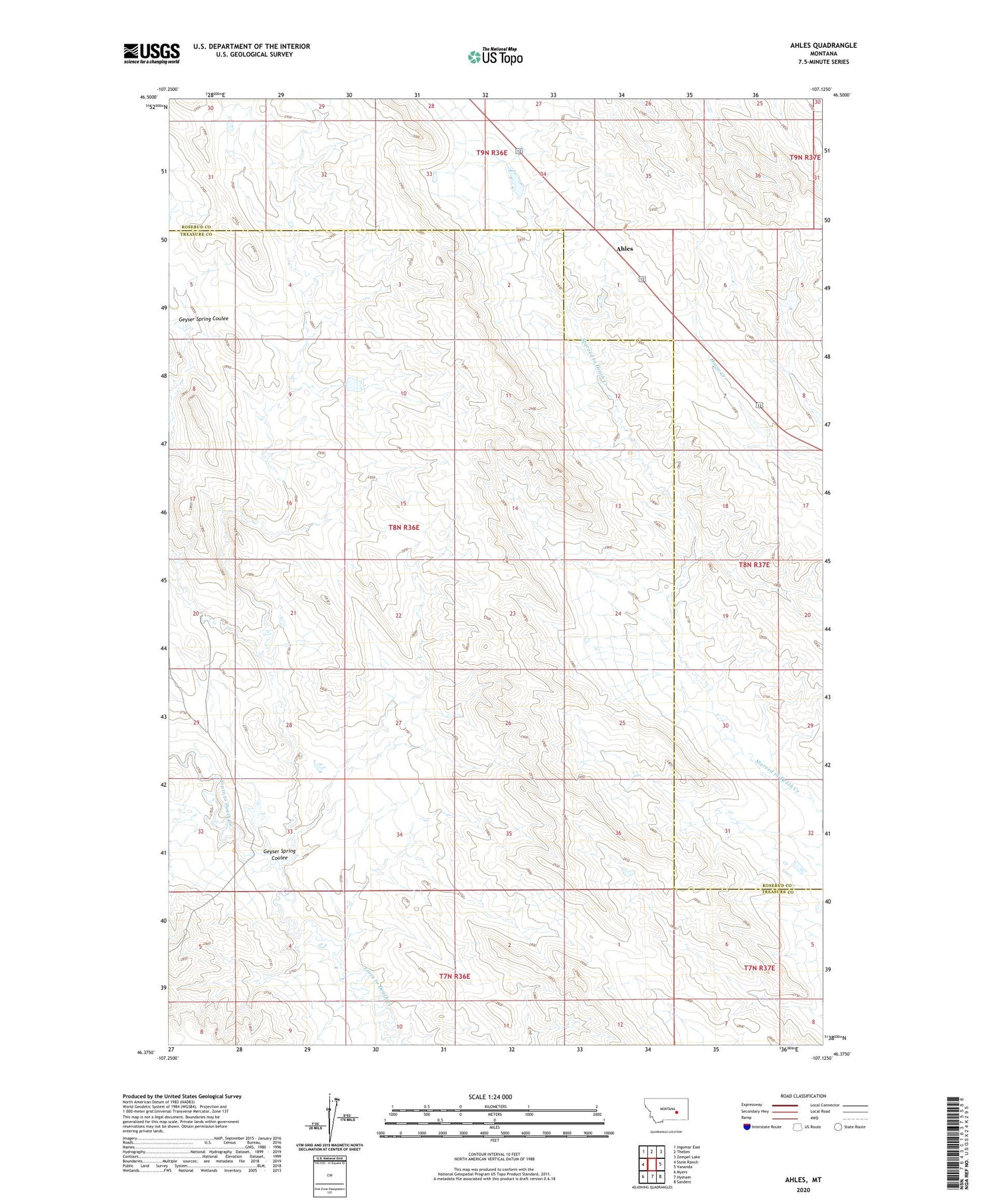
2020 topographic map quadrangle Ahles in the state of Montana. Scale: 1:24000. Based on the newly updated USGS 7.5' US Topo map series, this map is in the following counties: Treasure, Rosebud. The map contains contour data, water features, and other items you are used to seeing on USGS maps, but also has updated roads and other features. This is the next generation of topographic maps. Printed on high-quality waterproof paper with UV fade-resistant inks.
Quads adjacent to this one:
West: Steie Ranch
Northwest: Ingomar East
North: Thebes
Northeast: Zempel Lake
East: Vananda
Southeast: Sanders
South: Hysham
Southwest: Myers
Contains the following named places: Ahles, Ahles Post Office, Ahles School, Ballard Number 1 Dam, Big Timber Number 41 Dam, BN Number 9 Dam, Geyser Spring Coulee, JA Montgomery Number 1 Dam, Kniepp Number 1 Dam, NW Starved to Death-24 Mine, W Starved to Death SW Mine, W Starved to Death-5 Mine, West Starved to Death 31 32 Mine