MyTopo
Alberton Montana US Topo Map
Couldn't load pickup availability
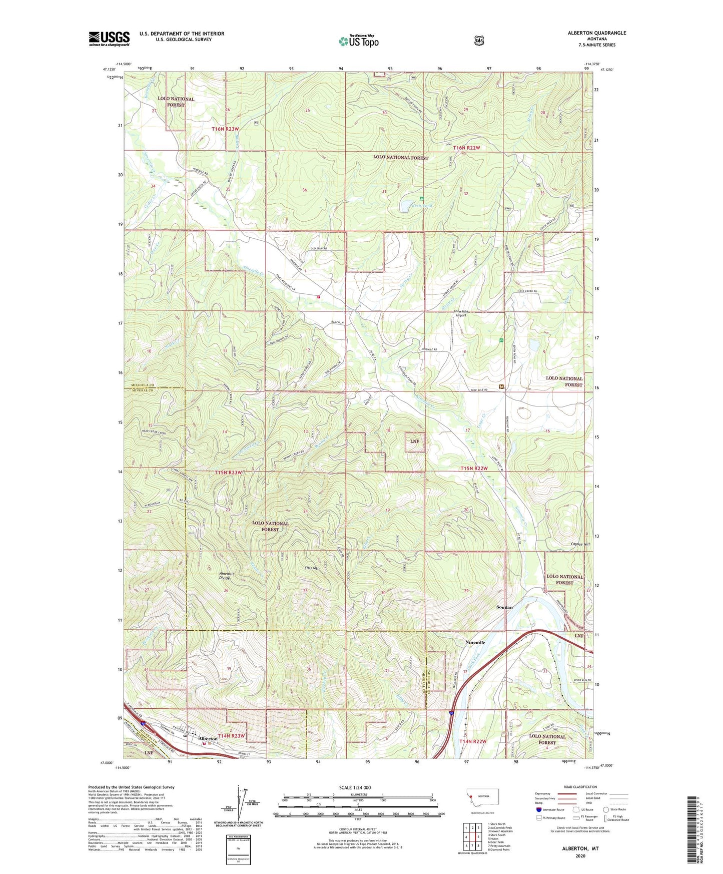
2020 topographic map quadrangle Alberton in the state of Montana. Scale: 1:24000. Based on the newly updated USGS 7.5' US Topo map series, this map is in the following counties: Missoula, Mineral. The map contains contour data, water features, and other items you are used to seeing on USGS maps, but also has updated roads and other features. This is the next generation of topographic maps. Printed on high-quality waterproof paper with UV fade-resistant inks.
Quads adjacent to this one:
West: Stark South
Northwest: Stark North
North: McCormick Peak
Northeast: Hewolf Mountain
East: Huson
Southeast: Diamond Point
South: Petty Mountain
Southwest: Deer Peak
Contains the following named places: 15N22W07DCAB01 Well, 15N22W28BADC01 Well, 15N22W33BAC_01 Well, 15N22W33BAC_02 Well, 15N22W33BDDD01 Well, 15N22W33DBCC01 Well, 15N23W01ADAA01 Well, 15N23W01BDCB01 Well, 15N23W12ABCA01 Well, 15N23W12ABDD01 Well, 15N23W12ACCA01 Well, Alberton, Alberton Branch Library, Alberton Community Church, Alberton Post Office, Alberton Public Schools, Butler Creek, CCC Camp Site Point of Interest, Cedar Creek, Cromwell Creek, Duff Creek, Eddy Creek, Ellis Creek, Ellis Mountain, Free Creek, Frenchtown Rural Fire District Station 4, Frenchtown Rural Fire District Station 8, Frenchtown-Wye Division, Grand Menard Recreation Site, Issac Creek, Kennedy Creek, Kreis Pond, Longpre Dam, Nine Mile, Nine Mile Airport, Nine Mile School, Ninemile, Ninemile Community Hall, Ninemile Creek, Ninemile Post Office, Ninemile Ranger Station, Ninemile Remount Deport Point of Interest, Rennic Creek, River Edge Resort, Rock Creek, Saint Alberts Catholic Church, Soudan, Spring Creek, Spring Creek Dam, Spring Creek Reservoir, Stark Creek, Stony Creek, Tank Creek, Ted Luark Private Stolport, Town of Alberton