MyTopo
Alkali Lake Montana US Topo Map
Couldn't load pickup availability
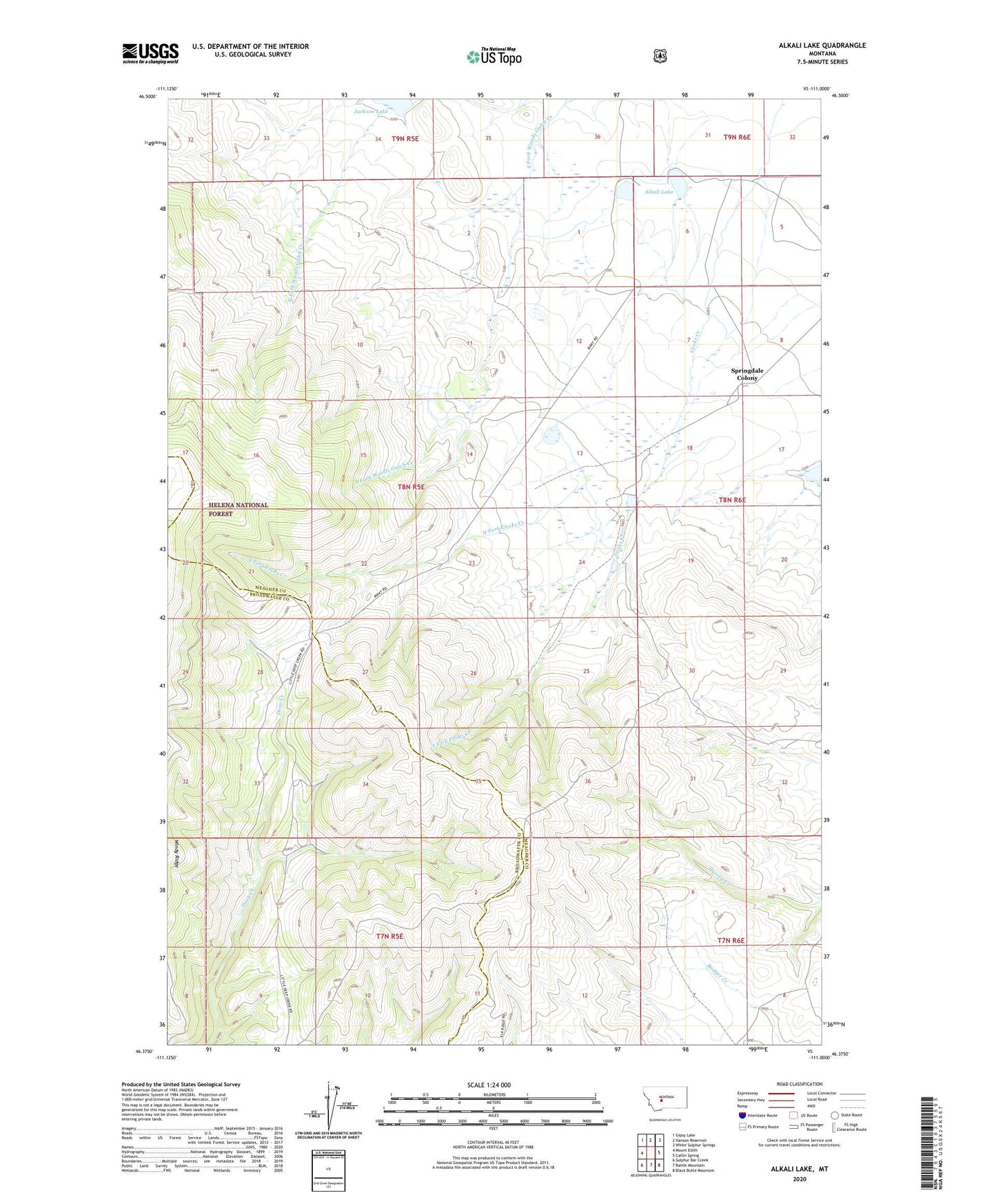
2020 topographic map quadrangle Alkali Lake in the state of Montana. Scale: 1:24000. Based on the newly updated USGS 7.5' US Topo map series, this map is in the following counties: Meagher, Broadwater. The map contains contour data, water features, and other items you are used to seeing on USGS maps, but also has updated roads and other features. This is the next generation of topographic maps. Printed on high-quality waterproof paper with UV fade-resistant inks.
Quads adjacent to this one:
West: Mount Edith
Northwest: Gipsy Lake
North: Hanson Reservoir
Northeast: White Sulphur Springs
East: Catlin Spring
Southeast: Black Butte Mountain
South: Battle Mountain
Southwest: Sulphur Bar Creek
Contains the following named places: 08N06E07DD__01 Well, Alkali Lake, Jackson Lake, Jackson Lake Dam, Manger, North Fork Cooks Creek, O Connor, Onion Head Dam, Screwed Up Dam, Shindahl, South Fork Cooks Creek, Springdale Colony, Springdale Colony Census Designated Place, Springdale Colony Dam, Springdale Colony School, Springdale Dam, Springdale Number 2 Dam, Springdale Number 3 Dam, Springdale Number 4 Dam, Unity Post Office, Unity School