MyTopo
Alzada Montana US Topo Map
Couldn't load pickup availability
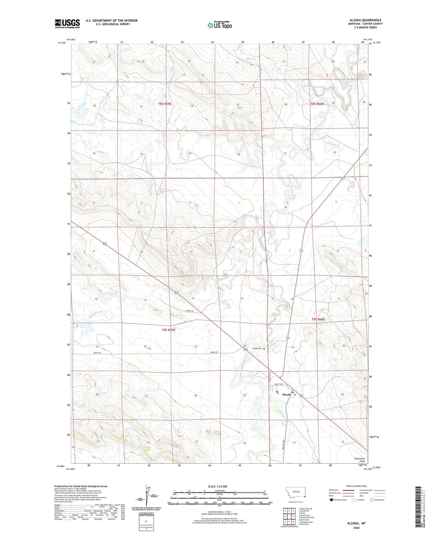
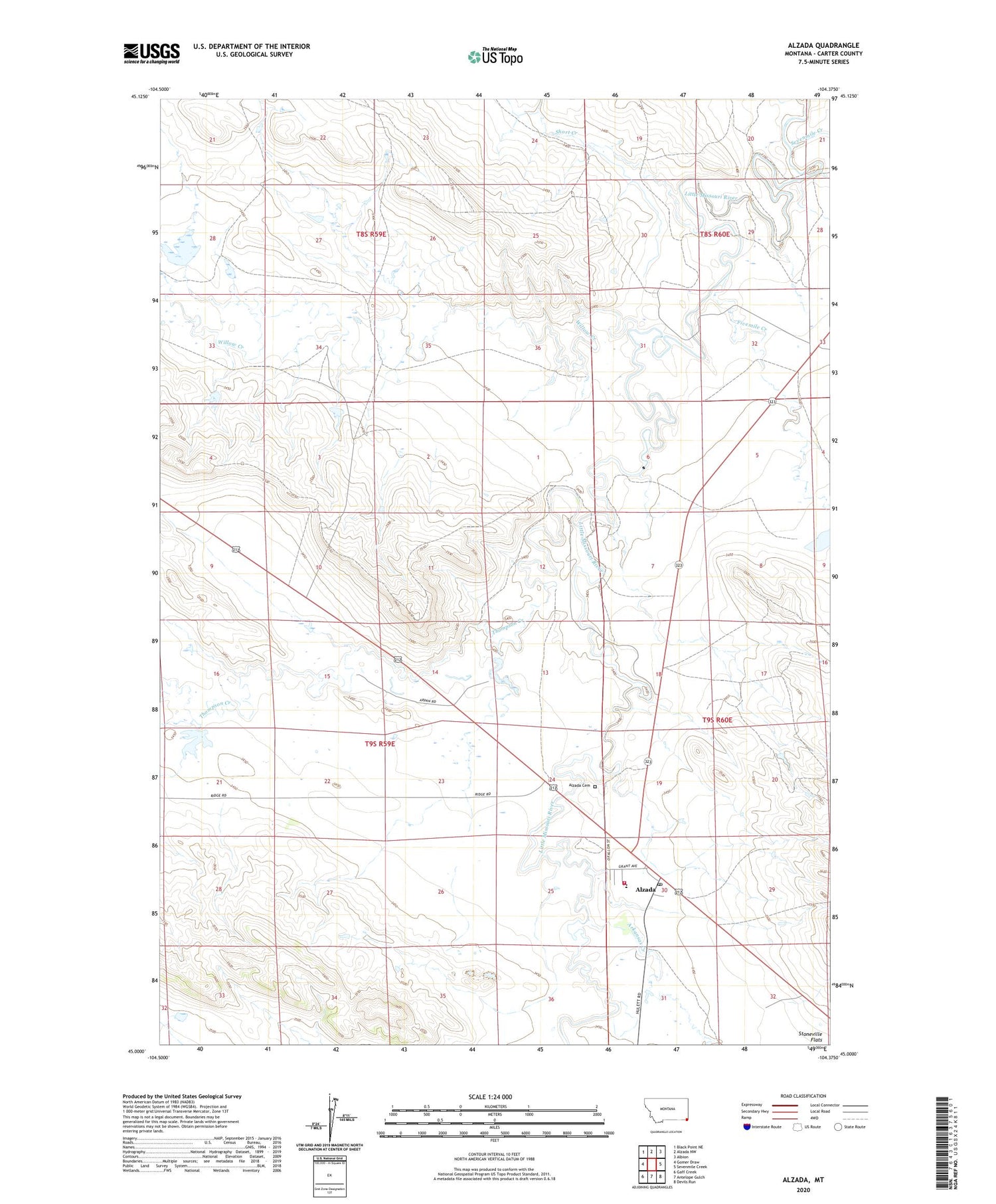
2020 topographic map quadrangle Alzada in the state of Montana. Scale: 1:24000. Based on the newly updated USGS 7.5' US Topo map series, this map is in the following counties: Carter. The map contains contour data, water features, and other items you are used to seeing on USGS maps, but also has updated roads and other features. This is the next generation of topographic maps. Printed on high-quality waterproof paper with UV fade-resistant inks.
Quads adjacent to this one:
West: Gomer Draw
Northwest: Black Point NE
North: Alzada NW
Northeast: Albion
East: Sevenmile Creek
Southeast: Devils Run
South: Antelope Gulch
Southwest: Gaff Creek
Contains the following named places: 09S59E15ADCC01 Well, Alzada, Alzada Baptist Church, Alzada Cemetery, Alzada Census Designated Place, Alzada Congregational Church, Alzada Mission, Alzada Post Office, Alzada School, Alzada Volunteer Fire Control, Arkansas Creek, B59-26-1 Mine, B59-26-2 Mine, B59-26-3 Mine, Fivemile Creek, Fivemile Post Office, K and L McDowell Number 5 Dam, K and L McDowell Number 7 Dam, Sevenmile Creek, Short Creek, Willow Creek