MyTopo
Amelong Creek Montana US Topo Map
Couldn't load pickup availability
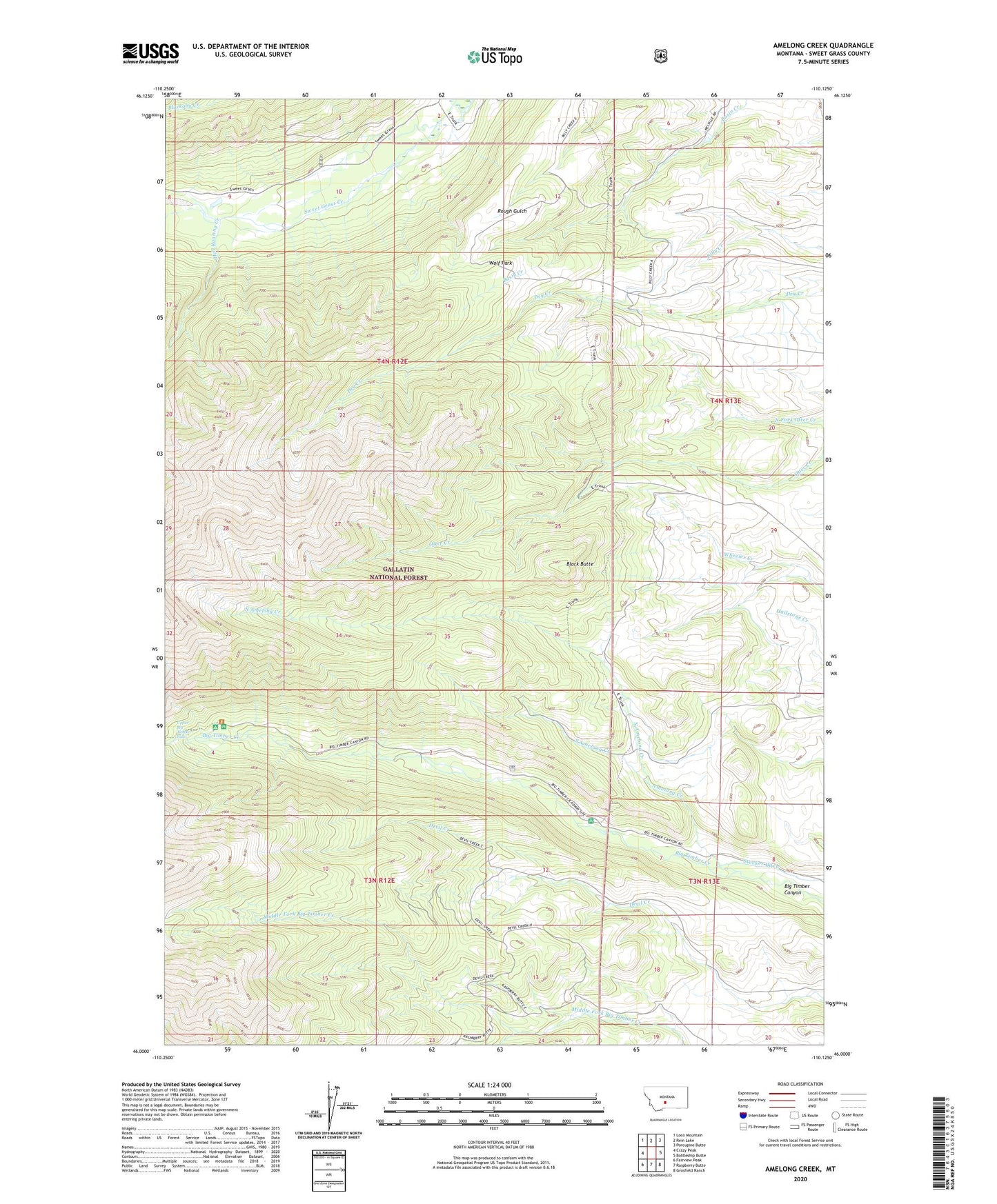
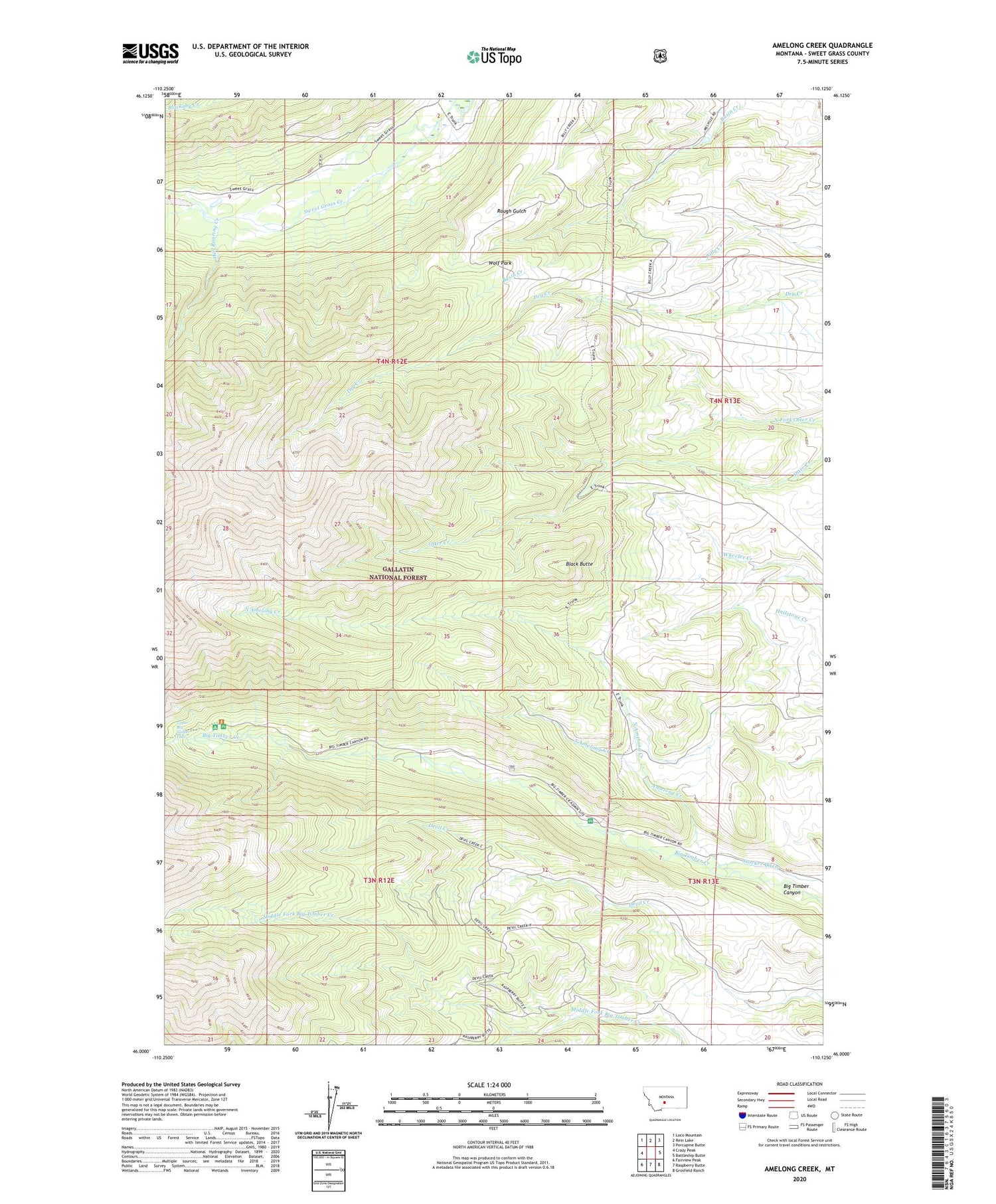
2020 topographic map quadrangle Amelong Creek in the state of Montana. Scale: 1:24000. Based on the newly updated USGS 7.5' US Topo map series, this map is in the following counties: Sweet Grass. The map contains contour data, water features, and other items you are used to seeing on USGS maps, but also has updated roads and other features. This is the next generation of topographic maps. Printed on high-quality waterproof paper with UV fade-resistant inks.
Quads adjacent to this one:
West: Crazy Peak
Northwest: Loco Mountain
North: Rein Lake
Northeast: Porcupine Butte
East: Battleship Butte
Southeast: Grosfield Ranch
South: Raspberry Butte
Southwest: Fairview Peak
Contains the following named places: Amelong Creek, Big Timber Canyon, Big Timber Guard Station, Black Butte, Bruin Creek, Half Moon Campground, Hell Roaring Creek, Langhus Airstrip, North Amelong Creek, North Fork Otter Creek, South Amelong Creek, Upper Big Timber Falls, Wolf Park