
MyTopo
Archer Montana US Topo Map
Couldn't load pickup availability
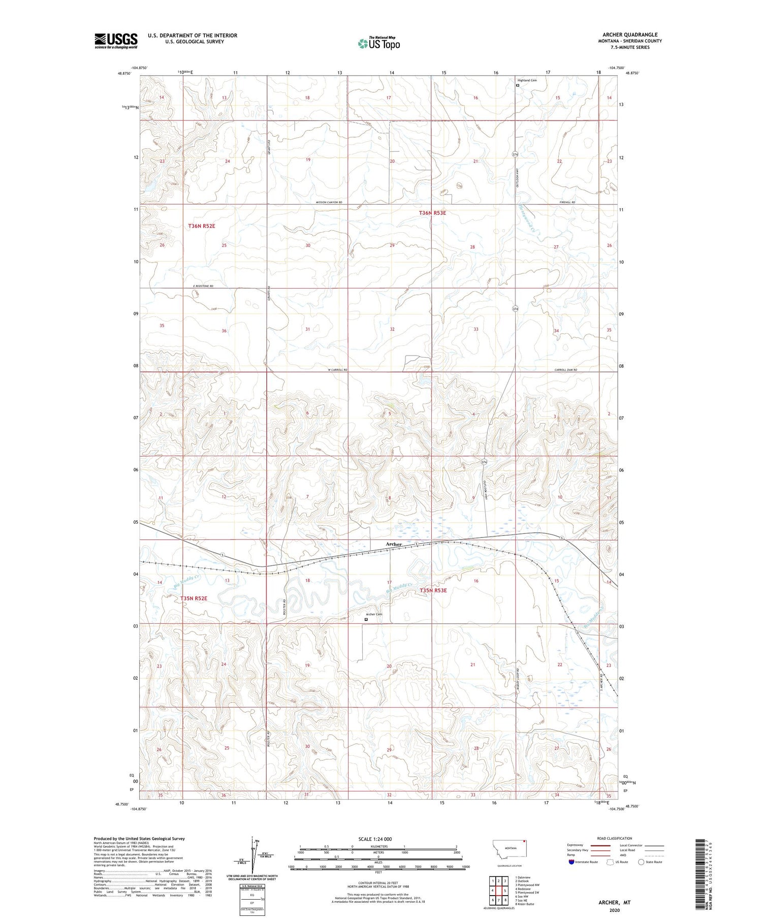
2020 topographic map quadrangle Archer in the state of Montana. Scale: 1:24000. Based on the newly updated USGS 7.5' US Topo map series, this map is in the following counties: Sheridan. The map contains contour data, water features, and other items you are used to seeing on USGS maps, but also has updated roads and other features. This is the next generation of topographic maps. Printed on high-quality waterproof paper with UV fade-resistant inks.
Quads adjacent to this one:
West: Redstone
Northwest: Daleview
North: Outlook
Northeast: Plentywood NW
East: Plentywood SW
Southeast: Kisler Butte
South: Soo NE
Southwest: Soo NW
Contains the following named places: 35N52E12ABAC01 Well, 35N52E12B___01 Well, 35N53E07DDAA01 Well, 35N53E16ABCC03 Well, 35N53E16BABD01 Well, 35N53E21AAAA01 Well, 35N53E34AABA01 Well, 36N53E31BBC_01 Well, 36N53E32DD__01 Well, Archer, Archer Cemetery, Archer Lutheran Church, Archer Post Office, Archer School, Highland Cemetery, Johnson School


