MyTopo
Armells Montana US Topo Map
Couldn't load pickup availability
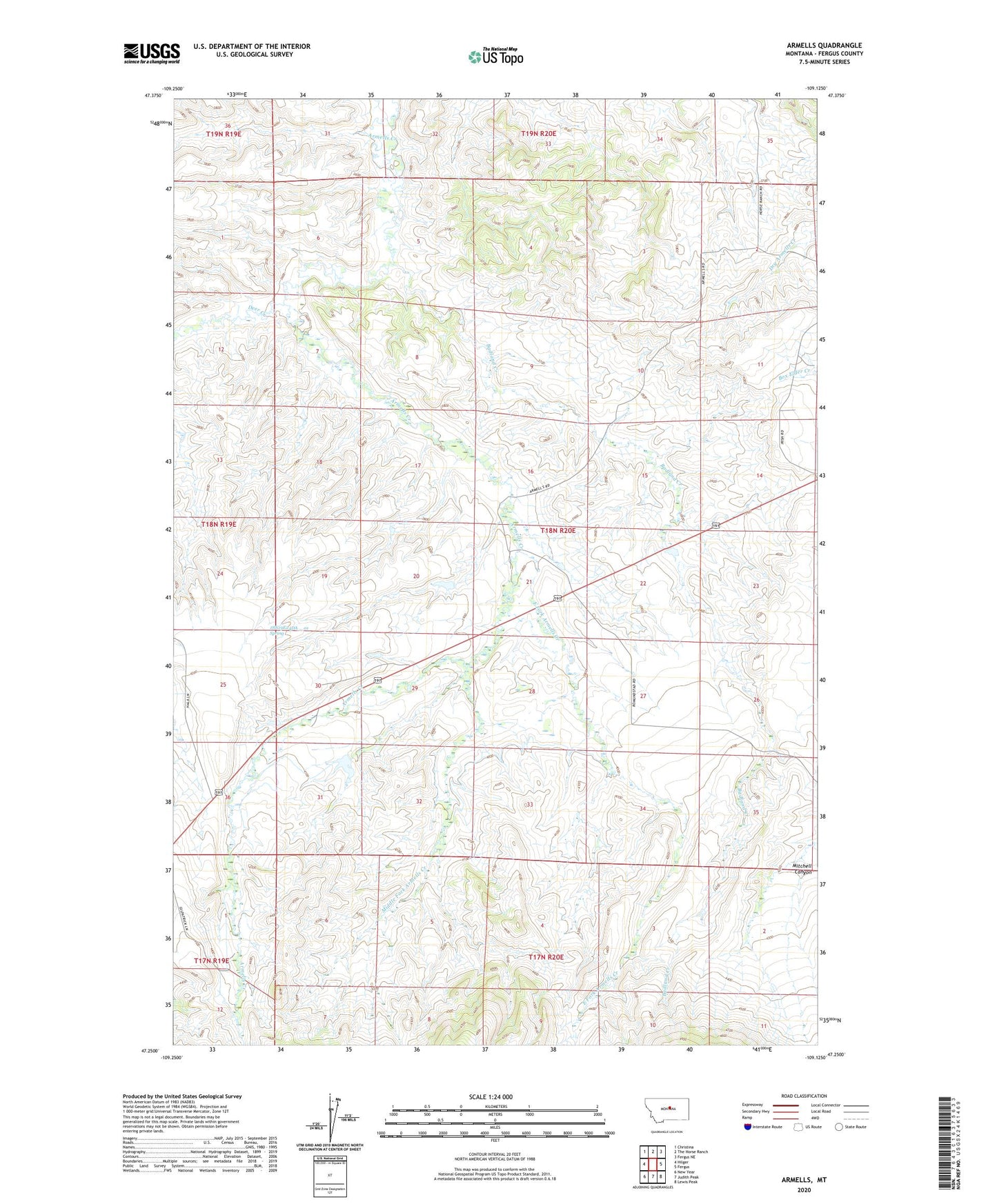
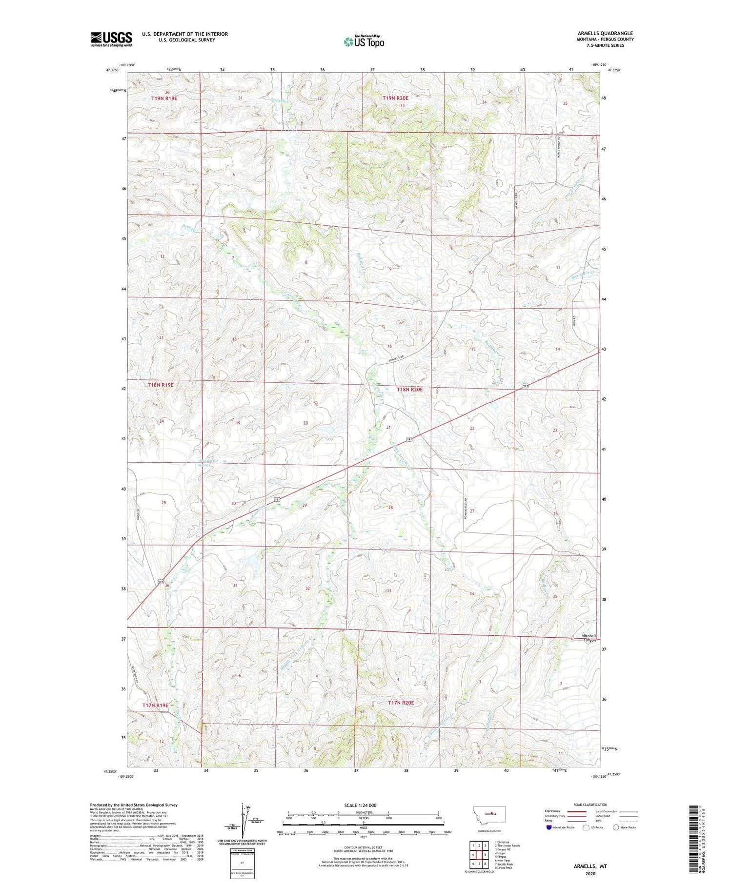
2020 topographic map quadrangle Armells in the state of Montana. Scale: 1:24000. Based on the newly updated USGS 7.5' US Topo map series, this map is in the following counties: Fergus. The map contains contour data, water features, and other items you are used to seeing on USGS maps, but also has updated roads and other features. This is the next generation of topographic maps. Printed on high-quality waterproof paper with UV fade-resistant inks.
Quads adjacent to this one:
West: Hilger
Northwest: Christina
North: The Horse Ranch
Northeast: Fergus NE
East: Fergus
Southeast: Lewis Peak
South: Judith Peak
Southwest: New Year
Contains the following named places: 18N19E24DA__01 Spring, 18N19E26DAD_01 Well, 18N20E16BBB_01 Well, 18N20E17BBAA01 Well, 19N20E35CA__01 Well, Armells, Armells Post Office, Armells School, Badland Creek, Big John M Dam, Deer Creek, East Fork Armells Creek, Fergus County, Knob Hill School, Middle Fork Armells Creek, Weideman School