MyTopo
Armington Montana US Topo Map
Couldn't load pickup availability
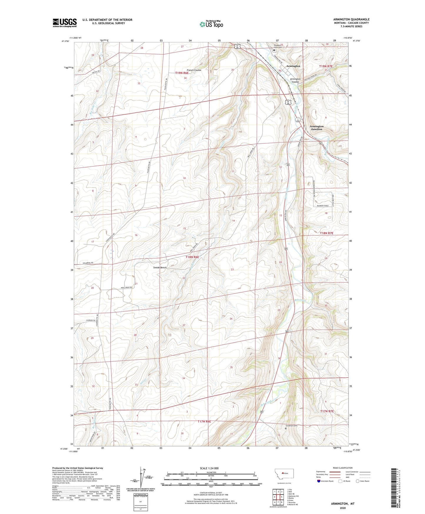
2020 topographic map quadrangle Armington in the state of Montana. Scale: 1:24000. Based on the newly updated USGS 7.5' US Topo map series, this map is in the following counties: Cascade. The map contains contour data, water features, and other items you are used to seeing on USGS maps, but also has updated roads and other features. This is the next generation of topographic maps. Printed on high-quality waterproof paper with UV fade-resistant inks.
Quads adjacent to this one:
West: Mahoney Hill
Northwest: Fife
North: Belt
Northeast: Belt NE
East: Blythe
Southeast: Monarch NE
South: Riceville
Southwest: Evans
Contains the following named places: 17N06E01C___01 Well, 17N06E01C___02 Well, 18N06E14A___01 Well, 18N06E14C___01 Well, 18N06E15A___01 Well, 18N06E20D___01 Well, 18N06E25D___01 Well, 18N06E28A___01 Well, 18N06E33A___01 Well, 18N06E36____01 Well, 19N06E32A___01 Well, 19N06E32DA__01 Well, 19N06E34____01 Well, 19N06E36ACDA01 Well, 19N06E36DDDC01 Well, Armington, Armington Coulee, Armington Junction, Armington Junction Rest Area, Armington Post Office, Belt Division, Big Otter Creek, Goodman, Goodman Cemetery, Goodman School, Neil Creek, Neil Creek Ranch, Neil Creek School, Peterson School, Pleasant View Cemetery, Siegling, Swede Bench, Tiger Butte Community Center, Voights Spur