MyTopo
Ash Creek West Montana US Topo Map
Couldn't load pickup availability
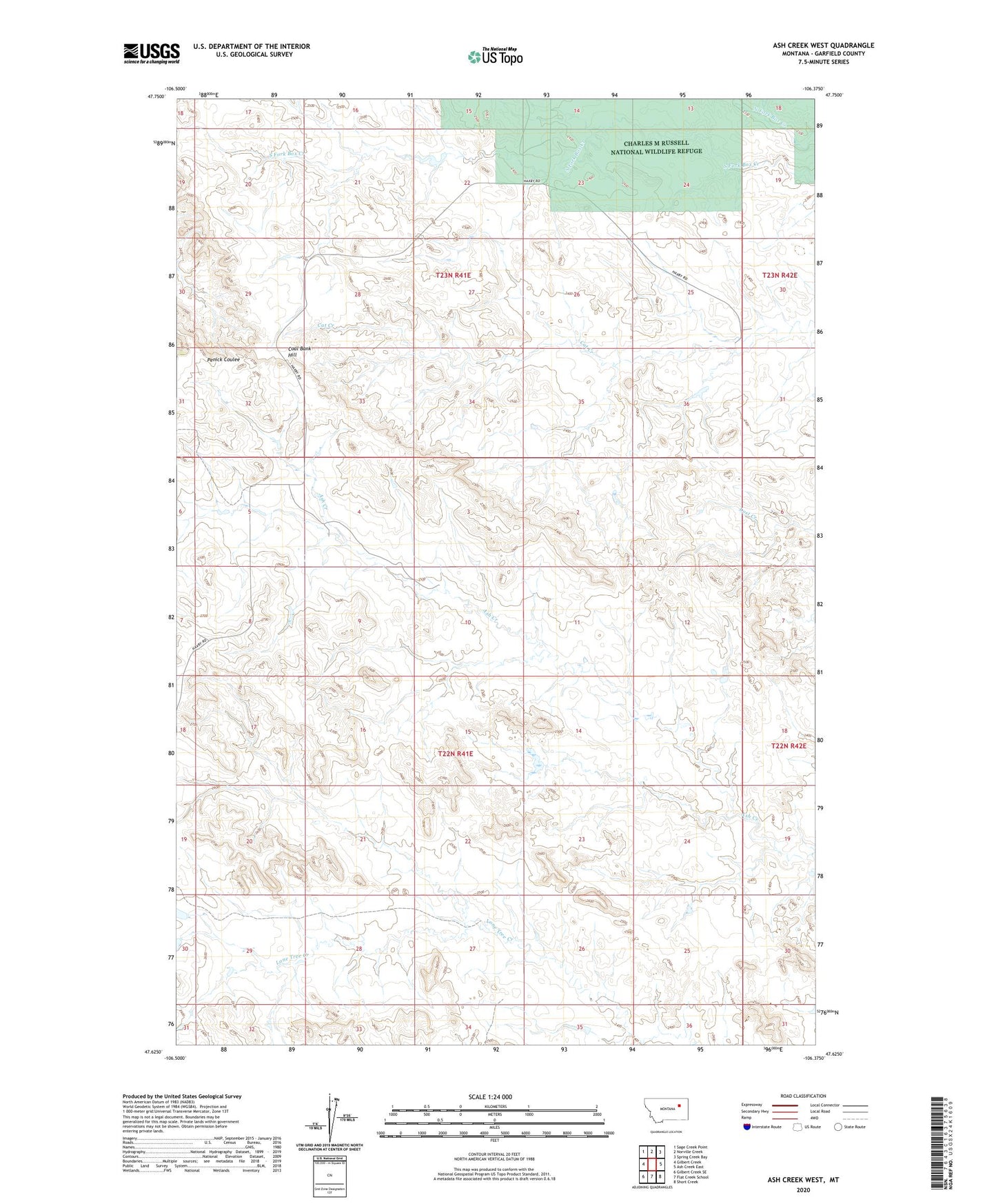
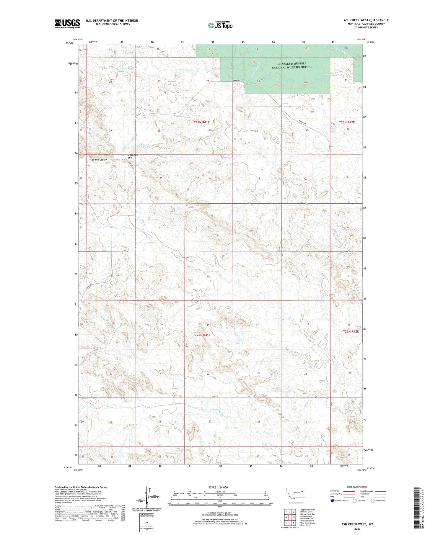
2020 topographic map quadrangle Ash Creek West in the state of Montana. Scale: 1:24000. Based on the newly updated USGS 7.5' US Topo map series, this map is in the following counties: Garfield. The map contains contour data, water features, and other items you are used to seeing on USGS maps, but also has updated roads and other features. This is the next generation of topographic maps. Printed on high-quality waterproof paper with UV fade-resistant inks.
Quads adjacent to this one:
West: Gilbert Creek
Northwest: Sage Creek Point
North: Norville Creek
Northeast: Spring Creek Bay
East: Ash Creek East
Southeast: Short Creek
South: Flat Creek School
Southwest: Gilbert Creek SE
Contains the following named places: 22N41E04B___01 Well, 22N41E04CCAA01 Well, 22N41E10B___01 Well, 22N41E10D___01 Well, 22N42E05DB__01 Well, 23N41E23B___01 Well, 23N41E25D___01 Well, 23N41E36A___01 Well, Cat Creek School, Coal Bank Hill, Dirty Wash Reservoir Dam, Dry Dam, Pink Sketter Number 1 Dam, Pink Sketter Number 2 Dam, Spring-Miller Dam