MyTopo
Avon Montana US Topo Map
Couldn't load pickup availability
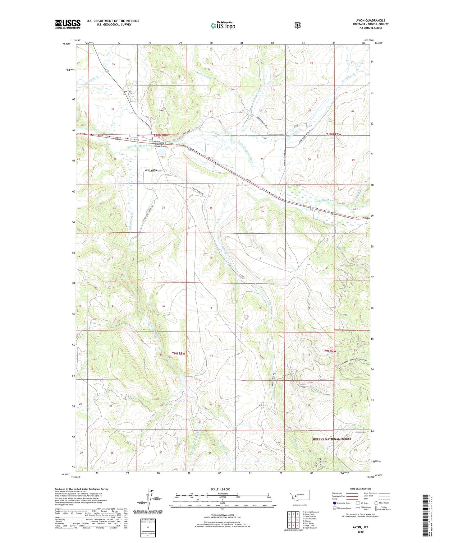
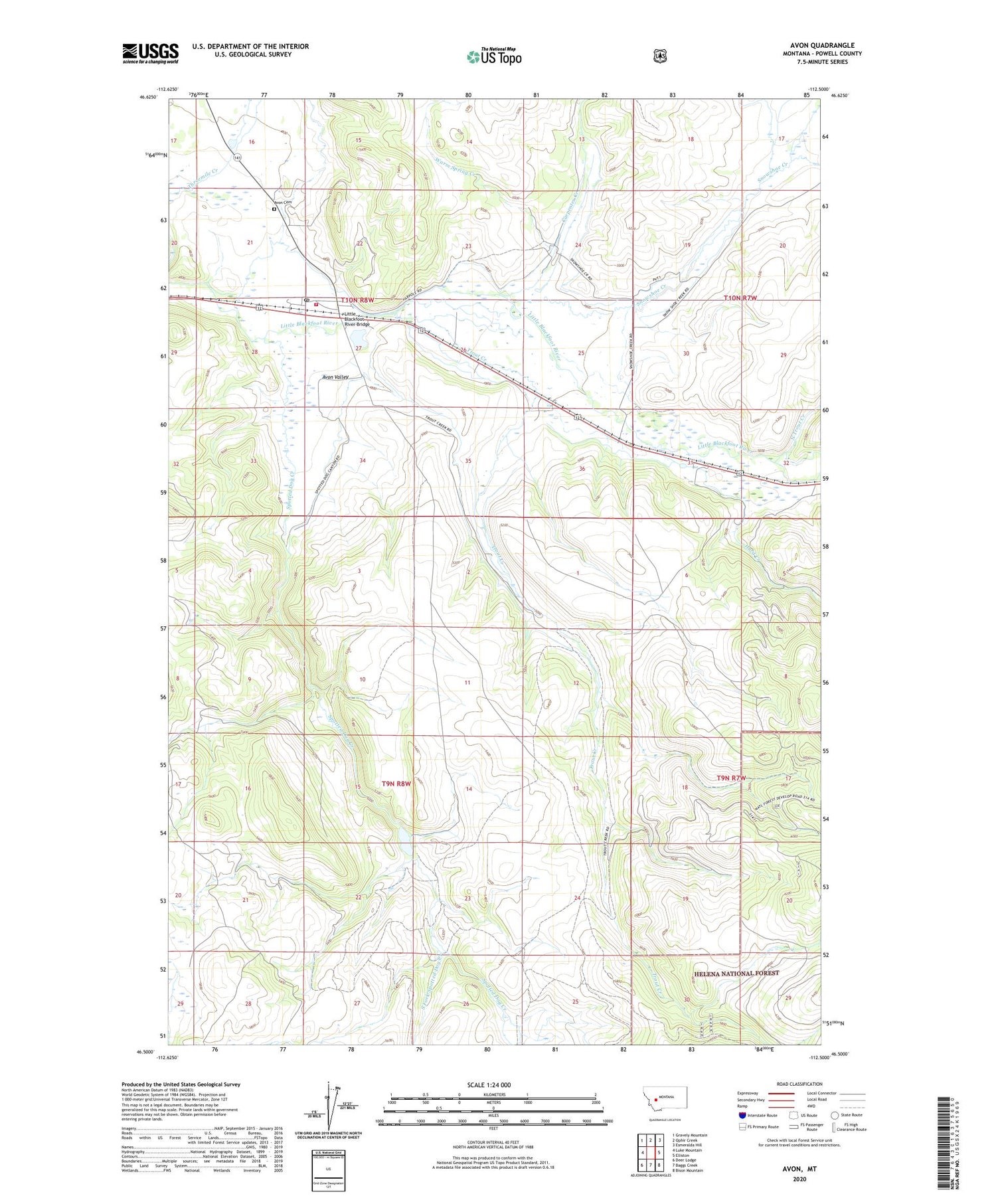
2020 topographic map quadrangle Avon in the state of Montana. Scale: 1:24000. Based on the newly updated USGS 7.5' US Topo map series, this map is in the following counties: Powell. The map contains contour data, water features, and other items you are used to seeing on USGS maps, but also has updated roads and other features. This is the next generation of topographic maps. Printed on high-quality waterproof paper with UV fade-resistant inks.
Quads adjacent to this one:
West: Luke Mountain
Northwest: Gravely Mountain
North: Ophir Creek
Northeast: Esmeralda Hill
East: Elliston
Southeast: Bison Mountain
South: Baggs Creek
Southwest: Deer Lodge
Contains the following named places: 10N07W30BBC_01 Well, 10N07W31CAAC01 Well, 10N08W21ABDB01 Well, 10N08W27BAAB01 Well, 10N08W27BABA01 Well, 10N08W27BABA02 Well, 10N08W28AAA_03 Well, Avon, Avon Cemetery, Avon Church, Avon Elementary School, Avon Post Office, Avon Volunteer Fire Department, Buffalo Mine, Carpenter Creek, Dog Creek Reservoir Dam, Echo Valley Campground, Gilbert, Hurd Creek, Keene, Keene Post Office, Little Blackfoot River Bridge, Middle Fork Spotted Dog Creek, North Trout Creek, Saint Theodore Mission, Snowshoe Creek, South Fork Spotted Dog Creek, Spotted Dog Creek, Spring Creek, Trout Creek, Warm Spring Creek