MyTopo
Winslow Creek Montana US Topo Map
Couldn't load pickup availability
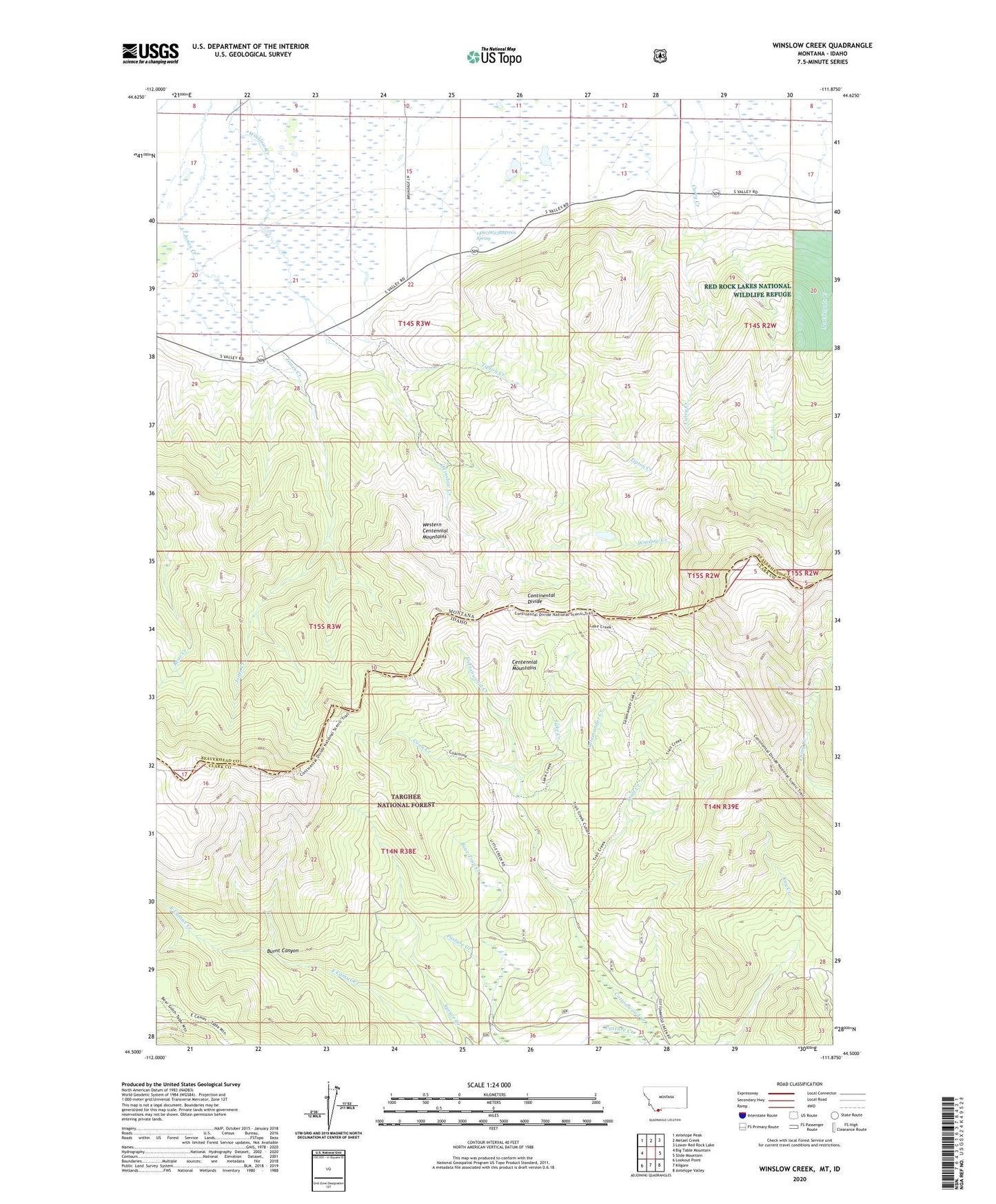
2020 topographic map quadrangle Winslow Creek in the states of Idaho, Montana. Scale: 1:24000. Based on the newly updated USGS 7.5' US Topo map series, this map is in the following counties: Beaverhead, Clark. The map contains contour data, water features, and other items you are used to seeing on USGS maps, but also has updated roads and other features. This is the next generation of topographic maps. Printed on high-quality waterproof paper with UV fade-resistant inks.
Quads adjacent to this one:
West: Big Table Mountain
Northwest: Antelope Peak
North: Metzel Creek
Northeast: Lower Red Rock Lake
East: Slide Mountain
Southeast: Antelope Valley
South: Kilgore
Southwest: Lookout Point
Contains the following named places: 14S03W13DBCB01 Well, 14S03W21DDCC01 Well, 14S03W22CABD01 Well, 14S03W23BBD_01 Spring, Bear Trap Creek, Burnt Canyon, Coal Mine, Coon Creek, Doyle School, Lake Creek, Mule Meadows Creek, Salamander Creek, Seven L Ranch, Table Mountain Trail, Tipton Creek, Trail Creek