MyTopo
Yellowtail Dam Montana US Topo Map
Couldn't load pickup availability
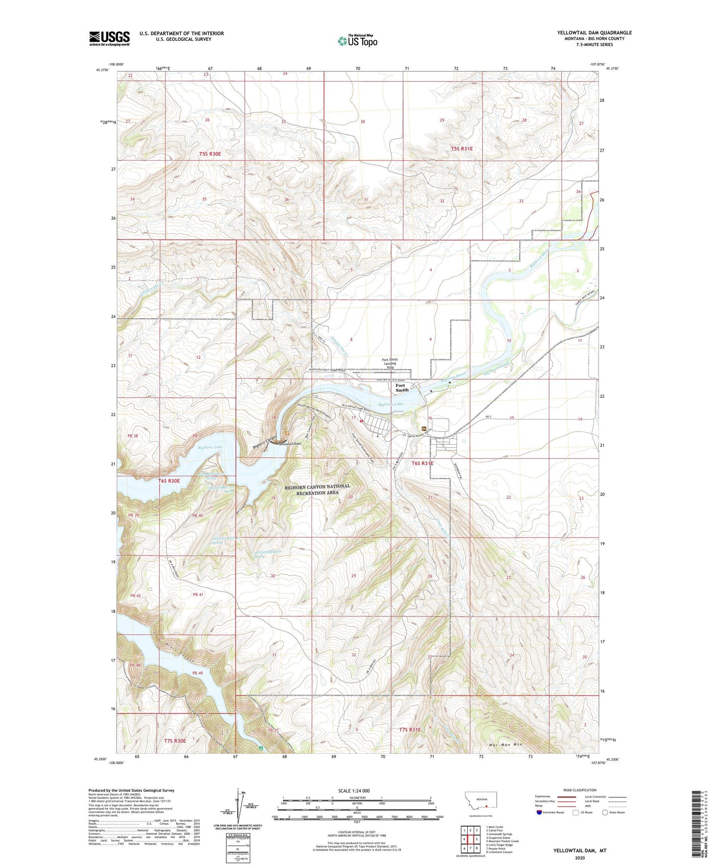
2020 topographic map quadrangle Yellowtail Dam in the state of Montana. Scale: 1:24000. Based on the newly updated USGS 7.5' US Topo map series, this map is in the following counties: Big Horn. The map contains contour data, water features, and other items you are used to seeing on USGS maps, but also has updated roads and other features. This is the next generation of topographic maps. Printed on high-quality waterproof paper with UV fade-resistant inks.
Quads adjacent to this one:
West: Grapevine Dome
Northwest: Mott Creek
North: Camp Four
Northeast: Lemonade Springs
East: Mountain Pocket Creek
Southeast: Limestone Canyon
South: Peyote Point
Southwest: Little Finger Ridge
Contains the following named places: 06S30E13DDC_01 Spring, 06S30E24DCD_01 Spring, 06S31E19BCC_01 Spring, 06S31E30BDB_01 Spring, 59035, Afterbay Campground, Big Horn Mountains, Bighorn Canyon, Box Canyon, Cottonwood Camp, Fort C F Smith, Fort Smith, Fort Smith Census Designated Place, Fort Smith Landing Strip, Fort Smith School, Fort Smith Sewage Disposal Ponds Dam, Fort Smith Visitor Center, Grapevine Creek, Lime Kiln Creek, Limestone Military Reservation, Powerhouse Yellowtail Dam, War Man Mountain, Willcutt Ranch, Yellowtail Afterbay Dam, Yellowtail Afterbay Reservoir, Yellowtail Dam, Yellowtail Fire Station, Yellowtail Post Office