MyTopo
Albion West Nebraska US Topo Map
Couldn't load pickup availability
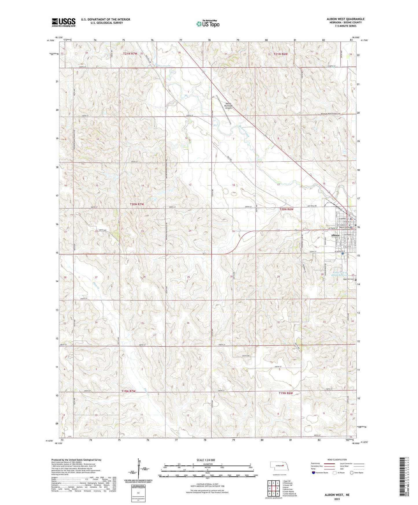
2021 topographic map quadrangle Albion West in the state of Nebraska. Scale: 1:24000. Based on the newly updated USGS 7.5' US Topo map series, this map is in the following counties: Boone. The map contains contour data, water features, and other items you are used to seeing on USGS maps, but also has updated roads and other features. This is the next generation of topographic maps. Printed on high-quality waterproof paper with UV fade-resistant inks.
Quads adjacent to this one:
West: Akron
Northwest: Elgin SW
North: Petersburg
Northeast: Closter SW
East: Albion East
Southeast: Saint Edward SW
South: Cedar Rapids SE
Southwest: Cedar Rapids
Contains the following named places: Albion, Albion Bible Church, Albion City Park, Albion Country Club, Albion Dental Clinic, Albion Municipal Airport, Albion Police Department, Albion Post Office, Albion Public Schools, Beaver Valley School, Boone County, Boone County Ambulance Service, Boone County Courthouse, Boone County Fairground, Boone County Health Center, Boone County Health Center - Hospital, Boone County Historical Museum, Boone County Sheriff's Office, Callahan Chiropractic Center, City of Albion - RV Campground, First Baptist Church, Fuller Park, KLBN-FM (Albion), Kohtz-City of Albion Dam, Kohtz-City of Albion Reservoir, Koinzan Dam, Koinzan Reservoir, Maple Hill School, Palmer Eye Associates Center, Rose Hill Cemetery, Saint Michaels Catholic Church, Saint Michaels Elementary School, School Number 2, School Number 21, School Number 25, School Number 44, School Number 81, Seventh Day Adventist Church, Southwest Manchester Election Precinct, United Church of Christ, United Methodist Church, Wolf Memorial Good Samaritan, Zion Lutheran Church, ZIP Code: 68620