MyTopo
Arthur Nebraska US Topo Map
Couldn't load pickup availability
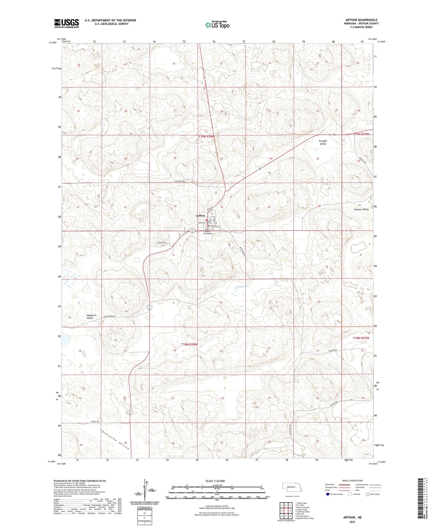
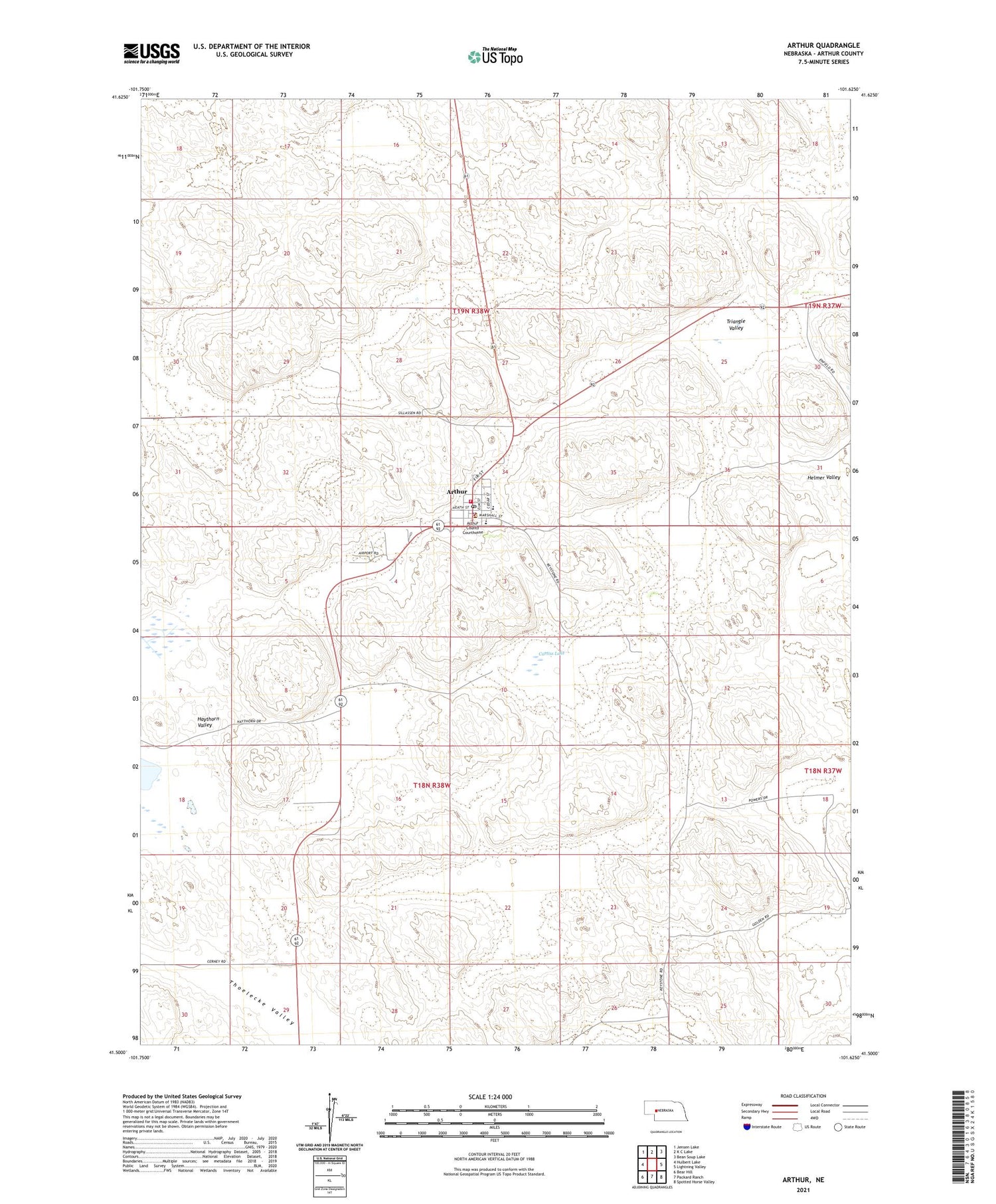
2021 topographic map quadrangle Arthur in the state of Nebraska. Scale: 1:24000. Based on the newly updated USGS 7.5' US Topo map series, this map is in the following counties: Arthur. The map contains contour data, water features, and other items you are used to seeing on USGS maps, but also has updated roads and other features. This is the next generation of topographic maps. Printed on high-quality waterproof paper with UV fade-resistant inks.
Quads adjacent to this one:
West: Hulbert Lake
Northwest: Jensen Lake
North: K C Lake
Northeast: Bean Soup Lake
East: Lightning Valley
Southeast: Spotted Horse Valley
South: Packard Ranch
Southwest: Bear Hill
Contains the following named places: Arthur, Arthur County, Arthur County Courthouse, Arthur County Fairground, Arthur County High School, Arthur County Library, Arthur County Rural Fire District, Arthur County Sheriff's Office, Arthur Election Precinct, Arthur Elementary School, Arthur Municipal Airport, Arthur Post Office, Baptist Church, Beekin Ranch, Berryman Ranch, Courthouse Museum, Curtiss Lake, Eymann Ranch, Golden Ranch, Hartman Ranch, Lute Kramer Ranch, Lyle Kramer Ranch, Pilgrim Holiness Church, Powers Ranch, School Number 3, Tillingbast Ranch, Triangle Valley, Village of Arthur, ZIP Code: 69121