MyTopo
Wisner Nebraska US Topo Map
Couldn't load pickup availability
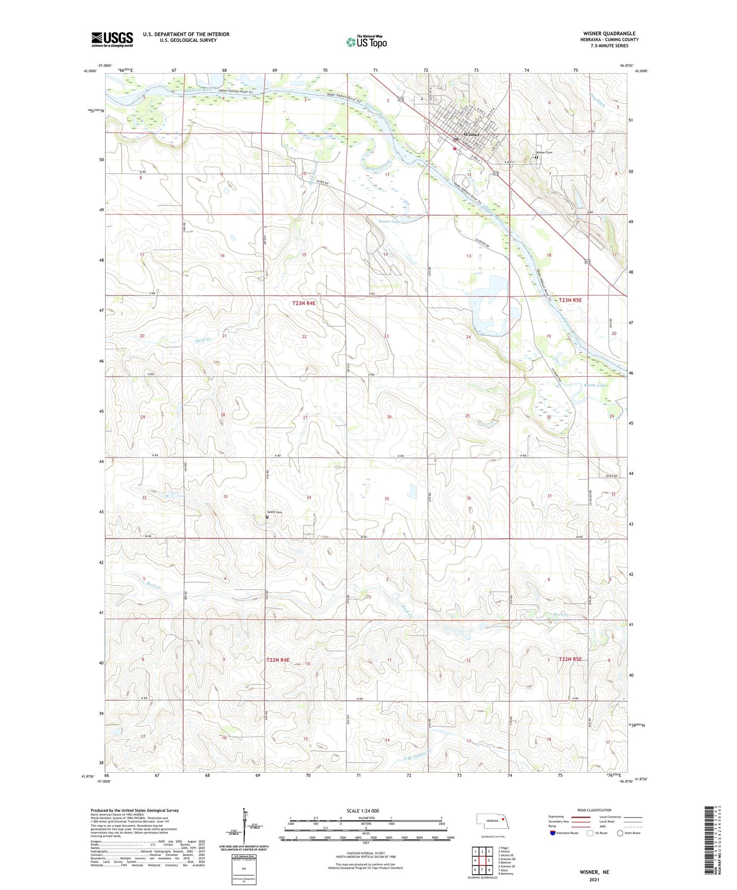
2021 topographic map quadrangle Wisner in the state of Nebraska. Scale: 1:24000. Based on the newly updated USGS 7.5' US Topo map series, this map is in the following counties: Cuming. The map contains contour data, water features, and other items you are used to seeing on USGS maps, but also has updated roads and other features. This is the next generation of topographic maps. Printed on high-quality waterproof paper with UV fade-resistant inks.
Quads adjacent to this one:
West: Stanton NE
Northwest: Pilger
North: Altona
Northeast: Altona SE
East: Beemer
Southeast: Monterey
South: Aloys
Southwest: Stanton SE
Contains the following named places: Bismarck, Bismark Post Office, Christ Lutheran Church, City of Wisner, Dry Ditch, Family Vision Center, Farmers Elevator Company - Wisner Elevator, Kanes Lake, Nebraska Ag Products Corporation Elevator, Raabe Lake, River Park, River Park Campground, Saint Johns School, Saint Joseph Catholic Church, Saint Pauls Lutheran Church, Salem Cemetery, Sand Creek, School Number 34, School Number 70, School Number 9, Stover Chiropractic Center, Township of Wisner, United Methodist Church, Wisner, Wisner Cemetery, Wisner Dental Care Center, Wisner Elementary School, Wisner Family Practice, Wisner Feedlots, Wisner Heritage Museum, Wisner Manor, Wisner Medical Clinic, Wisner Police Department, Wisner Post Office, Wisner Public Library, Wisner Volunteer Fire Department, Wisner-Pilger High School, Woerdeman Lake, ZIP Code: 68791